

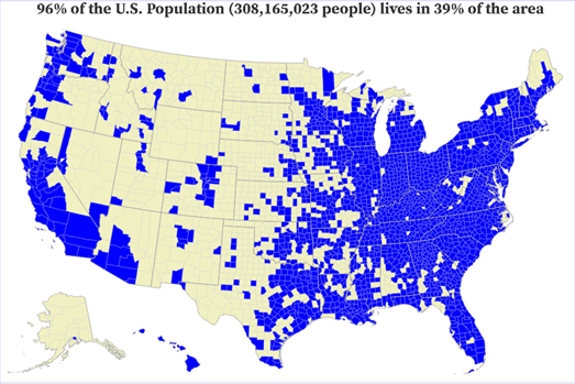
One of the perennial favorite map themes on the MapPorn subreddit are maps purportedly showing where half a country's population lives. Due to the fact that most people live in cities it is possible to create seemingly interesting maps showing that a large majority of people in a country live in a very small area of the country. It seems that some people are perpetually surprised that one result of urbanization and high population densities in cities is that last swathes of rural areas consequently have low populations.
It turns out that you can make these maps a lot more interesting by making them interactive. Albert Zhang's County Counting to Specified Proportion is an interesting map which allows you to see where different proportions of Americans live. Change the percentage of the total population you want to see mapped and Zhang's interactive map updates to show the lowest number of counties where that percentage of the population lives.
No comments:
Post a Comment