
The Charité university hospital in Berlin has ambitious expansion plans. Over the next few years, under its 'Rethinking Health' strategy, the hospital plans to develop its four campuses in order to further support health care in Berlin and to provide the hospital with cutting edge research facilities. These construction plans for the hospital can be viewed on an impressive new interactive map.
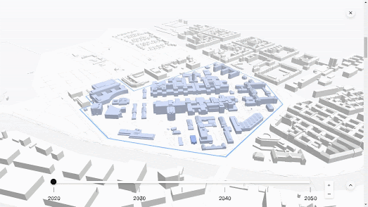
The interactive map in Building the future. The new Charité includes four map insets, showing the building footprints of each of the hospital's four Berlin campuses. The map also includes a timeline control which allows you to view how each campus will be developed over the next thirty years. Move the timeline forward and blue building outlines are added to the map to show where the hospital plans to erect new buildings.
If you click on one of the four inset maps you can view the chosen campus in full-screen mode. In this full-screen mode you can click on any of the blue 3D building outlines to learn more about that individual construction plan. It is also possible to rotate the map and to change the map's pitch by clicking and dragging on the 3D map.
No comments:
Post a Comment