
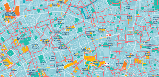
A new interactive map can help you navigate London on foot, showing you the quietest and most enjoyable routes for walking in the capital. The Footways map includes hundreds of kilometres of scenic, safe and pedestrian-friendly walking routes in central London.
The map includes hundreds of routes, spanning out from London's mainline stations, using the most low-traffic and low-pollution streets, and where possible completely car-free paths. The map includes a geolocation tool. So, if you share your location with the map, you can quickly zoom to your current location on the map and discover your closet recommended pedestrian-friendly routes

If you want to venture outside the capital then you can use the Slow Ways interactive map. Slow Ways is building a national network of walking routes across the whole of Great Britain. Using existing public footpaths, ancient foot ways and trails Slow Ways is designed to make it easier for people to plan hikes and walks in the UK.
No comments:
Post a Comment