
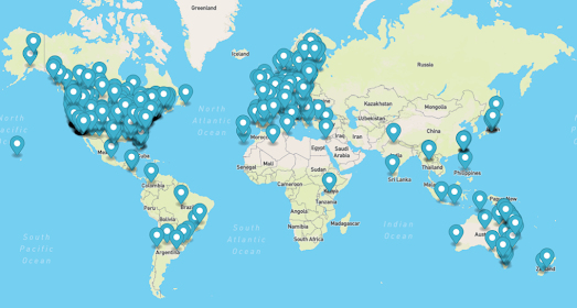
Transitland's Global Transit Map is an interactive map which shows the extent of public transport systems around the world. The map uses publicly available GTFS transit feeds to create a map of each city's transit systems.
Transitland aggregates feeds from over 2,500 operators in over 55 countries. However because transitland relies on the published GTFS feeds of public transit systems its coverage can be patchy or non-existent in some countries.
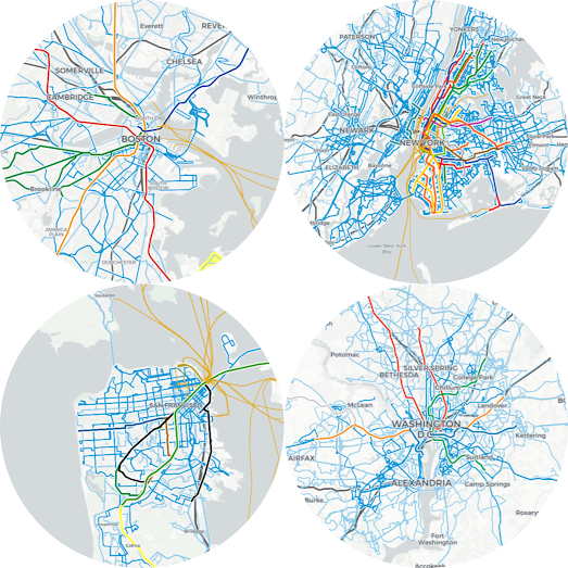
Because GTFS has been widely adopted in the USA transitland can be used to compare the transit systems of American cities. For example in the screenshot above I have compared the public transport systems of Boston, New York, San Francisco and Washington D.C. (based on their published GTFS feeds).
Transitfeeds is another web service which aggregates the GTFS transit feeds of cities around the world. Both transitland and transitfeed provide their own APIs which allow you to programatically access their aggregated GTFS feeds. This means that you can use both transitfeed and transitland to download information on public transport systems around the world, including stop locations and route geometries.
No comments:
Post a Comment