
The China National Silk Museum has created an interactive map which plots the technological advances in silk production over a period of around 6000 years. The Jinshow World Silk Interactive Map is the pilot project of a planned Interactive Atlas of Silk Roads. The initial world silk map plots the locations of over 12,000 artefacts related to the technological evolution of the production of silk and allows users to explore the development of materials and techniques in silk production over 6,000 years history.
The main Jinshow World Silk Map shows where archeological artefacts related to the production of silk have been discovered. These artefacts may be related to the developing technologies used in the production of materials, dyes and fibers. The map includes an interactive timeline which allows you to filter the archaeological discoveries by date.
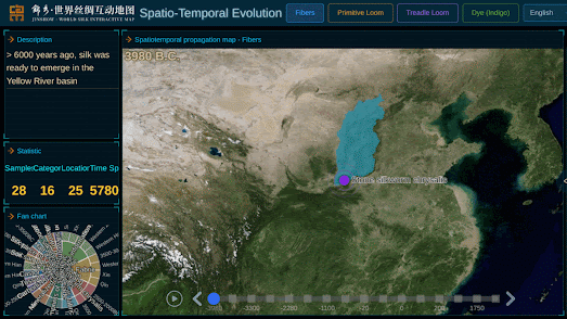
The Jinshow World Silk Map also includes a number of maps exploring the Spatio-Temporal Evolution of silk production. This consists of four separate maps which plot the evolution of 'fibers', the 'primitive loom', the 'treadle loom' and 'dye'. These four maps all include a timeline navigation control which you can use to view the chronological development of these four separate areas of silk production.
No comments:
Post a Comment