What if Google Maps Went Live?
What if Google Maps Went Live? is an art project from flux/S that imagines a map with live satellite views.
The film was recorded using six cameras attached to fishing rods on the former Philips industrial site Strijp S in Eindhoven. The concept explores ideas around redefining public spaces as places for collaborative performance art.
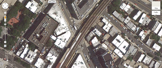
The project reminds me of Gidivigo's video that previews what Google Maps live satellite view will look like (when it is released in 2050 (maybe)).
His video shows a Google Maps satellite view with cars and trains moving as they would if the view was live.


Comments