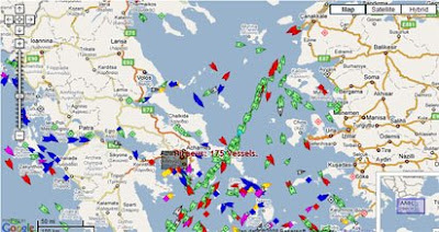
Thanks to this AIS data there are now a lot of Google Maps mashups showing the real-time positions of ships around the world.
Here are a few ship tracking maps:
MarineTraffic.com

MarineTraffic.com have produced a Google Map showing real-time information about ship movements throughout the world.
NOAA Fleet Map
Google Map tracking the ships of the National Oceanic and Atmospheric Administration.
Entrance of the Loire Estuary

Live ship tracking in the Loire Estuary, France. Includes a nautical map overlay.
- Live AIS for Boca Raton, Florida
- Portland, Oregon
- San Francisco Bay
- Seattle Live Ship Tracker
- Pointe à Pitre, Guadeloupe
- Live AIS Ship Tracking - Norway
- Live AIS data for Kristiansand
- Live AIS Stockholm
- Northern Baltic (Also Stockholm)
- Bay of Botnia, Sweden/Finland
- Saltdean (English Channel) Live Ship tracking
- Cape Pine Newfoundland
Hat-tip: Magic Instinct
_____________

In Belgium, the site "Shiphunters" has a AIS overview map of Flushing approach, the Scheld, and the Belgian harbours (Antwerp and Zeebrugge).
ReplyDeleteNot a very sophisticated UI, but I must admit they were on of the first on the web to offer this service).
http://www.ship-hunters.be/AIS/Overview.htm
It`s a big present for Somali pirate!
ReplyDeleteThank you google :)