Showing posts with label Sound Maps. Show all posts

Tuesday, November 19, 2024

Your Global Local Radio Map

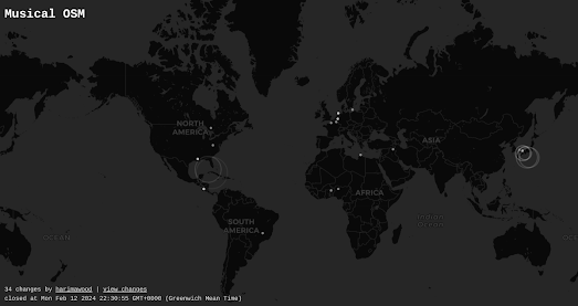
I'm currently listening to XEFO-AM from Mexico City, a radio station that seems to exclusively play classic, early 20th-century Spanish-language songs. The station is just one of about 100 local radio stations in Mexico City that appear on the Radiocast interactive map.

Radiocast is an interactive globe featuring over 7,000 radio stations broadcasting from around the world—all of which can be tuned into directly from the map. While Radiocast isn’t the first map to let you select radio stations by location, it boasts several features that might make it your go-to radio map.

One standout feature of Radiocast is its tag system, which lets you filter the 7,000+ radio stations by mood and genre. This makes it much easier to discover stations that match your personal tastes. If you’re not particular about mood or genre, you can use the ‘random’ feature to uncover a station from anywhere in the world. Radiocast also allows you to save your favorite stations, which are displayed as red hearts on the map.

My personal favorite feature is the sleep timer, which lets you set a timer for 15, 30, 45, or 60 minutes—perfect for falling asleep to your favorite station.

However, one feature Radiocast seems to lack is the ability to share links to your favorite radio stations directly from the map. That’s a shame because the world truly needs to experience XEFO-AM. To find it, zoom in on Mexico City and look for the marker labeled ‘1030 AM’ (as that’s how it’s listed on the map).

Other Radio Maps

Radio Garden - (includes unique URLs which directly link to individual stations)

Radiooooo - no radio stations - but discover music by location and decade

Drive & Listen - watch driving videos from cities around the world while listening to a local radio station 

Monday, June 24, 2024

The Dawn Chorus Map of Birds

map of europe with markers showing the locations of dawn chorus recordings
Each and every morning birds around the world herald the start of a new day by participating in the dawn chorus. While the aural phenomenon of birds singing at dawn is a global one the songs of the dawn chorus can vary greatly depending on where you live and on the make-up of your local avian population. Now, thanks to a new(ish) interactive map, you can tune into this morning serenade at thousands of locations around the globe

Select a marker on the Dawn Chorus map and you can listen to a recording of the morning dawn chorus captured at that location. Dawn Chorus is a citizen science project which aims "to document bird diversity over time using sound recordings through the help of citizen scientists". Using the Dawn Chorus map you can listen to the thousands of dawn chorus recordings already made by these citizen scientists.

The map includes a number of filter controls which allow you to search and listen to the recorded bird songs by location, date, species of bird, and by habitat. If you wish to participate in the project you can record bird song using the Dawn Chorus mobile app, or you can simply upload your own sound recordings directly through the Dawn Chorus website.

Via: weeklyOSM

a map of the world with lots of markers showing the locations of Nature Soundmap sound recordings
From the insect chorus of the Borneo rainforests to the crooning baritone song of an Atlantic humpback whale, the Earth.fm Nature Soundmap can also serenade you with the sounds of nature. Nature Soundmap is a map featuring the sounds of nature captured by professional nature sound recordists around the world. 

Maps have always been a fascinating way to explore the globe. Satellite imagery and Street View imagery have made armchair exploring even more immersive. Add in the sounds of the monsoon in Borneo and the soundscape of the Brazilian rain-forest and you can almost imagine that you really have been transported to the other side of the world.

Saturday, June 15, 2024

Some More Maps of Sounds

Yesterday Hacker News featured a thread on Sounds of the Forest, an interactive map of sound recordings made in forests around the world. Also linked in the Hacker News thread was the wonderful Radio Aporee, which, like Sounds of the Forest, has featured on Maps Mania before. Also mentioned in the thread were two interactive sound maps which I haven't seen (or heard) before.

Audiomapa

map of the world showing the locations of sound recordings featured on audiomapa
Audiomapa is a sound map which focuses on sound recordings from South America (although many users have contributed recordings from elsewhere in the world). Anyone can add a sound recording to the map simply by clicking on a location and uploading an MP3 file.

As well as browsing the submitted recordings by location on the map it is also possible to filter the sounds by category. This allows you to search for 'urban' or 'rural' recordings, or recordings of 'birds', 'machines', 'markets' or myriad other categories of sound. Just click on a marker on the map to listen to the submitted recording.

Freesound

map of the world showing sound recordings submitted to Freesound
Freesound, from the Universitat Pompeu Fabra Barcelona, is an interactive map of over half a million sound recordings. The map "aims to create a huge collaborative database of audio snippets, samples, recordings, and all sorts of bleeps, ... released under Creative Commons licenses that allow their reuse". 

As well as browsing the submitted sounds by location on the interactive map the Freesound homepage features a Random Sound of the Day, the latest sounds submitted, and the top rated and most downloaded sounds recordings. Using Freesound's tags and other search filters in conjunction with the interactive map can provide a wonderful insight into sounds around the world. For example have you ever wondered about how ambulance sirens sound in different countries or how similar church bells sound around the world.


Hundreds of other maps featuring sound recordings can be found under the Maps Mania Sound Maps tag.

Thursday, June 06, 2024

The Sound of the City

Every city in the world has a unique sound. On Sonicity that unique sound is generated by each city's map. Select a city on Sonicity (currently limited to 10 global cities) and you can listen to its map being played by various instruments. 

To be honest I have no idea what is going on here. The only info that Sonicity provides is that 'Each city has its own unique geographical data. These datasets create distinct sounds and patterns that offer a new way to experience the data.'

When you 'play' a city's song on Sonicity parts of the map are highlighted each time a note sounds. My guess is that the latitude and longitude coordinates are being used somehow to determine the note and pitch being played for each section of the map. Without any more detailed explanation the sounds and patterns may very well 'offer a new way to experience the data' but they really don't help us understand that data in any meaningful way.

I much prefer Ohio is a Piano, which not only comes with a detailed explanation but also allows you to create tunes from different datasets on the same map. Ohio is a Piano is even capable of playing a recognizable tune.

Monday, April 15, 2024

Spikkin Scots

The Shetland Dialect map allows you to listen to examples of the Shetland Dialect spoken across the Shetland Isles. The Shetland Isles are the northernmost region of the United Kingdom, Shetland, positioned between Orkney, the Faroe Islands, and Norway. 

Due to the isolated geography of the Shetland Isles the Shetland dialect (also called Shetlandic or auld Shetland) has continued to retain a degree of autonomy from other Scottish dialects. If you click on the green speaker icons on the Shetland Dialect map you can listen to a short sound clip of a Shetlander speaking in their local dialect.

Unfortunately the sound recordings are not accompanied by transcripts. This is a shame.  It would be very useful to be able to see some of these examples of Shetlandic vocabulary and grammatical forms written down. However if you do struggle with any individual words then you can always refer to the Shetland Dialect's Shetland Dictionary, which also includes sound recordings of individual Shetlandic words

The Scottish newspaper the Press and Journal has published a series of articles about the Scots language. This series includes a Spikkin Scots interactive map which features a number of sound recordings of people speaking Scots across the whole of Scotland. 

The newspaper estimates that there are currently around 1.5 million Scots speakers in Scotland. Scots is classed as a vulnerable language by Unesco. 

The Scots language has many dialects. You can explore and listen to these dialects on the Press and Journal's interactive map. The map includes 14 different sound recordings of people speaking Scots in different parts of Scotland (and one Scots speaker in Ulster). 

The map features at least 13 distinct dialects of Scots. Each of the sound recordings provides an example of a person speaking who actually lives and works in the mapped location.

Links to the other articles in the Press and Journal's Scots language series are provided beneath the map, at the end of the accompanying article.


The Scots Syntax Atlas is another interactive map which includes recordings of the Scottish dialects spoken in the different areas of Scotland. The map includes sound recordings of Scottish syntax recorded in all parts of the country, allowing you to explore where and how different types of Scottish syntax are spoken in different areas of Scotland. 

To create the map the researchers visited 145 communities in Scotland interviewing local people and recording their answers. In these interviews the researchers were particularly interested in the syntax of local dialects and in the ways that sentences are constructed in the different areas of Scotland. 

If you click on the markers on the map you can listen to interesting examples of Scottish syntax which were recorded in different parts of the country. You can also discover where these different types of Scottish syntax are spoken by selecting the 'who says what where' button. This option shows you where different types of syntax are spoken in Scotland. The 'stories behind the examples' button provides more detailed grammatical explanations of the recorded examples of Scottish syntax and information on how Scottish syntax differs from  'standard' English.

Tuesday, February 13, 2024

OpenStreetMap Edits in Real Time

OpenStreetMap (OSM) is a free, editable map of the whole world, built and maintained by a community of volunteers. It is often described as the Wikipedia of maps, to which anyone can contribute and update information. Very importantly all of the map data contributed to OpenStreetMap is open data, which anyone and everyone is free to use.

In a way maps have always been produced through collaboration. The cartographers of early Mappae Mundi created their world maps from geographical knowledge gained from the Bible, early explorers and the writings of even earlier cartographers such as Ptolemy. Early Portolan charts might also be said to be crowd-sourced, relying on the accumulated experience and shared knowledge of routes, landmarks, and hazards, acquired by generations of Mediterranean sailors.

What makes OpenStreetMap truly unique is both the global scale and immediacy of its underlying map data. It is a map which is constantly being updated in real-time all around the world by millions of volunteers with knowledge of their local areas. If you want to get an idea of the scale of OpenStreetMap's crowd-sourced reach then you can view these map edits happening in real-time on these two interactive maps:

Screenshot of Musical OSM showing real time edits of OpenStreetMap on a world map

Musical OSM allows you to not only view edits being made to OpenStreetMap but also allows you to listen to them being made in real-time. Whenever a new Open Street Map edit is committed then Musical OSM plays a relaxing chime sound and the location where the edit is being made is circled on the map. 

I don't think that the notes played by the map are affected by the actual geography of the edit, which is a bit of a shame. It would be fairly easy to equate specific notes to specific latitudes and different octaves to specific longitudes (or vice versa). This would obviously require a lot more recorded chime sounds but it would result in a real auralization of the edited map data. 

Screen recording showing real time edits of OpenStreetMap on a satellite map
OSMlab's Show Me The Way is another real-time visualization of OpenStreetMap's contributors in action. Using satellite imagery 'Show Me The Way' provides a captivating visualization of the ever improving OSM project, as it actually happens.

The OpenStreetMap Wiki lists two other real-time maps of OSM edits. But neither OpenStreetMap Live Edits or OSM in Realtime appear to be working at the time of writing.

Monday, December 18, 2023

The Global Birdspotting Map

BirdWeather uses machine learning to detect and map different species of birds around the world. The platform continuously collects sound from active audio stations distributed across the globe and provides what is effectively an automated AI bird spotting map of the world.

Thousands of crowd-sourced audio stations around the world contribute audio data to BirdWeather. Using the BirdNET artificial neural network, a highly sophisticated machine learning algorithm, BirdWeather uses this captured audio data to accurately identify bird calls and songs. From this analysis BirdWeather is then able to automatically map the locations of recorded and identified bird species.

You can explore the results of the machine learning analysis of the audio data provided by thousands of audio stations on the BirdWeather interactive map. This map allows users to explore bird activity by location, species, and by date. Users of the map can also listen to recorded bird calls and songs, and watch live cam streams of selected nesting sites.

If you own a Raspberry PI and a USB Microphone or Sound Card you can also contribute to BirdWeather. Install BirdNET-Pi and you will be able to record and automatically identify bird songs and submit your results to the BirdWeather map.

Active 'twitchers' may also be interested in the eBird interactive map. eBird collects and documents data on bird distribution, abundance, habitat use, and trends. It has detailed information on more than 1,000 bird species around the world. 

Select a species of bird on the eBird Status and Trends webpage and you can view an interactive map which shows the natural habitat of the selected bird. If you select the 'Weekly' option you can actually watch an animated map showing the species' relative abundance for every week of the year. This allows you to observe the migratory journeys undertaken by the selected species of bird over the course of the year.

Saturday, October 28, 2023

The World Map of Podcasts

MapsFM is an interactive map which can help you find and listen to podcasts produced around the world. Listening to location based podcasts could be a great way to learn more about a planned travel destination or even to learn more about your local neighborhood or town. Now you can easily find and listen to location based podcasts by using the MapsFM map of the podcast world.

Simply share your location with MapsFM or use the search option to enter an address and you can then view all the podcasts about that place marked on a local map. You can view the title of each podcast simply by hovering over a podcast's marker on the map. Click on the marker and you can then listen to the selected podcast directly from the map sidebar. 

For some reason all the podcasts about my area of East London seem to be about cocktail bars - which is incredibly boring. However by searching a little further afield I was able to discover some local history and art based podcasts that are definitely more up my street.

The first interactive map I ever made was a mashup of Google Maps and YouTube. Ever since then I've believed that interactive maps can be a great way to search for localized media. Some other great examples of localized media maps are: 

The Poetry Atlas - an interactive map of poems written about specific places around the globe
The Watercolour World - an interactive map geo-locating the locations depicted in paintings
Historypin - an interactive map of historical and vintage photographs

Over the years I have reviewed many geo-located book and video maps as well. Most of these however seem to have joined the dead-pool.

Via: this was yet another map which I discovered via the wonderful Webcurios newsletter.

Monday, January 16, 2023

A Dialect Map of England

The University of Leeds' Dialect and Heritage Project has released a Sound Map of English dialects. The map features archived audio recordings of native English speakers from the different regions of England. 

In the 1950s and 1960s the Survey of English Dialects undertook to complete a survey of the regional dialects of England. The survey was conducted in over 300 different towns and villages. In each location a local person was asked about the words they used for everyday objects and about their local customs, culture and way of life. The survey included a questionnaire of over 1,300 questions and the surveyors used a special notation to record accents and pronounciation differences.

As the survey progressed the surveyors also began to use recording equipment in order to capture actual recordings of natives speaking their local dialects. You can listen to some of these recordings directly from the Sound Map. 

If you want to listen to accents from north of the border then you can refer to the Scots Syntax Map. The Scots Syntax Atlas is an interactive map which features recordings of some of the many dialects spoken across Scotland.

To create the map researchers visited 145 communities in Scotland interviewing local people and recording their answers. In these interviews the researchers were particularly interested in syntax of local dialects and in the ways that sentences are constructed in the different areas of Scotland.

If you click on the markers on the map you can listen to interesting examples of Scottish syntax which were recorded in different parts of the country. You can also discover where these different types of Scottish syntax are spoken by selecting the 'who says what where' button. This option shows you where different types of syntax are spoken in Scotland. The 'stories behind the examples' button provides a grammatical explanation of the recorded examples of Scotish syntax and information on how Scottish syntax differs from more 'standard' English.

If you live in the United States then you may wish to peruse the New York Times's 2013 study How Y’all, Youse and You Guys Talk. This interactive feature asks you a series of questions about your pronunciation and use of certain words and, from your answers, creates a personal dialect map. The resulting heat-map shows you which areas of the US have dialects similar to you.

Friday, December 09, 2022

The Map of Stories

The Map of Stories is a fantastic interactive map which allows you to discover and listen to tales from the highlands and lowlands of Scotland. Using the the you can explore the rich oral storytelling traditions of Scotland and listen to stories born from the landscapes and people of Scotland.

Using the map you can browse over 70 stories by story location or by storyteller location. The map also includes controls which allow you to filter the stories shown by language (English, Gaelic or Scots) and by category.

The stories found on the map come in many forms. Many of the stories emerge from indigenous  communities, traveller communities and from the Shetland Islands. Others come from Scotland's migrant communities, from countries as far away as India and Iran. However, no matter their origin, all the stories can be listened to simply by clicking on its marker on the map.

Sgeulachdan na Mara / Sea Stories - an online cultural map of the sea is a wonderful interactive map featuring local stories found around the island of Barra, in the Outer Hebrides of Scotland.

To create the map the island's school pupils interviewed local Barra fishermen and older members of the local community. The result is a unique map featuring local legends and oral history as told by the islanders themselves. You can watch and listen to the videos and audio recordings resulting from the interviews directly from the Sea Stories map.

The map legend allows you to highlight on the map where audio, video, photographs or text are available to be viewed. These media are shown on the map using a number of different types of marker, indicating stories about wrecks, fishing, coastal features etc.

There is a lot to love about this map, not least the wonderful cartography of the vintage style map of Barra. The real stars of this map, however, must be the islanders of Barra. There are at least two Gaelic folk song recordings on this map which are worth the price of admission (there is none) on theur own.

Wednesday, November 23, 2022

The lutruwita place names map

pulingina to lutruwita (Tasmania) Place Names Map is an interactive map which shows the original palawa kani names for lots of locations in lutruwita (Tasmania). palawa kani is the language of Tasmanian Aborigines. The map was created by the Tasmanian Aboriginal Centre using research undertaken by the palawa kani Language Program.

According to the Tasmanian Aboriginal Centre only "a handful of places in lutruwita still bear their original names". These handful of palawa kani place names are also given using English spellings, which do not convey the original sounds. The pulingina to lutruwita Place Names Map includes audio recordings of each place name spoken by a palawa kani speaker. Click on a place name's marker on the map and you can also learn a little about the history of the name.

You can learn more about the map and the palawa kani Language Program on the Tasmanian Aboriginal Centre website.

You may also be interested in:

  • New Zealand - the Te Reo Māori Web Map shows the Te Reo place-names of New Zealand towns, cities, lakes, rivers, mountains and other notable locations.
  • Australia - The Land is a Map shows locations in Australia with names of Indigenous Australian origin. Click a place name marker on the map to learn more about a place name's etymology from its Wikipedia entry.

Saturday, November 12, 2022

Mapping Your Local Soundscapes

Hush City is an interactive map of quiet areas around the world which have been collected by people using the Hush City moble phone app. Using the map you can find the quiet spots near you where you can go to escape the busy chaos of everyday life. 

Areas in your neighborhood which have been observed as quiet places are shown on the map with colored markers. If you click on a marker you actually listen to an audio recording of the soundscape recorded at that location by a Hush City user. You can also read the user's feedback and any photographs of the location posted to Hush City. The color of a marker indicates the noise levels measured at a location by the app, shown in A-weighted decibels (an expression of the relative loudness of sounds as perceived by the human ear). 

The Hush City map also includes controls which allow you to filter the quiet areas shown on the map by noise level, by the user descriptions used to tag the location, and by the location's perceived quietness. 

From the insect chorus of the Borneo to the crooning baritone song of an Atlantic humpback whale, earth.fm wants to serenade you with the sounds of nature. Earth.fm is a map featuring the sounds of nature captured by professional nature recordists across the world. 

The earth.fm interactive map provides access to geo-located immersive soundscapes which have been recorded around the globe. Click on any of the markers on the map and you can listen to an actual sound recording which was captured at the chosen location. The map includes a number of controls which allow you to filter the sound recordings shown on the map by the predominant sounds in the recording and by the type of habitat.

Cities and Memory is a wonderful sound map which not only allows you to listen to recorded soundscapes but also allows you to listen to imagined soundscapes inspired by the same locations. 

Stuart Fowkes' Cities and Memory sound art project aims to present both the real sounds of the world and also their re-imagined counterparts, creating two parallel sound worlds; one of the real and one of the imagination.

Every location and every faithful field-recording on the Cities and Memory sound map is accompanied by a reworking, a processing or an interpretation that imagines that place and time as somewhere else, somewhere new. The listener can choose to explore locations through their actual sounds, or explore interpretations of what those places could be. They can can even flip between the two different sound worlds at their leisure.

For example, if you click on the Greenwich foot tunnel in London you can listen to the real sounds of people walking through the tunnel. Alternatively you can listen to an imagined soundscape of some poor souls entombed beneath the Thames.

Chatty Maps provides a number of maps which reveal the dominant soundscapes of city streets in a number of global cities. The map is based on an analysis of the tags used in photos posted to Flickr. This analysis is then used to determine the likely sound profile of individual city streets. 

Chatty Maps includes interactive Leaflet based maps of New York, San Francisco, Chicago, Boston, Washington, Miami, Seattle, London, Barcelona, Madrid, Milan and Rome. On each map the city's roads are colored to show the dominant sounds on the street, based on tags used in social media.

If you select a street on the map you can also view a data visualization which explores the relationship between the street's soundscape and emotions. For example streets with music sounds are often associated with strong emotions of joy or sadness, while those with human sounds are more usually associated with joy or surprise.

Wednesday, June 08, 2022

The Sound of 6,000 Years of Deforestation

Six Thousand Years of Forests tells the story of how the UK's forests have been transformed over the last 6,000 years into croplands, pastures and cities. What was once a country covered by primeval forest is now an intensely farmed and populated landscape, with only 13% of the country covered by woodland.  

However Six Thousand Years of Forests doesn't confine itself just to the UK. In fact it also contains a marvelous scrollytelling global map showing how land use has changed around the world over the last 8,000 years.

As you scroll through this map you can see how the history of the human race is also the story of the world's deforestation. In truth the map could be called '2,000 Years of Forests', as the first major change on the map appears around the time of the birth of Christ. Around 0 AD we begin to see dense urban settlements begin to appear in northern India. 

From around 0 AD we see a very slow increase in dense urban settlements in northern India. Elsewhere, in many parts of the world, there is a loss of forests to croplands and pastures. The major intensification of change comes with the industrial revolution. Around 1800 AD we begin to see dense urban settlements grow in many parts of the world, particularly in China and then in Europe. By the year 2,000 huge areas of the world have been deforested, either to be replaced by farmland or by dense human settlements. 

One result of all this deforestation is that most of us now have no understanding of the soundscapes of a primeval forest. Six Thousand Years of Forests includes a series of magical sound recordings, created by ecologist Joseph Monkhouse, which attempt to recreate the sounds of UK woodlands at different points in history. There are four recordings in all, including re-creations of the sound of a Mesolithic Woodland (3,980 B.C.), a Medieval Woodland (1422 A.D.), a 20th Century Woodland (1962 A.D.) and a 21st Century Woodland (2022 A.D.). 

Each of these sound recordings is accompanied by illustrations and a description of some of the birds, animals and other sounds which can be heard in each recording. The 21st Century woodland recording sadly (but probably realistically) includes the sound of cars on a nearby road.

Tuesday, June 07, 2022

The Noise of the City

Noisy Cities is an interactive map which visualizes noise pollution in New York, Paris and London.

Noisy Cities isn't just a mapped visualization of noise pollution. It is also a mapped sonification of noise pollution. These interactive maps of New York, Paris and London don't just use a heat map layer to visualize the average levels of road traffic and aircraft noise. If you turn on your speakers and hover over the map you can actually hear an audible representation of the noise pollution at any location. Move your mouse around and the traffic noise increases and decreases in volume based on the background traffic noise pollution.


Noisy Cities was inspired by Karim Douieb's 2020 interactive map Noisy City. Noisy City is an audible data visualization of noise pollution in the Belgium city of Brussels.

Like the New York, Paris and London maps the Belgium map visualizes average levels of noise pollution using a heat map layer. Like Noisy Cities it also uses real noise to indicate the levels of noise pollution in different parts of Brussels. Using real noise to help convey the levels of noise pollution is a really nice idea. I also really like the animated noise meters which are used on these noise pollution maps to reveal the number of decibels of noise pollution which can be found across all four cities.

Thursday, September 09, 2021

The Sounds of Caracas

Caracas can be a very noisy city. It's streets are full of the sounds of busy traffic, of cars and motorcycles zooming by. The streets are also full of the sounds of the city's inhabitants talking, playing music and going about their everyday business. Listen carefully and you may even hear some sounds of nature, made by dogs, frogs and crowing roosters.

You can experience the various soundscapes of Venezuela's capital for yourself on Valeria Escobar's Caracas Soundscape interactive map. Valeria's map allows you to actually listen to the different sounds which can be heard in the city's different neighborhoods. It even allows you to experience how these soundscapes change and fluctuate during the course of a normal day.

One of the things I really like about Valeria's sound map is the use of colored audio contour lines to visualize the different sounds which can be heard in different parts of the city. If you mouse-over a neighborhood on the map then you can listen to all the sounds indicated by these different colored lines. The map sidebar explains what sounds the different colors signify. You can also use this sounds key to turn on & off the different categories of sound shown on the map. 

A timeline control allows you to listen to the sounds of Caracas during different hours of the day. If you press play on this control then you can listen as the sounds of the city automatically change to give you a taste of the different aural landscapes which can be heard in the city during the course of a day. 

If you want to compare the sounds of Caracas to other major cities around the world then you might like:

If you want even more noise then you can also check out the Sound Maps tag on Maps Mania to discover many more exciting audio mapping projects

Wednesday, July 28, 2021

It's Open Mic Nite

There are lots of webcam maps which allow you to view live webcam feeds from locations around the world (check-out Earthcam, igoCam and Ivideon TV). Most of the well known sound maps however are not live, and tend to feature prerecorded sound clips rather than allow you to listen to live audio feeds. 

That is why I have taken a shine to the Locus Sonus Stream Project, which is an interactive map featuring open microphones around the world that provide permanently streaming local sounds. Click on any of the mike shaped markers on this map and you can listen live to the real-time sounds being recorded at that location. The map also features a day-night overlay so you can tell at a glance which of the open microphones are currently capturing daytime sounds and which are recording at night.

Locus Sonus is actually a research group which is interested in the relationship between place and sound.If you click on the 'about' link on the Locus Sonus Stream Project map you can view instructions on how to set up your own live streaming microphone, using a Raspberry Pi, a phone, tablet or computer. If you are struggling to identify the sounds from one of the open microphones you can always click on the 'read more' link to view some clues as to what sounds can normally be heard on the live audio stream.

Tuesday, June 01, 2021

The Sounds of the Forest

In March and April community radios stations across the UK took part in the Your Forest project. Community Radio Stations near forests asked their listeners to venture out into their local wooded areas and record the sounds that they could hear.

These sounds have now been added to the Your Forest interactive map. Using this map you can listen to the sounds of the UK's urban forests, as captured and recorded by the communities who live near them. On the map the leaf shaped markers show the location of forest recordings, all of which you can listen to directly from the map. The radio mast markers provide links to the websites of the community radio stations who took part in the Your Forest project.


You can listen to forests elsewhere in the world on the Sounds of the Forest interactive map. Sounds of the Forest allows you to listen to sound recordings made in forests around the world. The map includes many different sound recordings from around the globe, including the calls of lemurs in the forests of Madagascar, the song of a Nightjar in Australia and the cascade of a waterfall in Chile.

The sound recordings featured on the Sounds of the Forest map were originally collected for the 2021 Timber Festival. The map still includes a 'contribute' link so it looks like you can still submit your own recordings of forest aural landscapes to the map.


From the insect chorus of the Borneo rain-forests to the crooning baritone song of an Atlantic humpback whale, the Nature Soundmap can also serenade you with the sounds of nature. Nature Soundmap is a map featuring the sounds of nature captured by professional nature sound recordists all around the world.

Maps have always been a fascinating way to explore the globe. Add in the sounds of the monsoon in Borneo or the soundscape of the Brazilian rain-forest and you can almost imagine that you really have been transported to the other side of the world.

If you want to explore more interactive maps featuring sound recordings made in different urban and rural landscapes then check out the Maps Mania Sound Maps label. 

Friday, March 12, 2021

The OSM Ochestra

 OpenStreetMap isn't only the world's leading editable map, it is also a never ending free-form improvised song.

Open up Musical OSM and you can not only watch edits being made to OpenStreetMap in real-time but you can also listen to those edits as they are being made. Musical OSM is an interactive map which shows the locations of edits being made to OpenStreetMap around the world. As each edit is made to OSM the map also plays a single note. Thanks to the huge number of people contributing to OpenStreetMap around the world Musical OSM plays a continually emerging tune, which will play as long as people continue editing OpenStreetMap.

Musical OSM uses code from James Westman's OSM in Realtime map as the basis for the real-time map. The chimes used in the map come from the wonderful Trams of Helsinki map, which is an interactive map showing trams moving around the Finnish capital in real-time. 

Friday, January 15, 2021

The Sound of an Epidemic

Life has definitely become a lot quieter for me since the Covid-19 outbreak. During 2020 my social life became almost non-existent. I therefore no longer regularly hear the background noise of music and people that I am used to hearing in cafes, pubs and clubs. In London there is also a lot less plane noise than usual. Unfortunately road noise, which at one point during this epidemic had fallen drastically, seems to be returning to 'normal' levels. 

One thing that hasn't changed for me during lockdown has been my daily walk around my local park. However the soundscape of my local park has definitely changed. Now there is no noise from organized team sports. There are no encouraging shouts from eager players on the field of play or from supporters on the sidelines. There are now no players or fans. However there are lots of people. Before Covid in my local park I would normally see four or five other walkers and a handful of joggers. Now there are hundreds (or what seems like hundreds to me). So now I hear the occasional snatches of passing conservation from strolling couples and single walkers on mobile phones.

All of this is of course anecdotal. I haven't measured the change in noise levels from different sources in my local park and compared them to the noise levels from before Covid-19. I have left that to MIT's Senseable Lab. 

In Sonic Cities Sensable Lab has compared the levels of sound in five famous city parks in cities around the world and measured how their soundscapes have changed during the Covid outbreak.Using the Sonic Cities interactive map you can explore how sound has changed in New York's Central Park, London's Hyde Park, the Public Garden in Milan, Marina Bay in Singapore and Golden Gate Park in San Francisco.

In each park you can view a graph of how noise from human activity, bird song, city sounds and sirens has changed from before and after the Covid outbreak. Each map also includes levels of these noises visualized on top of a walk around the park. The pre-Covid noise levels (for each type of sound) were extracted from the audio of YouTube videos of park walks from previous years. These audio levels have then been compared to recordings captured by volunteers during the epidemic.


MIT are not the only ones making sound recordings during lockdown. The Listening Passport is an interactive map of sounds recorded during Covid-19. The Listening Passport project was originally designed for people in Cornwall, England to record the sounds that surround them during the isolation of lockdown. However the map is actually being used to record the aural soundscapes of coronavirus by people throughout the UK and even further afield.

Anyone can contribute a recording to the map by completing a short form and sharing their location on an interactive map. All recordings submitted to the Listening Passport can be listened to via the project map. Just click on any of the yellow markers on the map and you can listen to the submitted recording.


The Listening Project is not the only map which is interested in recording the sounds of the coronavirus lock-down. Over the last few months many of us have witnessed a dramatic change in our aural landscapes. The huge reduction in air and road traffic has allowed other sounds, like birdsong and the wind blowing through the trees, to come to the fore.

Pete Stollery has created a Google Earth sound map which aims to capture the new soundscapes which have emerged as a result of the huge reduction in normal human activity around the globe. The Covid-19 Sound Map includes recordings from all across the world. These sounds include recordings of now empty city centers, people clapping for health workers, croaking frogs and traffic free streets.

You can add your own sounds to the map by sending recordings and a short explanation of the recording to Pete Stollery. The instructions for how to record your sounds and the form for submitting your recordings are on the Sound website.

Friday, December 04, 2020

Living Nations Poetry

Joy Harjo is the 23rd Poet Laureate of the United States. As a member of the Muscogee Nation she is also the first Native American to hold the position of Poet Laureate. Joy's signature project as the 23rd Poet Laureate is an interactive map of the United States featuring recordings of a number of Native Nations poets and their poems.

Living Nations, Living Words - A Map of First Peoples Poetry features 47 Native Nations poets. Each of the poets has selected an original poem for the map on the theme of place and displacement. Each poet also chose where they wanted to be placed on the map. If you click on a poet's marker on the map an information window opens with a photograph, a short biography, and a link to actually hear the poet recite and comment on their original poem. 

You can also listen to each of the poems featured in the Living Nations, Living Words Collection on the Library of Congress website. The Living Nations, Living Words Collection includes a recording of each of the 47 poems in the collection and a short introduction to each of the poets.