Mapping Street Orientations

The animated maps above compare the extreme grid like layout of Chicago to the more organic street layout of London. As both maps move the attached compass roses update to show the orientations of all the roads in the current map bounds.
The two maps were taken from The Economist's The Decline of the City Grid. This article also includes an interactive map which allows you to enter the name of any town or city to view a compass rose visualizing the location's predominant street orientations.
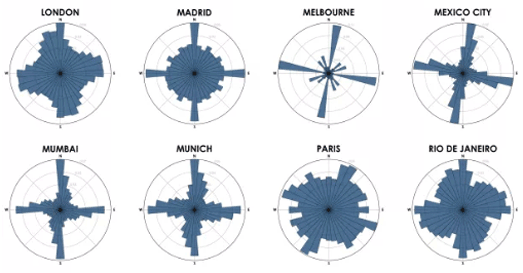
The Economist's article acknowledges its debt to Geoff Boeing's work on Comparing City Street Orientations, in which he compared the street orientations of 100 cities around the world. Geoff's study and his compass rose visualizations of predominant street orientations also inspired Mapbox's Vladimir Agafonkin to create his interactive Road Orientation map.
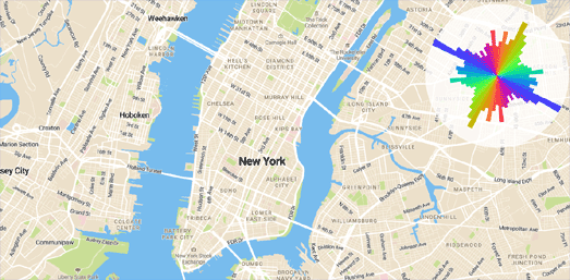
I suspect that The Economist has reused Vladimir's road-orientation-map code. I have used Vladimir's code myself many times (for example to map airport runway and church orientations). The code is very easy to adapt for different map features. I explain a little how you can adapt the road-orientation-map code in this post The Streets and Avenues of New York (which uses the code to just show the alignment of all the roads named 'Avenue' and all the roads named 'Street' in New York).


Comments