Showing posts with label London. Show all posts

Monday, June 30, 2025

A Time Traveller's Guide to the Zoo

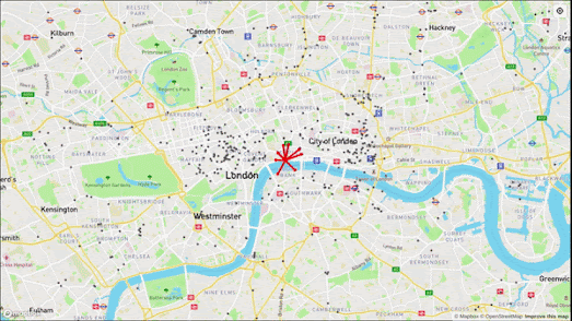
London Zoo is the world’s oldest scientific zoo. In 2028, it will celebrate its 200th anniversary - a milestone in a long and storied history that visitors can now explore through the Zoo’s Time Traveller’s Guide to London Zoo, a collection of vintage maps that even includes the original 1826 "Design for the Garden."

The Time Traveller’s Guide to London Zoo offers a fascinating journey through nearly two centuries of zoological innovation, conservation breakthroughs, and iconic architecture - all presented through a beautifully curated collection of vintage maps dating back to 1826, the year the Zoo first opened its gates.

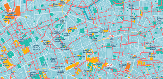
Using the map timeline, you can explore in detail the zoo’s historical layouts over the last 200 years. This series of maps reveals how the Zoo has evolved in response to new understandings of animal care and public engagement, while offering glimpses of its most iconic structures and beloved animal residents.

These structures include the much-loved Lubetkin Penguin Pool (now Grade I listed), the world’s first public aquarium (London Zoo even coined the word aquarium), and the Snowdon Aviary (now transformed into Monkey Valley). Some of the Zoo’s most famous residents - including Jumbo the elephant and Guy the Gorilla - also feature on the maps, along with notable human figures such as the naturalist Charles Darwin (who was a fellow and council member of London Zoo).

Thursday, May 15, 2025

A Panorama of Victorian London

The city of London has inspired many beautiful panoramic maps over the centuries, each lovingly crafted by talented artists. Interestingly, these panoramas almost always share a common perspective - north from the south side of the River Thames. This same viewpoint is used in Frederick James Smyth’s 1844 Panorama of London.

Exeter University’s Digital Humanities Lab has created an interactive guided tour of Smyth’s Panorama of London. Using Knight Lab’s StoryMap.js platform, the project offers a rich, navigable journey through 19th-century London as captured in one of the era’s most visually striking urban illustrations.

Originally commissioned by the Illustrated London News and first published in 1845, Smyth’s panorama is a remarkable feat of Victorian printmaking. Stretching over eight feet in length, it presents a detailed bird’s-eye view of the city from a south-of-the-Thames vantage point.

Exeter University’s story-map guides viewers through some of 1844 London’s most prominent landmarks. These include long-lost sites such as Millbank Penitentiary (where convicts were held before deportation to Australia) and the Hungerford Suspension Bridge. It also features familiar icons that remain central to the city today, including St. Paul’s Cathedral, the Houses of Parliament, and Buckingham Palace, to name just a few.

More vintage panoramas of London:

1543 - The Wyngaerde Panorama
1616 - Claes Jansz Visscher's Panorama (1848 copy)
1829 - View of London from the Adelphi

Monday, April 14, 2025

Live London Underground Trains

Live maps displaying the movements of planes, trains, and automobiles have been among my favorite mash-ups over the years, so it seems fitting to launch the third decade of Maps Mania with a beautiful illustration of a live, real-time transit map.

The Live Tube Map is a fully interactive, real-time 3D map that lets you watch underground trains move across London as they shuttle through tunnels, stations, and lines. It’s like the classic Tube map - but alive. Built by Ben James, the Live Tube Map uses real-time data from Transport for London (TfL) to visualize each train’s location, progress, and route. Each moving colored line you see gliding across the screen is a real train, updated in near real-time and placed on a highly stylized 3D map of London.

The choice of using moving colored polylines with transparent tails gives the map a beautiful and mesmeric aesthetic (although I think the blocky trains used by Mini Tokyo 3D are hard to beat). 

Under the hood, the map is powered by:

Hovering over a train on the map reveals a clean tooltip: line name, current status, journey progress (with a neat progress bar), and even upcoming stations. Beyond the sheer visual appeal, the Live Tube Map is a fascinating demo of what’s possible when you mix open data with open-source tech. It transforms a complex network of live infrastructure into something playful, transparent, and informative. 

It shows you moving trains on a map in real-time!

Tuesday, January 14, 2025

Notable Memorial Map

map of central London with the names of individuals added where there are memorials to them in the city

Notable Memorials

This morning, I created a map of memorials in central London.

My Notable Memorials map displays the names of individuals with memorials in central London, many of which are blue plaque memorials.

While there’s nothing particularly groundbreaking about the map itself (although seeing the names of individuals rather than just markers is quite engaging), what stands out is how quickly I was able to create it. In under five minutes, I gathered the data and built the map thanks largely to the Download Data from OpenStreetMap tool.

Download Data from OpenStreetMap

Download Data from OpenSteetMap is a new tool that makes it remarkably easy to view and extract geographical data from OpenStreetMap in GeoJSON format.

Anyone familiar with Overpass Turbo knows it is a powerful querying tool for OpenStreetMap data. However, mastering the Overpass Query Language (OQL) can be quite challenging (though tools like ChatGPT have made writing Overpass QL queries much easier). That’s why I believe there’s a significant demand for simple, user-friendly tools like Download Data from OpenStreetMap.

The tool uses OpenStreetMap categories to populate a drop-down menu. To view and download data, you simply select one of these categories. Any subcategories are conveniently displayed in the map’s sidebar. Then, with just a click of the green 'download' button, you can export the selected data as a GeoJSON file.

Notable People Map

If I wanted to make my Notable Memorials map into something people might actually use when traveling around London I could use the Wikipedia API to add a brief biographical paragraph for each of the notable individuals displayed on the map. 

For now you might prefer Topi Tjukanov's Notable People Map, which shows the most notable people born in locations around the globe. If you want to find memorial markers then the Historical Marker Database records the locations of permanent outdoor historical markers and commemorative plaques across the world. Read the Plaque has also mapped the location of thousands of historical plaques.

Tuesday, October 15, 2024

The A-Z Music Map

Step into the heart of Swinging London and let its iconic music lead you through the streets of a city alive with creativity, rebellion, and freedom. The 'London A to Z 1962-1973' interactive map will take you on a sonic journey through the London locations that helped shape one of the most exciting periods in music history.

LONDON A to Z 1962-1973 is an interactive map of songs about London from the Swinging 60s. During the 60s, London was at the heart of a global cultural revolution. As a symbol of youthful energy and creativity, the city represented freedom and opportunity. Many artists were drawn to this vibrant atmosphere and naturally incorporated London’s spirit into their music. Now, you can experience that creative energy for yourself by exploring the tracks on the London A to Z map.

All the songs featured on the map come from a new compilation album published by Ace Records, titled Bob Stanley Presents: London A to Z (1962-1973). The album includes tracks from artists such as Nick Drake, Cat Stevens, Jethro Tull, and Marianne Faithfull (though it seems Ace Records couldn't secure the rights to Waterloo Sunset by The Kinks!). As the title suggests, all the songs on the album reference a location or landmark in London. 

Each song on the album is represented on the London A to Z map by a pin. When you click on a marker, you can listen to a 30-second excerpt from the song. If you enjoy the selections, you can purchase the full album from Ace Records. For me, discovering a Nick Drake song I’d never heard before was like finding a hidden treasure. What might you find with the new musical London A to Z?

Saturday, August 03, 2024

Exploring London Through the Artist's Eye

map of London with colored markers bearing the names of writers and artists
"... this tide is always moving! Always! When all those people we now see in such activity are in their graves, the same hurried activity will still continue here ..." - Hans Christian Andersen

When Hans Christian Andersen visited London in June 1847 he was obviously impressed by the pace of London life. In his autobiography he called the English capital,

"London, the city of cities! ... Here is Paris but with a mightier power; here is the life of Naples but without its bustle."

Hans Christian Andersen was not the only notable figure of the 19th Century to be struck by the pace of London life. When the composer Felix Mendelssohn visited London in 1829 he wrote to his sister,

"It is fearful! It is mad! I am quite giddy and confused. London is the grandest and most complicated monster on the face of the earth."

These observations of London are just a few of the many descriptions which can be found on the interactive map, Lost & Found: A European Literary Map of London

As a global city, once at the heart of a massive colonial Empire, London has of course long attracted visits by writers, artists and intellectuals from around the world. University College London is curating how London has been seen through the eyes of Europe's cultural luminaries by mapping some of these observations of the city.

'Lost & Found: A European Literary Map of London' is peppered with a series of colorful markers, each bearing the name of a European writer, artist or intellectual who has visited the city. Click on a marker and you can read an excerpt from the named cultural icon describing their impressions of London. The excerpts are taken from novels, letters and biographies, so contain a mix of fictional and non-fictional descriptions of the capital.

The map's curators acknowledge that at the moment there is "an over-representation of white, male writers" on the map - so they welcome ideas for new passages which can be added to the map, particularly from under-represented groups. You can submit "descriptions of different sites/encounters with London, written in European languages beyond English" by completing a short form.

Wednesday, July 10, 2024

John Snow's Proximity Mapping

I've probably seen over 100 modern interactive visualizations of John Snow's famous map of cholera victims during the 1854 cholera outbreak in Soho. John Snow's map shows the locations of cholera deaths clustered around a water pump in Broad Street. The map helped to disprove the prevailing miasma theory on the spread of diseases and establish that cholera was actually spread by contaminated water.

Despite the central importance of proximity to John Snow's interpretation of the Soho cholera outbreak I think that Carto's new 1854 Soho cholera outbreak map is the first of the 100+ reinterpretations of the data to actually visualize which water pump the victims lived closest to. 

On the Carto map straight lines are drawn from John Snow's recorded victim's homes to the nearest pump. The purple lines indicate all those victims which lived closest to the Broad Street Pump. As you can see a number of victims actually lived closer to other pumps. John Snow wrote in a letter to the 'Medical Times and Gazette', "In five of these cases the families of the deceased persons informed me that they always sent to the pump in Broad Street, as they preferred the water to that of the pumps which were nearer. In three other cases, the deceased were children who went to school near the pump in Broad Street."

John Snow's original Broadstreet Map showing cholera cases clustered around the Broad Street water pump

You can view an interactive version of John Snow's original map on the Wellcome website. The map, was originally published in 1855 in Dr. John Snow's 'Report on the cholera outbreak in the Parish of St. James, Westminster, during the autumn of 1854'. 

Friday, June 14, 2024

The New Medieval Map of London

The new medieval map of London zoomed in on St, Pauls's Cathedral

The Historic Towns Trust has created a modern map of Medieval London. The map depicts London as it existed at the end of the 13th Century using modern mapping techniques. The map is based on archaeological and historical records. 

You can explore an interactive version of the Medieval London map on Layers of London (check the 'Use this overlay' box and then zoom in on the City of London area on the map. You might also want to select the 'Hide Pins' button).

One thing you will notice while browsing the map is that the street name labels are written in Middle English. For example the modern street name of 'Ludgate Hill' is depicted on the Medieval London map as 'Ludgatstrete'. If a Middle English placename confuses you then you can use the 'eye' button in the 'overlay tools' pop-up menu to turn off the Medieval Map and view the modern place-name underneath (presuming the street still exists). You can also use the Grub Street Project website to search for historical London place-names and to discover what those locations are known as now.

The Agas Map of London zoomed in on the area around St. Paul's Cathedral

Of course the Historic Towns Trust's modern map of Medieval London was not how a map of London would have actually looked during the 13th Century. At the time most depictions of London would have presented a panoramic view of the city and not a detailed true map. 

One of the first 'true' map depictions of London can be seen in the Civitas Londinum, more commonly known as the Agas Map of London.  The Agas map dates from the 1560s and provides a bird's eye view of London. It therefore doesn't provide a true overhead plan of the city (London is depicted from a viewpoint somewhere above the south bank of the Thames). However unlike earlier panoramic views of London the buildings on the Agas map don't obscure the streets behind those buildings. So the Agas map does work as a true map of 16th Century London.

You can also buy a print of the Medieval London map from the Historic Towns Trust.

Via: A New Map of Medieval London

Friday, January 05, 2024

The Year of the Map Game

I've said it before but 2024 is the Year of the Map Game.

Every day of 2024 a new map game is released*. Today's game is Metrodle, a fun daily challenge to identify a station on the London Underground map.

Every day Metrodle shows you an unlabeled station on a map of the London Underground. Your task is to simply name the mapped station based on your microscopic knowledge of the London tube. You have six attempts to name the correct station and will receive clues after each unsuccessful guess.

After each incorrect guess you are informed how many stations you are away from the correct answer and in which direction you need to travel. If you know all 272 stations on the London Underground like the back of your hand then you will have no problem in identifying the correct station from the clues provided. If your knowledge of the London Underground is a little more limited then you can always cheat by consulting the official London Underground map.

If you are a fan of London Tube games then you are in luck. Metrodle follows in the footsteps of the hugely popular London Tube Memory Game and my own hugely unpopular Tubebusters game.

If daily game challenges are your thing then you might prefer Travle (a daily challenge to connect locations on a map) or any of the games featured in the post The 10 Best Wordle Like Map Games.

* - Past performance is no guarantee of future results

Friday, December 15, 2023

The Mapped History of the London Tube

In the 19th century, London was a city grappling with rapid population growth. The idea of an underground railway was conceived as a solution to the city's ever-growing traffic congestion. and to help improve travel efficiency.

In 1863, the world's first underground railway, the Metropolitan Railway, opened its doors. Powered by steam locomotives, the Metropolitan Railway connected Paddington and Farringdon, providing a lifeline for commuters and transforming the way Londoners moved through the city. 

My interactive map, the 19th Century Tube, tells the story of the building of the world's first underground railway in London during the second half of the 19th Century. Press the map's 'play' button and you can follow the construction of the London tube year-by-year from 1860 to the end of the 19th Century. You can also click on any of the underground station markers on the map to learn more about when each station was opened and which London Underground lines that they currently serve. 

I think this may have been the first interactive map I've made without the help of Stack Overflow. Instead, as an experiment, when I needed help I referred to Google's Bard AI. For example I asked Bard to provide the JavaScript and CSS style for the map's slide control. Bard's code works perfectly (although I'm not entirely sure about its design choices and may update how the slide control looks at some point in the future).

If you are interested in exploring the code of 19th Century Tube, or if you want to re-use the code to create your own historical transit map then you can clone 19th Century Tube on its Glitch Page.

Friday, October 06, 2023

The London Underground Map Quiz

The London Underground consists of 269 stations. I bet you can't name them all.

London Underground Names is an easy map game which simply requires you to name all 269 stations on the London Underground network. Naming all 269 stations is a little tricky so I've provided you with a couple of aides to help you remind you of some of the station names. 

Due to my personal commuting history I can name all the stations on the Victoria Line and the Jubilee Line. However if you asked me to reel off the names I'd probably omit a couple of stations on each line. I've therefore added an option to the map to view the locations of all the stations on a chosen line. I find this helps me to see which stations on a line I've missed out and still need to name.

There are lots of London Underground stations I couldn't name without a little help. I've therefore added a clue to every station's name for those who need it. If you need a clue to a station's name simply click on the station's marker on the map.

London Underground Names was inspired by the brilliant SF Street Names, which requires you to name the streets in San Francisco. I decided that London had far too many streets for a similar game in the English capital and decided that London Underground stations was a far more manageable challenge.

If you want to create a similar game for your own city's transit network then you can clone and adapt London Underground Names on its Glitch page.

Friday, September 22, 2023

The Royal Parks of London

There are eight Royal Parks in London. The parks are owned by the Crown and managed by the Royal Parks charity. The parks originated from land that the royal family once used for recreation and hunting. Over time, these lands were enclosed and became known as the Royal Parks. The public can enter and use the parks for free but public access to the parks remains at the grace and favor of the Crown.

How well do you know London's Royal Parks? Find out by playing the interactive map game London Park Names. All you have to do is type in the name of each one London's eight Royal Parks. Name all eight and you win the game.

London Park Names is my latest interactive map game inspired by the brilliant San Francisco Street Names (and I promise it will be my last for a while). Having created versions of the game using polylines (Streets of Winchelsea) and place-name labels (US State Names) I wanted to create a variation of the game which used polygons to highlight defined geographical areas. The result is London Park Names.

If you want to create your own variation of the game you can clone London Park Names on Glitch.

Saturday, August 26, 2023

How the Blitz Changed London

In East London you can usually tell where German bombs fell in World War II by the age of the buildings. For example in my street the majority of houses were built in the Victorian age. All the homes built in the later half of the 20th Century were all built on homes destroyed by falling bombs during the war.

The Economist has added a new factor to my bomb site detection observations - building height. In How the Blitz Changed London The Economist notes that the destruction of buildings in London during the blitz allowed the city to build bigger and taller buildings after the war - in the long run 'supercharging' the city's economy.

At the core of The Economist's article is a map of London which uses red markers to show the locations of all the German bombs that fell on the city during World War II. On this 21st Century map all the buildings are shaded to show building heights (the darker red the building the taller it is). The Economist's central argument is that after the war taller buildings could be built on the locations of destroyed buildings. This is evident in the fact that now the heavily bombed City and East London areas of London have some of the city's tallest buildings, drastically "expanding the amount of commercial floor space".

The Economist's conclusion that German bombing enabled the City of London to build taller buildings has the ring of truth about it. The argument is based on work by Gerard Dericks of Oxford Brookes University and Hans Koster of Vrije Universiteit Amsterdam, which show that the heaviest bombed areas of London now have the highest density of workers. However I would like to be able to explore the Economist's map for myself. It is a shame that after building such a wonderful map of bomb sites and building heights that The Economist won't let us actually play with it. 

If you do want to explore a map of London bomb damage for yourself then check-out the Layers of London map, which includes an overlay of the London County Council Bomb Damage Maps. You could also try the Bomb Sight map (although the map isn't loading for me today)

Saturday, March 11, 2023

The City of Women Subway Map

Barcelona, like New York and London, now has a reimagined subway map designed to celebrate and recognise the lives of some of the city's most remarkable women. The Barcelona City of Women subway map highlights the extraordinary contribution of women to the Catalan capital.

On the Ciutat de Dones map every station on Barcelona's metro network and all the stops on the city's railway network has been replaced with the name of a woman. The map is a joint project of Barcelona City Council and Haymarket Books. An advisory editorial board decided on which women to celebrate on the map with the help of a number of organizations and women groups based in Barcelona.

If you click on the name of a woman on the interactive version of the map you can learn more about her achievements and why she has been recognised by the Ciutat de Dones project. In total 153 women have been recognised on the map (limited by the number of stations). Among the women celebrated on the map are the opera singer Montserrat Caballe, philosopher Simone Weil, and director Carla Simón.

The City of Women London Tube Map is a reimagining of the iconic London Underground map, in which all the station names have been replaced with the names of notable women.For example Swiss Cottage station has been renamed for the poet Sylvia Plath and Hyde Park Corner has been renamed for Emmeline Pankhurst, the leader of the UK suffragette movement. 

The map, released for International Women's Day, is the culmination of a project led by the actress Emma Watson, the journalist Reni Eddo-Lodge and the writer Rebecca Solnit.The City of Women London Tube Map was inspired by a similar map created by Rebecca Solnit, Molly Roy and Lia Tjandra for New York. Their City of Women New York City Subway Wall Map replaces the names of all the stations on the New York Subway with the names of notable woman who have a New York connection. 

You can buy a copy of the City of Women New York City Subway Wall Map (20 x 20 Inches) from Haymarket Books.

The interactive version of the City of Women London Tube Map allows you to click on a station name to learn more about the woman celebrated at that station. Many of the women shown on the map have a personal connection with the area where they have been placed on the map. For example the singer Amy Winehouse replaces Camden Town on the map, because she lived and regularly performed in this north London neighborhood. You can also buy poster sized prints of the London map from Bookshop.org or Waterstones.

One reason why the Barcelona, New York and London Subway maps have had to be reimagined to celebrate the achievements of women is because women are so rarely recognized by having squares, roads or stations named for them - unlike men. You can see this imbalance in the recognition of men and women in city road-names and place-names in the maps listed on the Maps Mania post The Sexist Streets of the World.

Friday, September 23, 2022

The RAF Map of Post-War London

Layers of London is an interactive map which gives you access to lots of historic maps and historical information about the capital city. This morning I've being exploring the Layers of London RAF Aerial Collection (1945-1949).

After World War II the Royal Air Force methodically flew over the whole of Britain to photograph the country from the air. This resulted in 24,000 photographs of London. This aerial imagery provides a stunning visual record of London just after World War II. Bomb damage from the Blitz is clearly visible in lots of the imagery. 

In the screenshot of West Ham above you can clearly see where the bombs fell. The rows of Victorian era terraced housing are interrupted by temporary white prefab buildings (at the center of the image). This is where houses were bombed out during the war. If you walk this neighborhood today you can still easily see where the bombs fell. If any building was clearly built after World War II then you can be sure it was built on the location of a bombed out Victorian era building. 


You can get an even better idea of where German bombs fell on Layers of London's Bomb Damage Map. On this map individual buildings are colored to show the extent of any bomb damage. Buildings colored black on the map were totally destroyed by a bomb. Dark red buildings were 'Seriously Damaged'. Buildings colored green were cleared (presumably as a result of bomb damage).

Monday, September 12, 2022

The Queen's Procession Route in London

On Wednesday the Queen's coffin will be carried in procession from Buckingham Palace to Westminster Hall in the Palace of Westminster. Here the monarch will lie in state until her funeral on Monday 19th. The coffin will be carried by the King’s Troop Royal Horse Artillery and will be accompanied by the Royal Family, led by King Charles.

If you want to attend the coffin procession in person then you can view the route on the Queen's Funeral Route Map. This map shows the route of the procession from the Palace, along the Mall, through Horse Guards, down Whitehall and finally to Westminster. The map includes an option to view the whole route animated using Google Street View.

The procession is scheduled to leave Buckingham Palace at 2.22pm. It will arrive at Westminster Hall at around 3pm. The Queen will then lie in state and the public will have the opportunity to pay their respects. The government says that you should expect long queues and that you may have to stand for many hours throughout the night.

Thursday, June 23, 2022

The Drunken Spider Crawl

Today I finally got around to creating my own 'data spider' map, inspired by William Davis's viral Hub and Spoke interactive map.

My Drunken Spider Map can help you find the ten nearest bars to any location in London or New York. If you pan around the map then the 'spider' will walk around the map, so that it is always pointing to the ten nearest bars to the center of the map.

Cloning William's map was very easy. Essentially all it involved was adding my own data and Mapbox account code. I also added a geolocate button. So, if you live in London or New York you can simply press this button to automatically find the ten nearest bars to your current location.

My Drunken Spider Map is hosted on Glitch, which means you can easily clone the map simply by pressing the 'Remix' button on its Glitch page. If you want to create a Drunken Spider Map for your town or city then you can use overpass turbo to quickly get the data for all the local bars.

If you want bar data for a different city then you can use this overpass turbo query. Simply center overpass turbo on a city, press the 'run' button' and then press 'export' and save the data as a geojson file. Then add the data to your Glitch clone of my Drunken Spider Map.

Of course you could always use overpass turbo to download other data. For example this query will give you the locations of all the cafes in the current map view on overpass turbo. Of course if you do use cafe data then you should change the name of your project from the Drunken Spider Map to the Caffinated Spider Map.

Monday, May 30, 2022

Footways and Slow Ways

A new interactive map can help you navigate London on foot, showing you the quietest and most enjoyable routes for walking in the capital. The Footways map includes hundreds of kilometres of scenic, safe and pedestrian-friendly walking routes in central London.

The map includes hundreds of routes, spanning out from London's mainline stations, using the most low-traffic and low-pollution streets, and where possible completely car-free paths. The map includes a geolocation tool. So, if you share your location with the map, you can quickly zoom to your current location on the map and discover your closet recommended pedestrian-friendly routes

If you want to venture outside the capital then you can use the Slow Ways interactive map. Slow Ways is building a national network of walking routes across the whole of Great Britain. Using existing public footpaths, ancient foot ways and trails Slow Ways is designed to make it easier for people to plan hikes and walks in the UK.

The Slow Ways map includes over 7,000 walking routes stretching over 100,000km. Routes and footpaths which can help you walk (or cycle) off-road between UK towns and cities. If you create an account with Slow Ways you can also help to make the map better. If you have an account you can review and rate walking routes and suggest other slow way routes. User input helps Slow Ways to review and verify all of the suggested routes on the map. Which helps to make Slow Ways a more robust and reliable map of the UK's off-road paths and trails.

Wednesday, December 22, 2021

Hologram Cities

Digital City is an impressive experimental map which uses OpenStreetMap data to create a 'hologram style' map "showcasing the connectivity of people within a modern urban area'. 

Visit Digital City and you can choose to view hologram style maps of either New York, London or Dubai. As you can see from the GIF above each city is visualized with pulsating colors to create a hologram style effect. This sci-fi ambience is enhanced by the addition of a spectral sound-track to each map. You can actually pan around each city map and even click on certain city landmarks to view contextual information.

The three city maps were created using OpenStreetMap location data with three.js.

Tuesday, June 29, 2021

London's New Constituencies

The Boundary Commission for England recently released its 2023 Review of Parliamentary Constituencies. This review includes its proposals for changing the parliamentary constituencies in England. Under these proposals the number of constituencies in London will increase from 73 to 75. 

My Gerrymander London map shows the boundaries of the recommended 75 London constituencies. Some of the boundaries for these new recommended electoral areas are significantly changed from the existing constituency boundaries. You can respond to these new recommendations from the Boundary Commission during the consultation period, which lasts until 2nd August 2021. 

On the map each of the recommended constituencies is colored by its Polsby-Popper score. The Polsby-Popper test is a mathematical formula for calculating how compact an electoral district is in order to detect for possible gerrymandering. The general assumption is that the more compact a constituency is the less likely it has been gerrymandered.

Based on my analysis Bethnal Green and Stepney has the highest Polsby-Popper score, so is therefore the constituency which is least likely to have been gerrymandered. Brent Central has the lowest Polsby-Popper score, so it is the constituency in London which is most likely to have been gerrymandered.

On my map I have also tried to calculate which party would be elected in each of the 75 proposed new constituencies. There is very little difference in the average Polsby-Popper scores for each of the three main political parties in London. So although some constituencies, such as Brent Central, are not very compact there is little evidence that the Boundary Commission has attempted to gerrymander London's proposed new constituencies in favor of any of the political parties.