Showing posts with label tourism. Show all posts

Saturday, March 15, 2025

Air Tours of the World

TripGeo's new Air Tours app is an engaging and immersive way to virtually explore cities around the world. This interactive web application combines Google Maps' 3D imagery, Street View, and aerial perspectives to provide you with four different perspectives of some of the world's most iconic locations. Whether you're a travel enthusiast, an urban explorer, or simply someone looking to get a new perspective on global destinations, Air Tours delivers an exciting way to navigate the world's major cities.

A Multi-Layered View of Iconic Cities

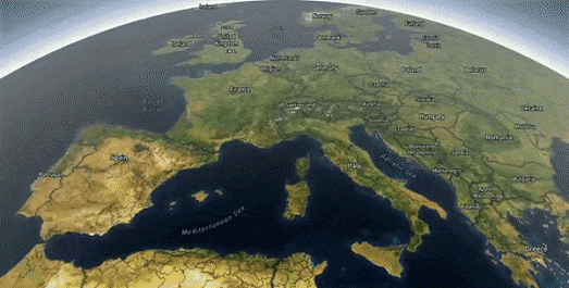
Air Tours allows users to virtually visit renowned cities such as London, Paris, and San Francisco, among many others. By combining multiple mapping technologies, Air Tours gives you a number of different perspectives of each featured location. You can fly over city skylines, orbit around landmarks, or dive down to street level for a more detailed view of urban landscapes. The smooth transitions between aerial and ground perspectives create a fluid and natural navigation experience that enhances the sense of immersion.

Famous Landmarks

The numbered buttons at the top of each city's Air Tour allow you to easily navigate between some of the most iconic locations in each city. Hover over these buttons to view labels for each destination. Click a button and the four map views will automatically pan to your chosen location, which you can then explore in 3D from the air, or from the ground using Google Maps Street View.

Fly Free

One of the standout features of Air Tours is its 'Fly' mode. This flight-sim mode allows you to take control and explore your city from the air. The ability to switch seamlessly between different perspectives - whether an expansive bird's-eye view or an up-close Street View experience - sets Air Tours apart from conventional mapping applications.

Air Tours is an innovative and exciting way to experience cities from multiple perspectives. Whether you're preparing for an upcoming trip, reminiscing about past travels, or simply indulging your wanderlust from home, this application provides a captivating way to interact with the world's urban landscapes. 

Air Tours is best suited for desktop users. The level of detail and the fluidity of navigation are best experienced on a larger screen. If you're looking for a new way to see the world, Air Tours is well worth exploring.

Travel Cat

If you enjoy the Flight mode in Air Tours then you will probably love Travel Cat, TripGeo's playful flight-sim exploration game. Travel Cat allows you to explore over 11,000 cities worldwide from the comfort of a feline piloted golden monoplane.

Tuesday, January 21, 2025

Your Personal AI Travel Guide

Street View image of London's Houses of Parliament with a transcript of an AI generated narration of the building

Imagine wandering through a city with your very own AI travel guide, ready to reveal the stories behind every landmark, monument, or hidden gem you encounter. With Google’s Talking Tours, this vision takes a significant step closer to becoming a reality.

Google Talking Tours offers a fascinating glimpse into the future of AI-driven travel guidance. Developed as part of a collaboration between Google Arts & Culture Lab and artist-in-residence Gaël Hugo, this experiment leverages generative audio and Google’s cutting-edge Gemini AI to provide dynamic, location-specific insights about cultural landmarks captured in Street View. 

Talking Tours currently covers 55 major landmarks around the world, offering an AI-generated audio guide that provides insights based on the visual content of Street View panoramas. Users can explore a 360-degree view of a site, take a snapshot, and receive detailed commentary from the AI. Additionally, users can click an “ask a question” button to generate three contextual questions about the location, enhancing interactivity and personalized learning.

Street View image of the Eiffel Tower with a transcript of Talking Tour's AI generated narration.

The technology relies on a blend of visual analysis and geospatial data. Gemini, Google’s multimodal large language model, processes the scene, combines it with GPS data, and crafts a descriptive script. This script is then converted into audio using a Google AI audio model, creating an immersive learning experience.

You can even explore individual museums and galleries, take snapshots of specific works of art or artifacts, and listen to Talking Tours' AI-generated narrated guides. Unfortunately, at this stage, the AI does not yet possess extensive knowledge of all exhibits in every museum and gallery worldwide. As a result, you may often receive a generic-sounding response rather than detailed information about a specific work of art or artifact. However, if the exhibit is particularly notable - for example, the Rosetta Stone in the British Museum - Talking Tours is able to generate a reasonably informed narration that describes and explains the selected exhibit.

Saturday, August 13, 2022

Hiking the Inca Trail to Machu Picchu

The 3D Inca Trail Tour is a guided tour of the four day trek from Piskacucho to Machu Picchu. This interactive tour of the incredible journey to the historic Incan citadel in the Andes makes impressive use of MapboxGL's 3d terrain data to provide a virtual taste of some of the world's most beautiful views.

As you scroll through the tour you will follow the actual ancient path taken by the Royal Incan leaders to get to Machu Picchu. The tour features a number of waypoints along the trail which include historic Incan ruins and the natural wonders of the Andes mountains. The tour also shows you the locations of the three camps along the route where visitors are able to grab a night's rest before continuing their trek.

You can discover more about how the 3D Inca Trail Tour was made at Learn How 3D Inca Tour Was Made with MapBox, GPS, and xyz... . This includes explanations of how turf.js was used to help create the small inset map and native JavaScript to control the scrolling elements of the tour.

If you want to create your own 3D tours with MapboxGL then you might also like Building Cinematic Route Animatios with MapboxGL. During this year's Tour de France and Le Tour Femmes the Mapbox Twitter account posted animated route maps every day of the current stage. 

The Mapbox blog's post on these cinematic route animations explains how they animated each stage's route, how they controlled the camera position for the fly-over animations and how the interactive map animation of each stage was finally exported to video.  

Monday, June 27, 2022

Explore the Pyramids of Meroë

Fresh from climbing Mount Everest in 3D today I'm undertaking a tour of the Pyramids of Meroë. If you travel south down the River Nile through Egypt to Sudan, just before you get to Khartoum you will come to Meroë, the ancient capital of the Kushite Kingdom. Here you will discover an ancient city which is home to more than 200 pyramids.

Google Arts and Culture's Pyramids of Meroë is a fascinating virtual tour of the Nubian pyramids located in the Sudanese desert. The Pyramids of Meroë were constructed in the Kingdom of Kush during the Meroitic period (542 BC–4th century AD).

As you scroll through the Pyramids of Meroë you are taken on a virtual tour of a 3D model of the pyramid of King Arkamani the First. This tour explains how these distinctly steep sided structures were built over 2,500 years ago. Keep scrolling and you can dive inside the pyramid, explore the hieroglyphs on the Offering Chapel's walls and view a 3D illustration of the pyramid's underground tomb.

After exploring this 3D model of King Arkamani the First's pyramid you can explore Meroë for yourself  using Google Maps Street View. This Street View tour includes interactive panoramic images of the partially buried pyramid of King Kalka Kaltaly, the pyramid of Queen Amanitore and the pyramid of King Adeqetali.

Saturday, July 10, 2021

The Traveling Tourist Problem

POI Path is an interactive route planning map which can help you plot an interesting walk around the city of Zurich, taking in some of the city's most famous landmarks. You just have to select the places that you want to visit in Zurich and POI Path will calculate a route between your selected points of information

The POI Path interactive map is populated with points of interest taken from the Open Data Catalog of the City of Zurich. These include locations such as historical buildings, monuments, churches, art objects in public spaces, and parks & gardens.If you select any of the mapped points of interest then an information window will open to provide information on the selected location.

To plan your walk around the city of Zurich you just have to select the attractions that you wish to visit. The map will then calculate the optimal route taking in all the sights of the city that you wish to see. The route chosen is also optimized to be the most attractive route for walkers or cyclists (using the City's own routing service). If you are happy with the calculated route then you can download it as a gpx file.


Calculating an optimal path taking in a number of different selected points of interest is essentially a Traveling Salesman Problem (in this case with the added constraint of choosing paths attractive for walkers & cyclists). You can get an idea about how to solve Traveling Salesman Problems on Shiny Salesman, which is a tool for solving a global Traveling Salesman Problem (TSP).

The Shiny Salesman tool allows you to choose a number of different locations around the world (or in the USA) to include in the TSP. You can then watch the map solve the traveling salesman problem using your own simulated annealing parameters. Shiny Salesman runs through iterations of possible routes searching for the optimal path. As it does this it also plots the distance of each calculated route so that you can see how many iterations it took to find the quickest possible route.

Wednesday, May 26, 2021

Bletchley Park & the Enigma Machine

During World War II Bletchley Park in Milton Keynes, England became the principal center of Allied code-breaking. It became the headquarters of the Government Code and Cypher School (GC&CS). It was at Bletchley Park that Alan Turing and other code-breakers built Colossus, the world's first programmable digital electronic computer. It was this computer which was responsible for decoding the messages created by the German cipher device, the Enigma machine.A feat which many believed shortened the war by at least one to two years.

Bletchley Park is now a museum open to the general public. The museum's Bletchley Park interactive map is a useful plan for visitors to the Bletchley Park site and to its facilities and attractions. The map contains lots of useful information about the Government Code and Cypher School and the role that its different buildings played in the breaking of German codes.

The map itself is an oblique pictorial plan of the Bletchley Park Estate. It features a couple of animated features, such as birds flying over the estate and a working fountain. Labels on the map reveal the name's of the museum's significant buildings. If you click on a building's label an information window opens providing information of the building's role in the GC&CS during the war. 

Huts, 3 and 6 are two of the code-breaking huts where Enigma messages were decrypted. Hut 8 was where Alan Turing's office was located and where Enigma messages were also decoded. The Bletchley Park Museum website provides lots of additional information of the role that the site played in the war, the amazing people who worked there, the challenges they faced in decrypting enemy codes and how they created and built the world's first programmable digital electronic computer.

Monday, April 12, 2021

Hiking the Virtual Appalachian Trail


The Appalachian Trail stretches over 2,000 miles between Springer Mountain, Georgia and Mount Katahdin, Maine. It is believed that nearly every year at least two million people hike at least part of the trail. This year, during lock-down, you can explore the trail virtually on a new 3D interactive map.

Backpacker's interactive map allows you to explore the beauty of the Appalachian Trail in glorious 3D. The Appalachian Trail in 3D map allows you to appreciate some of the natural attractions of the trail through its visualization of the trail's peaks and terrain.

This 3D tour of the Appalachian Trail starts at Springer Mountain in Georgia. Forward and back buttons allow you to progress along the trail in marked stages. Each stage take you to another point on the trail. The map sidebar provides information and images of the mapped locations. The map itself provides you with a beautiful 3D aerial view of the trail from that location. 

The mapped locations include Backpacker's favorite spots on the trails and the favorite locations submitted by Backpacker's readers. You can add your own favorite spots to the map by filling in a short form on the Backpacker site.

Friday, January 29, 2021

Virtual Tourism

Do you remember vacations? 

In the past, before the global pandemic, once or twice a year people would often take a break from their normal work in order to travel and relax. They would sometimes spend this time visiting far away places and exploring famous landmarks in person. 

Sadly this freedom to travel, which many of us enjoyed in the past, no longer exists. Which means we now have to explore the world virtually from within the confines of our tiny Covid bubbles. 

If you are wondering where to spend your virtual vacation this summer might I suggest a little online trip to the Mediterranean and to the ancient port city of Marseilles. On this journey allow yourself to be guided around the city by Marseilles 2021. Marseilles 2021 by La Phase 5 is a wonderful virtual mapped tour around some of the amazing sights of the French city of Marseilles. 

Marseilles 2021 consists of a custom designed map on which a number of the city's most memorable landmarks are highlighted using numbered markers. Click on a marker and you can visit the location virtually with a custom 360 degree panoramic 'Street View' image. These attractions include the Chinese Garden (pictured above), the Opera House, the Fort St John and the Villa Valmer. Each of the panoramic images includes a little 'information' button which, when clicked, will provide a short guide to the selected landmark. 

Of course one of the highlights of every vacayion is the exotic nightlife that you can enjoy by exploring a city at night. Some areas of Marseilles can be a little dangerous at night so it is wise to take a guided tour with someone local.

Google Night Walk is an amazing narrated Street View tour of Marseilles at night. Google Night Walk takes you on an immersive journey through the lively Cours Julien neighborhood of Marseilles. The tour includes an audio narrated guide by Julie and Christophe, two urban storytellers, who help explain the living history of the city. Many of the custom Street View panoramas in the tour are also enhanced by sound experiences recorded at the same time as the panoramas.

Wednesday, April 22, 2020

Take a Virtual Tour of Europe


You can explore some of London's most iconic landmarks on the VisitLondon Virtual Tour. The tour consists of a number of 360 degree panoramic images which have been taken in some of London's most well known locations. Included on the tour are custom 'Street View' images of the Houses of Parliament, Buckingham Palace, Tower Bridge, the Tower of London and many, many more places of interest around the English capital.


Visit Paris is an even more immersive virtual tour. This virtual reality experience allows you to explore Paris from within a 360 degree panoramic movie.

The landing page on Visit Paris features a fully interactive 360 degree video which allows you to explore a number of famous Paris landmarks in panoramic moving images. Visit Paris also includes lots of more traditional static 'Street View' panoramas from locations across the whole of Paris, including the Eiffel Tower, the Louvre and the Notre Dame :(.


Visit Paris was created by You Visit, who have also created a virtual tour of Rome. You Visit Rome includes 360 degree panoramic images of the Colosseum, the Vatican, the Trevi Fountain and many other iconic landmarks in Rome. You might also enjoy You Visit's virtual tours of Berlin, Madrid and Amsterdam.

If you want to step inside and experience some virtual tours of some of the world's best museums then you can also explore this Maps Mania round-up of Cultural Virtual Tours.

Monday, September 30, 2019

The Scenic Routing Engine


Sight Safari is a routing engine which will find you the most interesting and picturesque route between two points rather than the shortest route. Everybody has used Google Maps to find directions - which is great for showing you the quickest route from point A to point B. What Google Maps doesn't do is show you the most scenic or interesting route.

Sight Safari uses data from OpenStreetMap to provide routes which take you past nearby sights, parks, and other points of interest. It doesn't necessarily show you the quickest route but it does show you the most interesting. When you ask for directions using Sight Safari your suggested route is displayed on an interactive map. Points of interest along your route are also shown on your map and in the map sidebar. These points of interest also include links, where available, to the location's Wikipedia entry.

I particularly like the 'Circular Route' option on Sight Safari. If you share your location with Sight Safari it will generate a circular walk around nearby points of interest. Just tell Sight Safari how long you wish your walk to take and it will create a route taking in tourist attractions, parks, historic and cultural monuments and other places of interest. You can even filter the results by selecting the categories which most appeal to you. If you are interested in how Sight Safari generates these circular routes you can read an explanation at We Walk Around Wisely (in Russian).

Via: weeklyOSM

Wednesday, May 08, 2019

The Map of Myth & Legends


In 1487 a ten year old boy invaded England in an attempt to depose Henry VII and make himself King. Lambert Simnel, who was really a tradesman's son from Oxford, pretended to be Edward Plantagenet, the Earl of Warwick, raised an army of Irish Soldiers and then led them on a campaign against the might of England.

Simnel's army was defeated at the Battle of Stoke Field in Nottinghamshire. Henry VII pardoned the young Simnel and, rather than execute the young pretender, put him to work as a spit-turner in the royal kitchen.

Lambert Simnel's tale is just one of many (not all of them true) on English Heritage's new interactive map of myths and legends. English Heritage's Map of Myth, Legend and Folklore includes a number of incredible stories which are associated with English Heritage properties throughout England. As well as all of these wonderful legendary tales the map includes a number of fun Easter eggs. Search around the map and you can find ships being dragged to the bottom of the ocean by many tentacled sea monsters, sea serpents riding the waves, ships being swallowed whole by huge whales and gigantic lobsters with deadly claws.

If you are interested in visiting any of the listed locations on the map then you might want to click on the flag markers on the map. These markers indicate special events which are taken place at English Heritage properties throughout 2019.

Monday, May 06, 2019

Do I Need a Visa?


If you are an international globetrotter then you should apply for citizenship of the United Arab Emirates. Travelers with a UAE passport can travel easily to more countries in the world than citizens of any other country. UAE passport holders can visit 167 countries with relative ease, 113 countries without a visa and 54 countries with a visa on arrival. Only 31 countries require UAE passport holders to obtain a visa before travel.

German passport holders are almost as lucky as those from the UAE. If you are German only 32 countries require you to have a visa before travel. 127 countries can be visited without a visa and 39 countries require a visa on arrival. Twelve countries (including the USA) tie for third place. These twelve countries only require a visa before travelling to 33 countries around the world.

If you want to know what visa requirements you need for visiting different countries around the world then you can use the Visa List interactive map. Enter your nationality into Visa List and you can view an interactive map showing the visa requirements for every country in the world. On the Visa List interactive map light green countries don't require a visa. The darker green colored countries require a visa on arrival. The red colored countries are probably best avoided (visa refused). 

If you like your visa advice in 3D then you might prefer using Travelscope, which is another interactive visualization of the visa requirements of countries around the world. This interactive map also comes with options to view the population and GDP of every country in the world.

I really like the animated transitions when you switch between Travelscope's two different map views. When you switch between the map and 3d globe view the map actually wraps itself into a sphere. The map also includes animated flow-lines, which are used to show all the countries that you can travel to from your selected country.

Monday, March 04, 2019

The Over-Tourism Map


The Disneyfication Map visualizes the number of tourists visiting the countries of the world, in proportion to the local population. The map is an attempt to show where over-tourism could be having a negative impact on the local population and the visited areas.

The map uses data from the World Bank to show which countries have the most tourists in comparison to each country's population. The redder countries have more tourists and the greener countries have less tourists per capita. If you are more interested in the total number of tourists visiting each country (not the per capita figures) then you can view the data on the World Bank map of International Tourism. This World Bank map colors the countries of the world based on the total number of visiting tourists in one year.

The tourists per capita figure is based on the number of tourists who visited the country over the course of twelve months. Therefore Iceland's 6.52 tourist / resident figure doesn't mean that every out of every 7 people in Iceland 6.52 are tourists. It just means that the 2,225,000 tourists who visited Iceland in 2017 is a significantly higher number than Iceland's population of 338,349. Obviously those 2,225,000 tourists didn't all vacation in Iceland during the same week.

As well as showing in red the countries where over-tourism might be a problem the Disneyfication map also highlights cities which might be suffering from excessive numbers of visiting tourists. If you click on a city with a red dot you can view the estimated number of tourists per resident in the selected city.

Sunday, February 03, 2019

The Great Australian Road Trip


Australia's Highway 1 is the longest highway in the world. It is around 9,000 miles long and circumnavigates the whole country (which I guess makes it the world's longest roundabout as well). If you've ever wondered how long it would take to travel around Australia's coastline, using the world's longest highway, on the world's greatest road-trip, then you should refer to this Esri story map How Long Would It ​Take You To Drive Around Australia.

This Australian road-trip story map breaks up this epic journey into different stages. It also tells you how long each stage of the journey would take to complete. The length of each leg of the journey is compared to other journeys you could make in other locations around the world. For example stage 1 of the journey from Melbourne to Sydney would take nearly 14 hours to drive. About the same time as it would take to drive from Edinburgh to Luxembourg.

If after exploring this map of Australia's Highway 1 you actually want to make this epic road trip then it will take you over a week of non-stop driving. If you want to make a few pit-stops on your trip then it will obviously take you much longer.

Thursday, November 22, 2018

A Short History of Industry in Latvia


Industrial Heritage for Tourism is an interactive map of historical industrial sites in Estonia and Latvia. The map provides a guide to early industrial factories, mills and other industrial sites which are now open to visitors in both countries.

You can filter the locations featured on the interactive map simply be selecting an icon from the map menu. The categories of industrial heritage centers shown on the map are mills, water towers, factories, lighthouses and railways. I really like the categorized map markers on the map which make it easy to select an industrial heritage site by type of center. I also like the 360 degree panoramic images which allow you to take a virtual tour of each location.

What I don't like about the map is that it seems designed to deter you from visiting any of the sites in person. Strangely for an interactive map designed to promote tourism Industrial Heritage for Tourism doesn't seem to want to help you physically visit any of the locations. The map doesn't provide addresses, driving directions or opening hours for any of the historical sites. The calendar section does have contact numbers for a very few of the industrial heritage sites. However, if you do want to visit any of the featured locations, it looks like you will have to do a bit of Googling first to find the site's official website (if there is one).

Tuesday, October 09, 2018

Cork in 3D


Cork Guide has released a mapped guide to Ireland's third largest city. This bird's eye view interactive map provides an interesting categorized guide to the city and its major points of interest, hotels & heritage bars.

At the heart of the Cork Guide is an oblique map of the city showing the city's buildings in 3D. The 3D map is a little bit of a cheat as an interactive 3D map as it is built on an image map rather than from vector map tiles. Using a static image of the city as the map means that more details on the buildings aren't revealed as you zoom in on the map. As the map image of the city doesn't have any map labels it also means that there aren't any road names displayed on the map, even at the highest zoom levels.

However the map is still interactive and you can click on areas of the city to discover more about Cork, its history and places to visit in the city. The map information windows also include links to OpenStreetMap, which means that if you decide to visit somewhere you discover on the map you can get the address details (and road names) you need from OSM.

The main advantage of the image map library developed for the city guide is that it can also be used for building plans. If you click on the Cork Public Museum link you can view the library has been used to create a floor map for the museum. Again an oblique bird's eye view is used, this time showing a roofless plan of the museum. Click on the individual rooms in the museum plan and you can find out more about what you will find in that exhibition space. This is a much better use of the Cork Guide static image mapping library.

If I was developing the Cork Guide going forward I would restrict the use of the static image map library for creating interactive building plans for major buildings in the city. I would then look to replace the main mapped guide to the city using an established 3D mapping platform such as OSM Buildings.

Monday, July 09, 2018

Your Personal Audio Guide to the World


Road Trip is a new map based web application which serves as your own personal tourism guide. Just share your location with Road Trip and it will tell you about all the interesting places that you pass on your journey.

If you open Road Trip while you are on a journey the application will read out loud the Wikipedia entries of locations and points of interest that you pass on your trip. Road Trip also works on your desktop computer. So it you are not on a trip you can also use Road Trip to find out about places of interest around the world (just move the map to a location and press the 'next' button.

Road Trip is a simple application of a brilliant idea. The code is available on GitHub so if you want to make the application a little more sophisticated you could always clone Road Trip and work on it yourself.

For example you could create an OpenStreetMap version of RoadTrip. One reason for using OSM is that you could use tags to refine the nearby features from Wikipedia and provide users with the option to choose the features that they are interested in hearing about. For example you could restrict Road Trip to only read out nearby Wikipedia entries about features tagged 'natural' or 'tourism' or 'historic' on OSM.

Friday, June 01, 2018

Discover Ukraine


The regions of Ukraine have partnered with Google to release a series of tourist maps which highlight and promote the tourist attractions available in each of the country's different regions. The new custom designed maps have been created to attract and help visitors discover the wonders of Ukraine and to provide visitors with all the tools they need to plan their trips around the country.

So far maps for two regions, Kyiv and Sumy, have been released. You can visit these individual regional maps at Discover Kyiv and Discover Sumy. Other regions maps will be available soon, but you can still find out what the rest of Ukraine has to offer at Discover Ukraine.

Each of the region maps uses a custom designed Google Map, interactive Street View tours, information about important locations and tools to help you plan your trip to the region. If you select one of the building icons on the map you can view detailed information about the chosen point of interest, views photos of the building and (where available) take a virtual tour using Google Street View.

Even if you have no plans to visit Ukraine these new individually designed maps are a great way to learn about the different regions of Ukraine and about each region's most historical buildings and places of interest.

Friday, April 13, 2018

Interactive Theme Park Maps


Kolmården Wildlife Park is Sweden's largest zoo. The park includes a dolphinarium, a cable car safari and two roller coasters. The Kolmården Wildlife Park website also includes a wonderful interactive park map.

The Kolmården Wildlife Park Karta shows the location of all the park's themed areas using an oblique stylized bird's eye view of the park. If you select any of the markers on the map you can drill down to view images of each of the park's separate areas. These close-up views include information about the animals that can be seen in each area and the facilities available to the park's visitors.

Each of these smaller area maps provide beautifully designed bird's eye views of the park. These images include little animations, often involving the animals themselves. You can click on most of the animals to learn more about these species in the park.


If you like park maps then you might also enjoy Disney's Walt Disney World map. Walt Disney's map uses the Google Maps API's Ground Overlay feature to overlay a custom made static map on top of the Google Maps base layer. This is a great way to create an impressive looking, distinctive map.

Of course to create such good looking park maps you need to start with a good custom designed static map. Luckily many theme parks already have beautifully designed static maps. It doesn't take too much effort to use these static maps as the basis for great interactive maps to help showcase a theme park on the Internet.

Sunday, February 18, 2018

Emoji Map Search


Air New Zealand has invented a new way to explore New Zealand. Just Tweet your favorite emojis to Air New Zealand and they will send you a personal interactive map of fun places to visit in New Zealand.

If you use the #EmojiJourney hashtag and three emojis in a Tweet then Air New Zealand will send you a link to a Google Map of New Zealand featuring recommended things for you to see and do - based on your choice of emojis. For example if you send a wine glass emoji, a bike emoji and a ski emoji you will be sent a link to a map showing wineries, great places to cycle and places to ski.

If you don't want to use Twitter you can just go to the #EmojiJourney map and search the tourist map of New Zealand by selecting your favorite emojis. You can even get your own emoji map by simply appending emoji symbols to the end of the map's URL.


Emojis can also be used as a simple universal non-written location coding system. For example, What3Emojis is a revolutionary new way of addressing the entire world using the only common language of the entire human race, the emoji.

With What3Emojis the Earth is divided into 4m x 4m squares which are randomly assigned a unique three-emoji combination. If you want to share your location with someone else all you need to do is send them the three emojis assigned to that location. They can then enter the emojis into What3Emojis and be shown that location on the interactive map. Simple!