3D Middle-earth
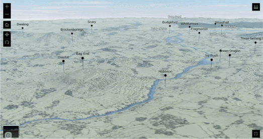
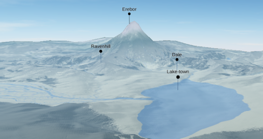
You can now explore the fantasy world of J.R.R Tolkein on a three dimensional globe. The Middle-earth 3D Map is a wonderful interactive map of the lands of the Shire, Mordor, Rohan and Gondor. A map that allows you to soar over the Misty Mountains, gaze upon the White City of Minas Tirith, and wander through the ancient forests of Lothlórien in a way that has never been possible before.
Unlike every other interactive map of Middle-earth that I have reviewed the Middle-Earth 3D Map includes elevation data. This means that you are able to explore the mountains of Middle-earth, such as Mount Doom and Erebor, from the perspective of a small Hobbit looking up at a distant summit disappearing into the clouds.
If you are a fan of Tolkien's novels then you will also love the interactive maps created by the LOTR Project. These include interactive maps of both Beleriand and Middle-earth. The LOTR Project interactive maps include place-name labels and lots of optional layers which allow you to overlay time-lines, route and events from Tolkein's novels directly on top of some wonderfully drawn interactive maps.


Комментарии