The Top 10 Posts of 2015
On the whole Maps Mania readers are idiots. Don't take my word for it - just take a look at some of the rubbish you've been reading this year on this ridiculous mapping blog.
These were the top ten most popular posts on Maps Mania in 2015. At least two of them were good maps. In 2016 we must all do better.

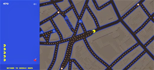
1. Pacman on Google Maps
Google Maps on the desktop may be slower than a folding paper map but Google do know how to create an amazing April Fools experience. I think this must be at least the fourth year running when Google's April Fools joke has been the most visited post on Maps Mania.
2. Ashley Madison Users Mapped
In August the Ashley Madison dating app for married cheaters was hacked. Malfideleco managed to exploit some of the news interest around this story with an interactive map showing the distribution of Ashley Madison users around the world. I managed to exploit the Malfideleco map with this second most read post of 2015.
3. Chennai Flood Map

In the number three spot we finally have a useful map. In November Tamil Nadu in southern India suffered the heaviest rainfall in over a century causing massive flooding. Flood Maps sprang into action creating a crowd-sourced interactive map to help identify inundated roads in the state capital of Chennai, the locations of open & closed flood relief camps and waterlogged locations in the city.
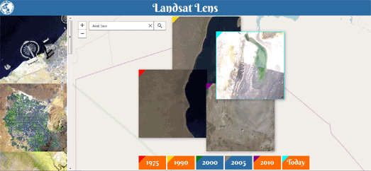
4. Landsat Maps Our Changing World

Landsat Lens is a great interactive mapping tool which allows you to explore how the Earth has changed by comparing Lansat satellite imagery from six different years. The map allows you to search for any location on Earth and then overlay satellite imagery of your selected location from 1975, 1990, 2000, 2005, 2010 & 2015.
5. Snowmaggedon Maps
In January the USA saw a lot of snow. Someone made a useless map of Twitter mentions of Snowmageedon. In turn loads of people visited my useless post about this useless map.
6. Close Encounters of the Mapped Kind
When Maps Mania is suffering from low traffic then a good old UFO map is sure to generate some traffic. This round-up of maps tracking UFO sightings was the sixth most visited post this year, Jeez!
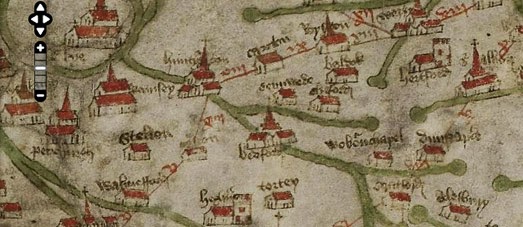
7. The Medieval Digital Map

The Gough Map or Bodleian Map is the oldest surviving route map of Great Britain. The map probably dates back to the 14th or 15th centuries. You can now examine the map in close detail on The Linguistic Geographies interactive version of the map.
8. Battleground Britain
This year the UK had a general election. Back in January there still seemed some hope that the malignant forces of evil ruling this Septic Isle might be defeated. What fools we were. However this map of the UK's 50 'most interesting' marginal seats was a worthy start to a frantic few months of election mapping in the UK.
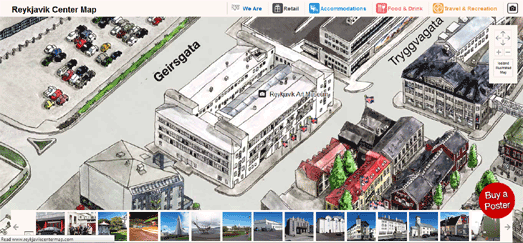
9. The Beautiful Hand Drawn Map of Reykjavik

This interactive hand drawn map of Iceland's capital was one of my favorite maps of the year, so I'm glad to see it just sneak into the top ten most read posts on Maps Mania. The Reykjavik Center Map is a hand-drawn watercolor map of the Icelandic capital made up of 186 A3 separate watercolor sheets, which took a team of architects and designers two years to complete. I love it!
10. The Witcher III Leaflet Map
What can I say? People like interactive maps of video game worlds. As maps of games go this isn't the worst I've seen. Why it made it into the top ten most popular posts on Maps Mania though, I cannot say.
These were the top ten most popular posts on Maps Mania in 2015. At least two of them were good maps. In 2016 we must all do better.

1. Pacman on Google Maps
Google Maps on the desktop may be slower than a folding paper map but Google do know how to create an amazing April Fools experience. I think this must be at least the fourth year running when Google's April Fools joke has been the most visited post on Maps Mania.
2. Ashley Madison Users Mapped
In August the Ashley Madison dating app for married cheaters was hacked. Malfideleco managed to exploit some of the news interest around this story with an interactive map showing the distribution of Ashley Madison users around the world. I managed to exploit the Malfideleco map with this second most read post of 2015.
3. Chennai Flood Map

In the number three spot we finally have a useful map. In November Tamil Nadu in southern India suffered the heaviest rainfall in over a century causing massive flooding. Flood Maps sprang into action creating a crowd-sourced interactive map to help identify inundated roads in the state capital of Chennai, the locations of open & closed flood relief camps and waterlogged locations in the city.
4. Landsat Maps Our Changing World

Landsat Lens is a great interactive mapping tool which allows you to explore how the Earth has changed by comparing Lansat satellite imagery from six different years. The map allows you to search for any location on Earth and then overlay satellite imagery of your selected location from 1975, 1990, 2000, 2005, 2010 & 2015.
5. Snowmaggedon Maps
In January the USA saw a lot of snow. Someone made a useless map of Twitter mentions of Snowmageedon. In turn loads of people visited my useless post about this useless map.
6. Close Encounters of the Mapped Kind
When Maps Mania is suffering from low traffic then a good old UFO map is sure to generate some traffic. This round-up of maps tracking UFO sightings was the sixth most visited post this year, Jeez!
7. The Medieval Digital Map

The Gough Map or Bodleian Map is the oldest surviving route map of Great Britain. The map probably dates back to the 14th or 15th centuries. You can now examine the map in close detail on The Linguistic Geographies interactive version of the map.
8. Battleground Britain
This year the UK had a general election. Back in January there still seemed some hope that the malignant forces of evil ruling this Septic Isle might be defeated. What fools we were. However this map of the UK's 50 'most interesting' marginal seats was a worthy start to a frantic few months of election mapping in the UK.
9. The Beautiful Hand Drawn Map of Reykjavik

This interactive hand drawn map of Iceland's capital was one of my favorite maps of the year, so I'm glad to see it just sneak into the top ten most read posts on Maps Mania. The Reykjavik Center Map is a hand-drawn watercolor map of the Icelandic capital made up of 186 A3 separate watercolor sheets, which took a team of architects and designers two years to complete. I love it!
10. The Witcher III Leaflet Map
What can I say? People like interactive maps of video game worlds. As maps of games go this isn't the worst I've seen. Why it made it into the top ten most popular posts on Maps Mania though, I cannot say.


Комментарии