Generate Environmental Factsheets

Geofolio is an easy to use map tool for generating environmental reports for any location on Earth. The application uses data from various sources, including NASA, ESA, USGS and the Global Cropland Area Database, to provide you with a comprehensive environmental report for your chosen location.
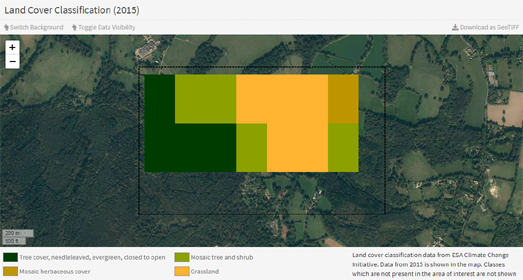
Simply select a location on Geofolio's interactive map and it will generate thematic factsheets providing information on the vegetation, agriculture, soils, weather, climate, and land use which can be found within the chosen area. This report includes a breakdown of the land cover (tree-cover, grassland etc). It also includes a digital elevation model showing the topography of your defined area.
Most of these reports are visualized on separate interactive maps. For example the cropland section of your report visualizes a cropland mask overlaid on top of a background map. This mask highlights all the areas identified as cropland (based on Global Food Security Analysis Support Data). Similarly an interactive map is used to show a prediction of the soil texture in your chosen area (using data from the United States Department of Agriculture).


Комментарии