
RIP the Wikipedia layer. Killed ten years ago by Google Maps.
Every August I hold a day of remembrance for the sad demise of the Wikipedia layer on Google Maps. Younger readers probably won't remember the glory days of Google Maps when you could simply click on the Wikipedia layer in Google Maps to discover more about all the interesting POI's around any location in the world. For some reason this fantastic layer was killed and removed from Google Maps in August 2013.
This year however I have been able to throw away my mourning veil forever. Thanks to History Travels I am now able to emerge from my bereavement and resume normal life.
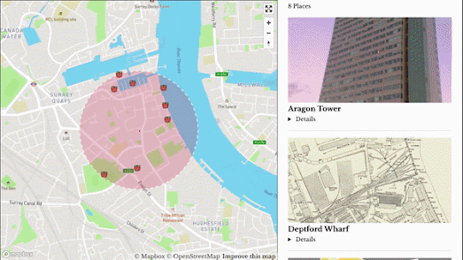
History Travels is an interactive map which uses the Wikipedia API and Wikigeosearch to show you historical places around any location. Enter a location and a radius distance into History Travels and it will show you all the nearby locations featured in Wikipedia. Click on any of the historical place markers on the map and you can learn more about the selected Point of Interest. All the mapped POI's are also listed in the mapped sidebar with a link to the location's full entry on Wikipedia.
There have been lots of interactive maps which have used the Wikipedia API over the years. You can find links to some of these using the Wiki label on Maps Mania. What I most like about History Travels is that the map automatically updates when you move the map to show the closest historical points of interest. This is a great feature to help you quickly find the nearest Points of Interest as you move around a town or city
No comments:
Post a Comment