Skip to main content
Search
Search This Blog
Maps Mania
Posts
Showing posts from October, 2008
Show all
October 31, 2008
Christmas Present List
October 31, 2008
Spooky Google Maps
October 30, 2008
Argentinian Google Maps Round-Up (Oct 2008)
October 30, 2008
Win Free Shoes for a Year by Mapping
October 29, 2008
Street View Comes to Italy
October 29, 2008
Montreal Gets Transit Planning
October 29, 2008
Umapper Just Got Better
October 29, 2008
Sites With Spanish Street View
October 29, 2008
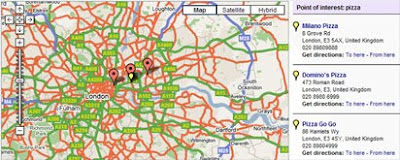
Google Maps in the News
October 28, 2008
Data Scraping Wikipedia
October 28, 2008
A Street View Drive Through Madrid
October 27, 2008
Street View in Spain
October 27, 2008
Street View on the iPhone
October 27, 2008
Panoramas on Google Maps
October 26, 2008
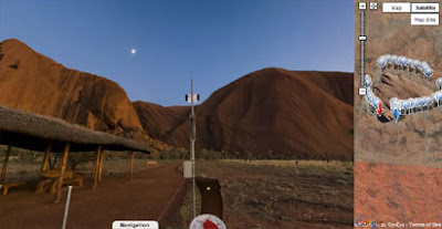
Around the World in 80 Seconds
October 25, 2008
Street View in Spain
October 25, 2008
A Weekend Break
October 24, 2008
My Maps Australia Awards 2008
October 24, 2008
Friday Fun With Google Maps
October 23, 2008
Paragliding Simulator
October 23, 2008
Reverse Geocoding With Google Maps
October 23, 2008
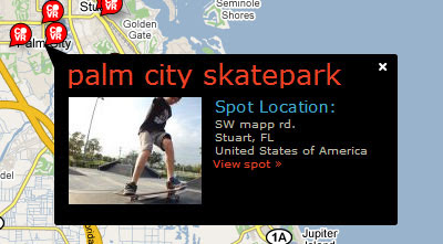
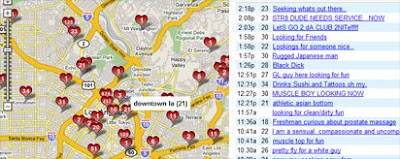
The Adults Only Google Map
October 22, 2008
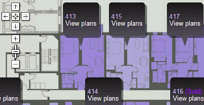
Buying Property on Google Maps
October 22, 2008
Finding a Restroom With Google Maps
October 21, 2008
Gears Geolocation API Updated for Wifi
October 21, 2008
UK Media Using Google Maps
October 21, 2008
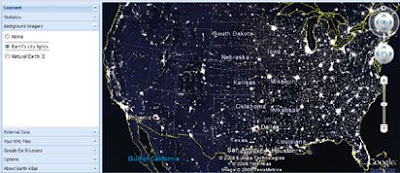
Earth Atlas
October 20, 2008
Book a Hostel on Google Maps
Newer Posts
Older Posts
Home