Skip to main content
Search
Search This Blog
Maps Mania
Posts
Showing posts from July, 2018
Show all
July 31, 2018
U.S. Wildfire Maps
July 31, 2018
This is an AI World
July 31, 2018
The Native People of Australia
July 30, 2018
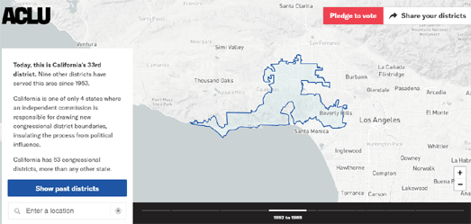
How Gerrymandered is Your District?
July 30, 2018
The World According to Strabo
July 30, 2018
The Art of Location Tracking
July 29, 2018
The California Wildfire Map
July 28, 2018
The World as Seen in Vintage Photos
July 27, 2018
An Extremely Misleading Election Map
July 27, 2018
Tonight's Total Lunar Eclipse
July 26, 2018
Pakistan Election Maps
July 25, 2018
When Birds Attack
July 25, 2018
Mapping Three Buses at Once
July 24, 2018
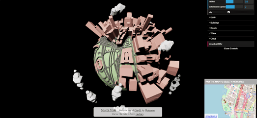
OSM World
July 24, 2018
Swimming to America
July 24, 2018
Mapping the Billionaire Yacht Club
July 23, 2018
Why New York Deviates from the North
July 23, 2018
Mappae Mundi on Monday
July 23, 2018
Cassini's 3D Globo Terrestre
July 23, 2018
Average Income by Metro Station
July 21, 2018
The Geography of UK Pub Names
July 20, 2018
Homeless in Seattle
July 20, 2018
The Map of Languages
July 20, 2018
Mapping the History of Liverpool
July 18, 2018
Mapping America's Education Deserts
July 18, 2018
Britain's Broadband Speed Map
July 17, 2018
The Māori Map of New Zealand
July 17, 2018
Street Orientations - Anywhere Edition
July 16, 2018
Elevation Kaleidoscope
July 16, 2018
Mappa Monday
July 16, 2018
The Yangon Time Machine
July 14, 2018
Street Orientations - World Edition
Newer Posts
Older Posts
Home