
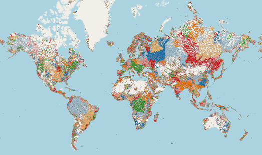
A river basin is an area of land drained by one river system and its tributaries. It includes all the land where rainwater or melted snow drains into the river, either directly or through smaller tributary streams and rivers. River basins can be incredibly large - covering thousands of square kilometers, or very small - covering just a few square kilometers.

A watershed is a smaller and more localized area within a river basin. It is a specific area of land where all the water that flows over or under it converges into a common point, such as a lake, river, or wetland. Watersheds are often delineated based on the topography or land contours, where the water collects and drains towards a particular outlet.
In simple terms, a river basin is a larger region drained by a river, while a watershed is a smaller area within that basin where all the water flowing within it converges to a common point. River basins can have multiple watersheds within them, each contributing water to different sections of the river system.
The screenshot above shows the huge 1 million km² watershed flowing from the Andes into the Solimões River in Brazil. If you want to view the world's largest watersheds on the Global Wathershed map then click downstream in the Amazon Basin (the world's largest watershed) or downstream in the Mississippi River Watershed in the United States.
If you wish to see where a watercourse flows to then you can select the 'downstream' option on the map. This will then display the flow path of the selected river from the selected location to the ocean. Other options allow you to download the data of a watershed in geoJSON, shapefile or KML formats.
No comments:
Post a Comment