
OpenStreetMap (OSM) is a free, editable map of the whole world, built and maintained by a community of volunteers. It is often described as the Wikipedia of maps, to which anyone can contribute and update information. Very importantly all of the map data contributed to OpenStreetMap is open data, which anyone and everyone is free to use.
In a way maps have always been produced through collaboration. The cartographers of early Mappae Mundi created their world maps from geographical knowledge gained from the Bible, early explorers and the writings of even earlier cartographers such as Ptolemy. Early Portolan charts might also be said to be crowd-sourced, relying on the accumulated experience and shared knowledge of routes, landmarks, and hazards, acquired by generations of Mediterranean sailors.
What makes OpenStreetMap truly unique is both the global scale and immediacy of its underlying map data. It is a map which is constantly being updated in real-time all around the world by millions of volunteers with knowledge of their local areas. If you want to get an idea of the scale of OpenStreetMap's crowd-sourced reach then you can view these map edits happening in real-time on these two interactive maps:
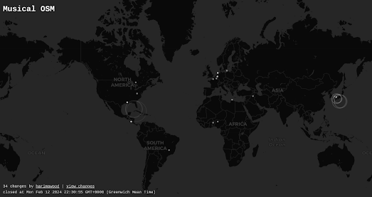
Musical OSM allows you to not only view edits being made to OpenStreetMap but also allows you to listen to them being made in real-time. Whenever a new Open Street Map edit is committed then Musical OSM plays a relaxing chime sound and the location where the edit is being made is circled on the map.
I don't think that the notes played by the map are affected by the actual geography of the edit, which is a bit of a shame. It would be fairly easy to equate specific notes to specific latitudes and different octaves to specific longitudes (or vice versa). This would obviously require a lot more recorded chime sounds but it would result in a real auralization of the edited map data.
No comments:
Post a Comment