
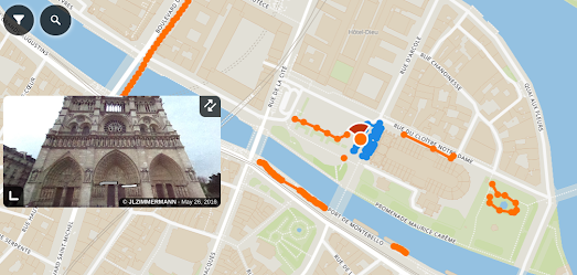
Panoramax is an open-source photo-mapping platform that allows users to share and exploit street level photography. It is a free alternative to proprietary services, such as Google Maps Street View, providing a freely available resource for sharing and mapping field photos. The Panoramax platform allows anyone to capture street level photographs and contribute them to the Panoramax database and interactive map. This imagery is then freely accessible and reusable by all.
Panoramax claims that "All photos (are) easily accessible and reusable without an account: via the website or a standard API (STAC format)". If you click on the 'share' button on the map you can also embed a Panoramax map and street level imagery on a website as an iframe.Via: WeeklyOSM
Mapillary was acquired by Meta in 2020 but was founded in 2013. Due to its ten year head start on Panoramax, Mapillary currently has far more imagery available on its platform. I'm guessing, however, that Mapillary's ownership by Facebook may be a disincentive to some users, who may be disinclined to share their street level imagery with Meta. To those users Panoramax may prove to be a welcome new addition to the world of crowd-sourced Street View.
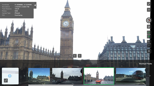
KartaView (previously known as OpenStreetCam) is another platform which can be used for collecting, viewing and sharing street level imagery around the world. Thousands of people around the world currently use KartaView to map street level photographs using the KartaView apps for Android and iOS.
You can explore all the uploaded street level imagery on the KartaView interactive map. Where imagery is available roads are colored blue on the map. You just need to click on a blue road to view the available imagery for that location. KartaView's street level imagery is free to use under an open-source license.
No comments:
Post a Comment