The Ukraine Population Density Map
Airwars has released a new interactive map which can help journalists calculate the number of people living in areas of Ukraine being targeted by Russian missiles. The new tool can help researchers and reporters understand the likely human impact of Russian aggression in Ukraine.
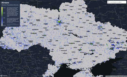
The Ukraine: Population Density map uses WorldPop data to show the number of people living in each square kilometer of Ukraine. Now that Russia has started using unguided missile attacks on Ukrainian towns civilian casualties are inevitable. Action on Armed Violence says that when explosive weapons are used in densely populated areas around 90 percent of those killed or injured are likely to be civilians.
On the Airwars map every point is color coded to show the number of people living at that location. If you click on a location you can view the exact population density per square kilometer. The map includes a search box which allows you to search for a Ukrainian location by name or by latitude & longitude. The population data used by the map dates from before the Russian invasion. Therefore the map doesn't reflect the reduced population density in many urban areas resulting from those who have fled the country or those who have been internally displaced within Ukraine.


Comments