Historic England from the Air
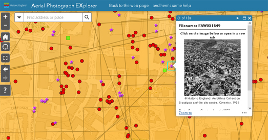
A new interactive map from Historic England allows you to search and explore historical aerial imagery of England captured over the last 100 years. The Aerial Photograph Explorer map includes over 400,000 digitized photos from Historic England's aerial photo collections.
The Aerial Photograph Explorer is a great way to explore how your town has changed over the last one hundred years. For example in my area of East London the pre & post World War II imagery reveals how my neighborhood changed from pre-war terraced housing and light industry to post-war tower blocks.and housing estates (mainly due to the heavy damage caused by German bombing).
You can use the map's search box to find a location or manually navigate to a location by panning and zooming on the map. The locations of aerial imagery available at a location are shown on the map using different colored markers (the different colors and shapes of markers appear to indicate when and who the images were captured by). To view an image you just need to click on its marker.
The Historic England aerial imagery archive actually contains over 6 million aerial photographs of England. Over the coming years Historic England plans to add more of these photos to the map, as they are digitized and geo-referenced.


Comments
But many of those images were taken by the Royal Air Force, before July 1957, and so their Crown copyright has expired, placing them in the public domain, and free for anybody to reuse.