The RAF Map of Post-War London
Layers of London is an interactive map which gives you access to lots of historic maps and historical information about the capital city. This morning I've being exploring the Layers of London RAF Aerial Collection (1945-1949).
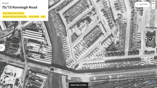
After World War II the Royal Air Force methodically flew over the whole of Britain to photograph the country from the air. This resulted in 24,000 photographs of London. This aerial imagery provides a stunning visual record of London just after World War II. Bomb damage from the Blitz is clearly visible in lots of the imagery.In the screenshot of West Ham above you can clearly see where the bombs fell. The rows of Victorian era terraced housing are interrupted by temporary white prefab buildings (at the center of the image). This is where houses were bombed out during the war. If you walk this neighborhood today you can still easily see where the bombs fell. If any building was clearly built after World War II then you can be sure it was built on the location of a bombed out Victorian era building.


Comments