The Map of Roman Amphitheaters
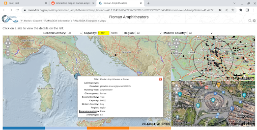
Roman Amphitheaters is an interactive map of Roman amphitheaters built in Europe and northern Africa during the long reign of the Roman Empire. The map has been created using Sebastian Heath's Roman amphitheaters data.
The amphitheater markers on the map are sized by capacity. Select an amphitheater on the map and an information window opens providing details on the amphitheaters's capacity, construction date and also a link to view the amphitheater's entry on Pleiades. You can also view an aerial imagery of the selected amphitheater on the provided satellite map (obviously many Roman amphitheaters no longer exist).
Pleiades is an online gazetteer of ancient places. The gazetteer provides information on more than 34,000 ancient places around the world. Because Pleiades is open data the content is freely available to anyone who wants to use it - for example to create a map of Roman Amphitheatres.
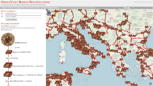
Omnes Viae is based on an ancient Roman map known as the 'Tabula Peutingeriana' and allows you to plan a route that contains all the main roads and cities of the Roman Empire. You could therefore use the map, for example, to plan a route between Rome and the amphitheatre in Lecce. Depending on your strength and fighting skills you might not need the directions back.


Comments