Mapping Trees in 3D
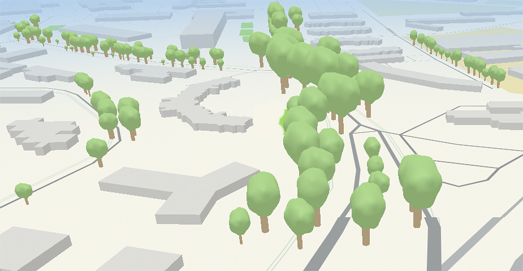
Chee Aun was so impressed with Apple Maps' new 3D trees that he decided to replicate the feature using Mapbox GL. The result is ExploreTrees 3D, a 3D map of Singapore which (you guessed it) is replete with hundreds of thousands of 3D models of the country's trees.
Explore Trees uses data from Trees.sg, which is a map and database of over half a million trees in Singapore. The data on Trees.sg includes information on each tree's girth size, height, age, species and type. Chee Aun has used this height and girth data to help create a 3D model of each and every tree.
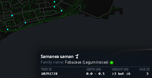
If you are on a mobile device then you might prefer the 2D layer of ExploreTrees. This map also allows you to explore half a million Singapore trees. If you hover over a tree on the 2D layer the map will reveal the species of tree, its girth, height and even its age.
If you intrigued by ExploreTrees then you can read more about how the map was made on Chee's blog post Building ExploreTrees.SG.


Comments