No Fly Zones for Drones
The Federal Aviation Authority receives over 100 reports a month of unauthorized unmanned aircraft (UAS). Flying drones around aircraft and airports is both dangerous and illegal. Which is why there is mounting concern over the dramatic increase in incidents involving authorized drones over the last two years.
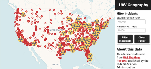
UAV Geography's Map of Drone Incidents plots the location of all the UAS sighting reports made to the FAA by pilots, citizens and law enforcement officers. The red markers on the map indicate the location of sightings of unauthorized drones. You can click on these markings to read the actual sighting report.
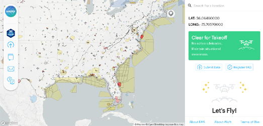
If you want to fly a drone then you should bookmark the B4UFLY interactive map. The B4UFLY map shows you where you can and can't fly your drone. The map provides clear status indicators which show you where it is safe to fly or not. For example the map shows that you cannot fly in the Special Flight Rules Area around Washington, DC.
If you are flying a drone outside the United States then you might want to bookmark the Fly Safe Geo Zone Map which provides a guide to where drone flying may raise concerns and where it is restricted around the world.


Comments