The Interactive Geological of the World

William Smith is largely credited with creating the first nationwide geological map. Smith's beautiful 1815 map 'A Delineation of the Strata of England and Wales with Part of Scotland' visualized Britain's geological types using different colors for different types of geological feature. Smith's use of colors and many of his names for different strata are still used today.
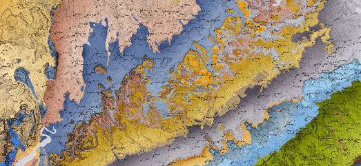
You can see William Smith's enduring influence for yourself on the Macrostrat interactive map. Macrostrat is a global map visualizing the world's geology. Using the map you can explore stratigraphic and lithological data for any location on Earth. For example if I click on my location on the map I discover that I live on top of the Thames Group, which has a lithology of clay, silt, sand and gravel.

You can even view interactive versions of William Smith's Maps online. These interactive maps allow you to explore Smith's original geological maps of England, Scotland & Wales in very close detail. The interactive map interface allows you to view geo-rectified overlays of a number of William Smith's maps including his original 1815 geological map and his 1828 New Geological Map of England and Wales.


Comments