Switzerland is Now Open
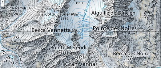
The Swiss Federal Office of Topography, or 'Swisstopo' as they are officially known, is Switzerland's national mapping agency. Swisstopo are renowned for their incredibly detailed and accurate topographical maps. Maps which you can now use in your own mapping projects.
From today Swisstopo is making its geodata free to use according to the principles of Open Government Data (OGD). This means that you can Swisstopo's national maps, orthophotos and geological vector data in your own mapping projects - free of charge.
To get started you should head over to Swisstopo's new Free Geodata page, which explains in detail which of its products are now freely available and which also includes links to Swisstopo's free geodata and geoservices. If you are interested in creating interactive maps using Swisstopo's map tiles then you might be interested in the JavaScript API examples for Swisstopo's Web Map Tiling Services. This section of Swisstopo's API docs includes links to a number of demo maps showing Swisstopo's map tiles being used with Leaflet.js, OpenLayers 3 and CesiumJS.


Comments