Earthquakes - Global Risk & Hazard Maps
The Global Earthquake Model Foundation is a non-profit organization working to assess and help manage the risk from earthquakes and seismic activity around the globe. Part of its mission is to is assess and share open data on earthquake risks and hazards.
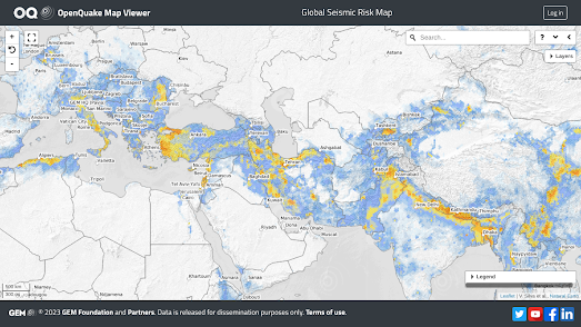
The Global Earthquake Model Foundation has released two interactive maps, the Global Seismic Risk Map and the Global Seismic Hazard Map, which can be used to explore the risk from earthquakes at locations around the world. The estimated hazards are based on the foundation's own OpenQuake engine, an open-source seismic hazard and risk model.
I think the main difference between the two earthquake maps is that the hazard map visualizes earthquake hazards based on seismic faults around the world, while the risk map is based on likely damage and risk assessments. In other words the hazard map shows the estimated ground effect of an earthquake and the risk map shows the potential damage to buildings at that location from seismic activity.
Global earthquake hazards can also be seen on ResourceWatch's Global Earthquake Hazard Frequency and Distribution map. This interactive map visualizes all earthquake activity around the world, from 1976 to 2002, exceeding 4.5 on the Richter scale.

Comments