Mapping Segregation in the United States
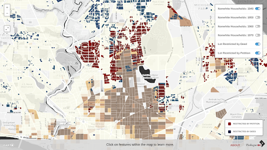
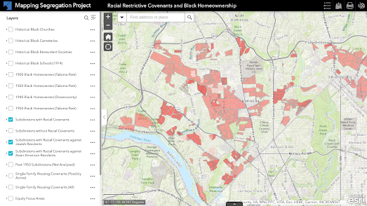
Yesterday the Washington Post published an article exploring the lasting legacy of racial covenants. These 'racial covenants' were clauses which were written into property leases or deeds prohibiting them from being sold or rented to people not "of the Caucasian race." The article Historians Mapping Racial Covenants links to interactive maps created by Montogomery County Planners, by the University of Minnesota and in Washington DC.

The University of Minnesota's Mapping Prejudice includes an animated map which shows the spread of covenants over time in the city of Minneapolis. The 'timelapse' map shows the growth of the number of buildings in the city placed under racial covenants from 1911 to 1954. As the map plots covenants added through time you can see how whole neighborhoods are essentially segregated as more and more buildings in the city are given racial covenants.


Comments