Mapping the French Election
On Sunday the French voted in the first round of the 2022 presidential election. Emmanuel Macron and Marine Le Pen emerged as the two leading candidates in the election and will go forward into the second round of voting to be held on 24 April.
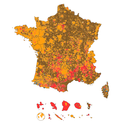
Yesterday Le Monde published an interactive map of the election which colors each commune based on the candidate who received the most votes in the first round. Because of the large number of candidates in the first round of the election Le Monde's 2022 Presidential Election Map doesn't portray a particularly clear overview of the votes across France. Because there were 12 different candidates standing in the election and because the map uses very similar colors to represent each candidate the map is a little hard to read at the national level.
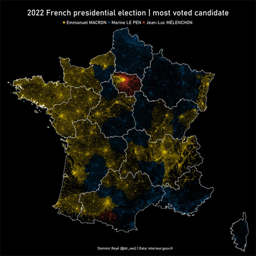
A much clearer overview of the geographic patterns in votes cast for the three main candidates emerges in this static map by Dominic Royé. This map only shows the leading three candidates (Macron, Le Pen and Mélenchon) each shown with a different color. When each department is colored to show the candidate who won the most votes out of Macron, Le Pen and Mélenchon a very interesting geographic pattern emerges. Le Pen seems very popular in the north-east and south-east, Macron seems very popular across most of the west of France, while Mélenchon seemed to be the most popular candidate in a lot of departments around Paris.
However Le Monde's map does win out when you want a more detailed view of the local results. If you click on the newspaper's interactive map you can view a more detailed map of the votes cast in the selected commune. If you hover over an area on the map you can also view the exact number of votes cast for each candidate in that commune.


Comments