The First Images from EUMETSAT MTG-I1
The first high quality image from Europe's newest weather satellite has been released.
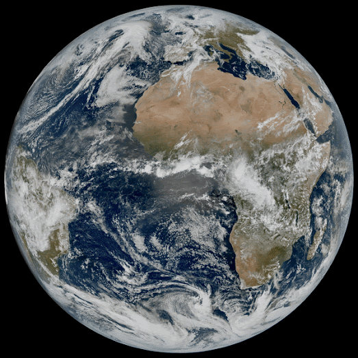
The European Organisation for the Exploitation of Meteorological Satellites (EUMETSAT) operates a fleet of satellites with which it monitors weather, climate, and the environment from space. EUMETSAT's newest satellite, Meteosat Third Generation – Imager 1 (Meteosat-12) was launched in December 2022 and is designed to provide continuous, high-quality imagery and sounding data for weather forecasting, climate monitoring, and environmental protection.
Meteosat-12 is in stationary orbit with a permenant view over Europe, the Middle East and Africa. It captures new imagery every ten minutes. The first of these images can now be seen on the EUMETSAT website (including the 24 hour animation shown above). Another satellite is due to be launched in 2026, which will enable EUMETSAT to capture new imagery every 2.5 minutes.
EUMETSAT will continie to test Meteosat-12 and ground systems over the course of 2023. Later this year the images will be produced every 10 minutes and will be released operationally for use in weather forecasts. The images should then also appear in EUMETView, which provides public access to EUMETSAT satellite imagery. Using the EUMETView interactive map you can search for and browse European satellite imagery by date. It is also possible to create animations from the imagery for any selected time period.

Comments