SatellitExplorer
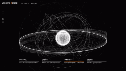
Esri's Geo Experience Center has released an awesome interactive map which plots the locations of satellites orbiting the Earth. This 3D celestial map also does a very good job at explaining what satellites are used for, who owns them and the various types of orbits that the satellites follow.
The Satellitexplorer 3D map shows the Earth surrounded by thousands of satellites and tens of thousands of space debris. Along the bottom of the map are four options which allow you to explore the 'Purpose', 'Orbits', Owners' and 'Debris' of Earth's satellites. Select one of these options and you can learn everything you ever wanted to know about how and why satellites are used.
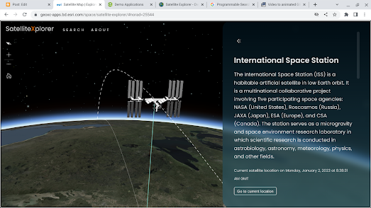
If you use the map's search facility you can also search and track individual satellites on the map. For example if you search for 'ISS' you can view the current location of the International Space Station and follow the satellite as it travels around the Earth in its low Earth orbit.
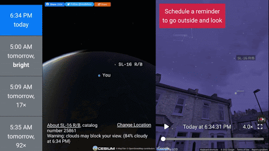
You can get a first person view from the ground of all these orbiting satellites on See a Satellite Tonight. James Darpinian's See a Satellite Tonight can tell you at what time tonight satellites will fly over your house. It can also show you exactly where to look in the night sky if you want to see a satellite passing overhead.
Share your location with See a Satellite Tonight and you can view an interactive 3D Cesium Earth map, showing your current location highlighted on the globe. The globe also features an animation of any satellites passing over your home tonight. The map menu (running down the left-hand side) tells you at what time a satellite will be flying overhead. It also includes, in chronological order, options to view any other satellite passes over your house tonight and on subsequent nights.


Comments