
The Mapbox Coloring Book
If you or your children are looking for fun and educational activities then you could try spending some time coloring in blank maps. The Mapbox Coloring Book (PDF) is a printable collection of blank maps from around the world. The book includes maps from Africa, Asia, Europe, Oceania and North & South America. All you need for this fun task is a printer and some colored pens, pencils or crayons.
If you or your children manage to complete all the maps in the book then the Mapbox Blog has instructions on how you can create your own coloring maps (you just need to create a free Mapbox account if you don't already have one).
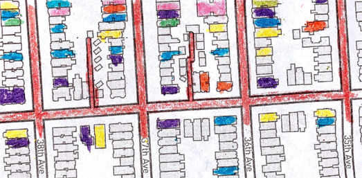
The New York Public Library has also created its own coloring book. The NYPL's Color Our Collection book includes a number of black & white images from its Digital Collections, which are perfect for coloring-in. The #ColorOurCollections (PDF) even includes a map (District Map Section No. 13) from 1913. The other black & white images which you can color in include animals, Egyptian hieroglyphics and flowers.
If you want some more maps to color in then the UK's Ordnance Survey has created 14 coloring in maps of various UK locations - Coloring Maps.
Colour Your Own Map
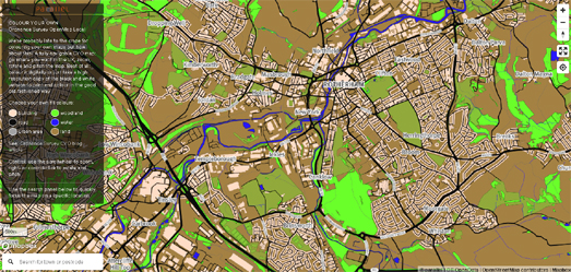
If you don't own a printer or colored pencils then you could try Color Your Own Map instead. Colour Your Own Map allows you to color a black and white digital interactive map. The blank map is made up of a number of different elements, including buildings, roads, water and woodland. Colour Your Own Map allows you to select different colors for each of these elements so that you can create your own individual looking maps.
Color Your Own Map uses the UK's Ordnance Survey OpenMap Local so the map only really works for UK locations.
Map Coloring & Graph Theory
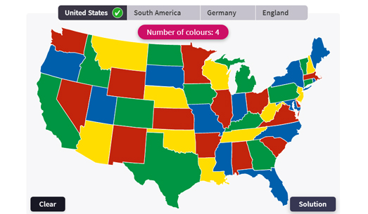
Coloring in maps can be a lot of fun. It can also teach you about graph theory. Mathigon's Map Coloring interactive exercise requires you to color in a number of maps using as few colors as possible (no two touching states, regions or countries can have the same color). If you use more colors than are strictly necessary when coloring in these maps Mathigon will tell you. For example when coloring in the United States you only need to use four colors.
No comments:
Post a Comment