Terradactile
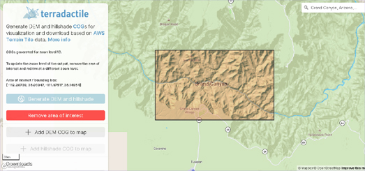
Terradactile is an interactive map which can be used for generating and downloading hillshade and Digital Elevation Model data for any area of the Earth.
To visualize and/or download the hillshade or DEM for an area simply draw a bounding box around it on the Terradactile interactive map. Terradactile will then show you either the DEM or hillshade data for the selected area. Either of which you can then download.
The hillshade and DEM data comes from Mapzen's AWS Terrain Tiles. The AWS Terrain Tiles consist of thousands of digital elevation model data sources from around the globe. When you have visualized the hillshade or DEM data you can download and save your hillshade or DEM as a Cloud Optimized Geotiff (COG).


Comments