Wednesday, November 30, 2011

Google Maps - Start Here


Google has created a pretty cool demo of Google Maps features, called Google Maps - Start Here.

The demo provides an interactive walkthrough of the new indoor maps available on Android phones and some of Google Maps' most popular other features. The features covered in the demo include:
  • Driving Directions
  • Street View
  • How to Create Custom Maps
  • How to Access your My Maps from your phone
  • How to Edit Google Maps

Street Views of Two Americas

Today I came across two contrasting Street View collections that provide an interesting contrast of different American urban environments.

Google Sightseeing has put together some interesting views of the Disney built Florida town of Celebration, in a post called The Town that Disney Built.


Disney's Celebration was built (I asssume) as a post-post-modern critique of Baudrillard's theories of hyperreality (although I might be wrong).

Whether you think Celebration is a Truman Show lite experiment or a successful re-imagining of American small-town values the Street Views on show in the Google Sightseeing post provide a stark contrast to the images in Doug Rickard's A New American Picture.


Rickard's collection of Google Maps Street View images presents a very different picture of American life. The collection presents an urban world of run-down infrastructure and deprivation.


Please submit your end of term papers - 'Street View and the Psychogeographer' before the end of December.

The Where and When of Google Maps


ImpromptuDo is an interesting experiment in presenting time based events listings. It allows users to find events happening around them right now or lets them plan ahead and find events happening later.

ImpromptuDo is a Google Maps based application that can show you events happening around you based on a set number of hours. Using the map you can centre on your current location. You can then use the slide control to view events happening within the next 1 to 24 hours.

Tuesday, November 29, 2011

Welcome to Indoor Google Maps


Indoor floor plans and maps are now available for many airports and shopping malls for users of Google Maps 6.0 for Android.

Where available detailed floor plans automatically appear when you open Google Maps in your Android phone. As usual the 'blue dot' will appear on the floor plan to show your current location within several meters.

When you move floors in a building the floor plan will even automatically update to display which floor you’re on.

Initially floor plans are available for a number of malls, airports and transit stations in the U.S. and Japan. You can see a detailed list of participating locations here.

Google have also created a Floor Plans website where business owners can upload their floor plans and make them available on Google Maps.

Via: Google LatLong

Scanned QR Codes on Google Maps


qrd.by is a service to generate a QR code of a website's URL and then helps you track when, where and from which device it is scanned.

Qrd.by uses Google Maps to show geo-tagged QR Codes being scanned in real-time around the world. The map uses coloured map markers to show QR codes that have not yet been scanned, have been scanned at least once and those that have been scanned more than three times.

If you click on a QR code's map marker on the map you can view the full URL of the website and how many times in total it has been scanned.

Via: Street View Funny

Weather for the Game on Google Maps


BleacherWeather.com allows you to find upcoming sporting events on a Google Map and get a weather forecast for the game.

It is possible to filter the upcoming games shown on the map by sport (MLB, NASCAR NCAA and NFL). It is also possible to filter the results by date to find a game on a particular day.

If you click on a game's map marker you can then view the weather forecast for that location. The forecast includes the current conditions, a three day forecast and an animated radar map of the location from the National Weather Service.

Have You Met Gemma?


Gemma (short for Geospatial Engine for Mass Mapping Applications) allows you to create Google Maps with data from a number of different sources.

It is possible to create maps with gemma with layers from MapTube, SurveyMapper, OpenStreetMap and from your own data. Gemma even has an accompanying iPhone app that lets you record observations on the go and then upload them to a gemma map.

Gemma was created by the University College London - Centre for Spatial Analysis. It is not surprising then that it works very well with CASA's own SurveyMapper (a geographic survey and polling tool) and with MapTube.

Monday, November 28, 2011

Win Olympics Tickets with Google Maps


The International Olympic Committee (IOC) are holding a competition called Show Your Best.

The competition can be entered by anyone aged 13-19. Entrants need to videotape, upload and share their 'personal best' moments. The personal best videos are being showcased and can be watched directly from a Show Your Best Google Map.

The two winners of the competition will win a trip to the London 2012 Summer Games, others will appear in a commercial to be broadcast during the London 2012 Olympic Games.

As well as the Google Map, showcasing the submitted videos, users can use a Digital Mash Up Creator to take their uploaded video and instantly see their best mixed into some of the greatest Olympic moments, and share the mashup with their friends.

Google Maps of Your Encounters


Uencounter.me is an interesting application that allows you to build a social network around the important geographical locations in your life.

At the heart of the application is the My Encounter Map, a Google Map of the places you have lived and worked, the important people you have met at different locations and other locations that have been important in your life.

The social aspect of uencounter.me comes from comparing your Encounter Map with the Encounter Maps of your friends. Uencounter.me allows users to overlay another user's map on top of their own; allowing users to identify when they may have been in the same place at the same time. Furthermore, uencounter.me allows the user to identify how their links are connected – bringing the concept of 'six degrees of separation' to life.

Historical Moscow on Google Maps


Old Maps of Moscow has a very large collection of historical maps of the Russian capital.

The site uses Google Maps to help users navigate the historical collection. Users need to click on the Google Map of Moscow to show the location they are interested in viewing. Then they can select from the many historical maps to view the chosen location on their chosen map.

The map collection goes back to 1739 and includes plans, topographic maps, historical aerial photography and much more.

Sunday, November 27, 2011

The Best Google Maps of the Week


Cleveland Historical is a fantastic free app for the desktop and for Android and iPhones that puts Cleveland's history at your fingertips. Using the app you can wander around Cleveland and explore the people, places, and moments that have shaped the city’s history.

The Google Map on the Cleveland Historical home page allow users to explore the many historical locations and tours available on the site. The site includes a large number of map-based, curated historical multimedia presentations of the city's history.


As part of a campaign for more people to register as organ donors in the Netherlands a Google Map called Ja of Nee (Yes or No) has been created to gauge people's reactions to the idea of becoming a donor.

Ja of Nee has made good use of the Styled Maps feature of the Google Maps API. The custom map markers not only match the custom style of the map but visually illustrate the percentage of votes cast in each town.


I think there must be a rule in the automotive industry that you can't have an advertising campaign for a car without featuring Google Maps Street View. It seems it is is Peugot's turn to create an impressive Street View application to promote the Peugot RCZ.

RCZ View is an application that allows you to create any route in Google Maps and then watch a Street View stop motion animation of your created route. It takes a little while for the application to grab the Street Views for a route but it is worth the wait.

If you want to save a little time you can just watch the preprogrammed routes.

Saturday, November 26, 2011

Capture a Google Maps Screenshot


Map2Pic allows you to grab a screenshot of a Google Map and save it in "png" or "jpg" format. For example, the screenshot above was captured with Map2Pic.

Mpa2Pic allows you to choose the map view you wish to capture (map, satellite or terrain), the size of the screenshot and even allows you to set a compression rate for the the saved image.

It is also possible to add a marker to the map. The marker comes in a choice of colours and with the option of a shadow or no shadow.

Map2Pic is in many ways similar to the Static Maps API Wizard. The Static Maps API Wizard can generate static maps using the Google Maps Static Image API. Now you can use Map2Pic when you want to host a static map image on your own servers rather than using Google's Static Maps API.

Friday, November 25, 2011

Even More Google Maps Friday Fun

xkcd: Map Projections

xkcd explains what your favorite map projection says about you.

Address Is Approximate


Aaron Hobson's Cinemascapes

Photographer Alan Hobson has taken a series of Google Maps Street View images and enhanced them in the same way that he would his other photographs. The results are pretty stunning.

The Wrong Trousers on Street View

Thursday, November 24, 2011

The Coal Seam Gas Rush on Google Maps


ABC News has used Fusion Tables and Google Maps to help map Australia's Coal Seam Gas Rush.

ABC News estimate that there will be at least 40,000 coal seam gas wells in Australia by 2030. The map allows users to search for gas wells by location and explore the full extent of coal seam gas mining in the Great Artesian Basin.

It is possible to click on individual wells to see their status, depth, the name of the company that owns the well and the exact geographical location. The 'leases' tab allows users to see where coal seam gas companies have the right to look for more gas.

Find Your Senator with Google Maps


Govtrack.us are using Google Maps to help voters Find a Representative or Senator.

Using the map it is possible to find a current or past Member of Congress. If you click on a state on the map you can find out who the current senators for the state are. You can then click on a senator to add them to your customized tracked events page on govtrack.us. It is also possible to search for a representative by name, zip postal code or street address.

Govtrack.us have also made available the state shape files for the map, which are available in KML or WMS map layer form.

Location Sharing in Venezuela


Conoce is a location sharing website for Venezuela. The application is a great way to find and share travel experiences and places in Venezuelan towns and cities.

The submitted locations in each city are displayed on a Google Map. It is possible to search for nearby locations by category, for example 'restaurants', 'hotels', cinemas' etc. When you select a location from the map you can view user reviews and submitted photos and videos of the venue.

Wednesday, November 23, 2011

Share Videos of Your City with Google Maps


My City Lives is an application that allows anyone to share their experiences and stories about a location with a short video. The uploaded videos are showcased on a Google Map based on where the videos were filmed.

Users can explore the uploaded videos by location on the map or by channel, tag or currently trending. It is also possible to ask questions about a location via the 'Voices' tab and hopefully members of the My City Lives community will post a video response.

German Marine Charts on Google Maps


GeoGarage Marine uses Google Maps to display marine charts from around the world. The site has just added 207 marine charts for the German coast. Adding the charts as overlays on Google Maps means that sailors can explore the charts using the familiar Google Map's pan and zoom controls.

GeoGarage Marine is not only a seamless chart viewer, overlaying charts at different scales on aerial and satellite imagery from Google Maps, but also allows the user to plot waypoints and to prepare navigation routes. These can be saved and uploaded to GPS (in gpx format or directly to Garmin GPS via its Communicator web plugin).

Take a Street View Drive with Google Maps


I think there must be a rule in the automotive industry that you can't have an advertising campaign for a car without featuring Google Maps Street View. It seems it is is Peugot's turn to create an impressive Street View application to promote the Peugot RCZ.

RCZ View is an application that allows you to create any route in Google Maps and then watch a Street View stop motion animation of your created route. It takes a little while for the application to grab the Street Views for a route but it is worth the wait.

If you want to save a little time you can just watch the preprogrammed routes.

Hat-tip: Street View Funny

Tuesday, November 22, 2011

Welcoming Belgium to Street View


Grand Place, Brussels

The whole of Belgium now has Google Maps Street View imagery!

Yesterday Google also added Street View imagery for two new ski resorts. The world famous Squaw Valley, in northern California and Breckenridge Ski Resort are the latest ski resorts to have been visited by the Street View ski mobile.


The Atomium, Brussels


Bruges

Cleveland's History at Your Fingertips


Cleveland Historical is a fantastic free app for the desktop and for Android and iPhones that puts Cleveland's history at your fingertips. Using the app you can wander around Cleveland and explore the people, places, and moments that have shaped the city’s history.

The Google Map on the Cleveland Historical home page allow users to explore the many historical locations and tours available on the site. The site includes a large number of map-based, curated historical multimedia presentations of the city's history.

If you live in or plan to visit Cleveland then get this app. It's brilliant and it's free!

Google Maps API Usage Limits Explained

Google has released more information about the new Google Maps Usage Limits. The new information should go a long way to assuage the fears of Google Maps developers.

Only 0.35% of Sites Affected

By setting the usage limits at 25,000 map loads per day Google are minimising the number of affected sites to 0.35% of all websites using the Maps API. My guess is that most of these top 0.35% of websites using the Google Maps API are corporations that should be using a Google Maps for Enterprise licence anyway.

Popularity Spikes:

One of the biggest worries for developers (based on many of the questions asked on the Google Maps API Developers Google Group), was what would happen if a map suddenly became very popular. For example, a media site that uses a map to illustrate a breaking news story, or a map that suddenly goes viral.

Google say that usage charges will only apply after a map exceeds the 25,000 map loads per day for 90 consecutive days. This is great news for developers as it means that a sudden spike in popularity for a map won't lead to a large bill from Google.

You can find out more about the new usage limits on the Google Maps API FAQ

Via: Google Geo Developers Blog

Voting 'Yes' or 'No' with Google Maps


As part of a campaign for more people to register as organ donors in the Netherlands a Google Map called Ja of Nee (Yes or No) has been created to gauge people's reactions to the idea of becoming a donor.

Users of the map can use Facebook connect to vote 'Yes' or 'No'. The results of the votes cast, broken down by town, can be viewed on a Google Map. The map markers themselves show the proportion of 'yes' and 'no' votes cast throughout the country. You can even click on the markers to get a more detailed breakdown of the results in each town.

Via: Nedercaart

Monday, November 21, 2011

Coffee & WiFi on Google Maps


You can't go far wrong with Coffee & WiFi and the Coffee & WiFi map doesn't go wrong at all.

This Google Map shows the location of nearby coffee shops with free WiFi. Adding new coffee shops to the map is very easy. You can add a short review of the coffee, ambience and WiFi on offer and even post a photo with your review.

Currently the map has a lot of locations added in Denmark and it has a growing number of users worldwide.

Seville's Public Buildings on Google Maps


Mirador - Diputacion de Sevilla is a Google Map showing information about all public owned buildings in the Spanish municipality of Seville.

The map shows the location of all public buildings and each building's footprint. Users can click on the public buildings displayed on the map and receive information about the services provided, the measurements of the building, and get directions on how to get there.

Each building's information window also includes two tabs to view a photo gallery of the town or village and data about the public buildings in the area.

The Metro's Social Sharing Application


Check My Metro is a social sharing network for French subway users. The application allows travellers to share information about interesting and useful sightings made on the metro systems in Paris, Lille, Lyon and Toulouse.

The system is being used to report sightings of interesting buskers, graffiti, ticket checks, delays or anything else that might be interesting or useful to other travellers. Check My Metro is available as an iPhone, Android or desktop app.

The desktop version of Check My Metro comes with a useful Google Map that not only shows the Metro system for each city but shows the location of messages shared by the application's users.

Via: Geo in Web

Sunday, November 20, 2011

The Google Maps of the Week


ExtendNY - New York City Expanded is a fun little map. It allows you to type in any location in the world and find out where you would live if New York's grid pattern of streets was expanded across the globe. For example, The Eiffel Tower in Paris will sit on the corner of 64,857 St and 12,770 Ave, once Paris inevitably becomes a suburb of New York.


On a more sombre note I was also impressed this week by The Detroit Free Press' homicide map. Living with Murder plots the 3,184 lives lost to homicide in Detroit between 2003 and June 2011.

The map makes good use of the Styled Map feature of the Google Maps API and also allows the user to explore the data in a number of ways.


This week also saw two very good Google Maps about books. GapVis is an interface for exploring the locations referenced in a number of historical texts. Whilst mapFast allows researchers to find books about any location in the world. Users can select a location and then view links to texts about the selected location in the WorldCat, the world's largest bibliographic database, or on Google Books.

Saturday, November 19, 2011

Secret Rosario on Google Maps


Rosario Invisible is a community driven Google Map that highlights the secret and hidden wonders of the Argentinian city of Rosario. The map allows anyone to share photos, text and videos of the interesting locations, characters and stories of the city in order to provide an insider's guide to the city.

Users of the map can explore the experiences added to the map by selecting from categorised map markers. There are a number of categories of locations added to the map, including 'architecture', 'food' and 'nature'.

Friday, November 18, 2011

Find Texts About Places with Google Maps


The Online Computer Library Center has created a Google Map that allows researchers to find information about a location held in Open WorldCat or Google Books. mapFast allows users to select a location and then returns links to texts about the selected location in the WorldCat, the world's largest bibliographic database, or on Google Books.

When users search for a location they can also define a search radius. The map then centers on the requested location and also displays other referenced locations within the selected search area. This helps researchers to discover texts on surrounding locations as well as for the primary search term.

The MINI Takes to Google Maps

MINI Link (i-Tunes store link) is a free iPhone application that helps MINI drivers to connect with other members of the MINI community and share their favourite drives and tips.

Using Google Maps users can share their favourite drives, sights and dives and find out out the nearby recommendations by other MINI motorists. The application can also be used to mark the location of heavy traffic, cheap gas, or speed traps.

The app can detect other MINI motorists in your area and automatically send them a digital 'wave' or it can send a 'wave' manually to other MINIs anywhere in the country.

_____________

Thursday, November 17, 2011

Vancouver's Buses Live on Google Maps


Vancouver's Next Bus has created a live real-time map of the city's bus network.

The Next Bus Google Map shows all the city's bus-stops with blue 'T' markers. If you click on a bus-stop marker you can view the scheduled times of the next bus due at the stop. However, as well as viewing the scheduled times of the next buses due, you can also see where the buses that service that route are in real-time on the map.

Hat-tip: Street View Funny

Driving Directions with Suggested Stops


OnTheWay is a free application for travelers to quickly create personalized road trips. The application allows users to grab driving directions for a trip and provides suggestions of interesting places to stop along the route.

The route and the suggested stops are displayed on a Google Map. Users can click on the suggested stops' map markers and if a stop fits the bill it can be added to the driving directions.

Once you have planned your journey and added all the required stops the driving directions can be printed out and the trip can be shared by e-mail, Twitter or Facebook.

Tracking Invasive Species with Google Maps


iMapInvasives is an initiative established to track invasive species in the United States.

So far the project has created four maps, using the Google Maps API, to map invasive species in Florida, New York, Oregon and Vermont. Each map allows the user to view a heat map for the distribution of different invasive species in the state.

Different species can can be selected from the map sidebar. The sidebar also contains other overlays that can be added to the map, such as county boundaries.

Wednesday, November 16, 2011

The Journey of Electricity on Google Maps


Canadian utility company BC Hydro has created an interactive presentation of the journey of clean electricity from generation to the customer's home.

Hydro to Home uses Google Maps satellite views and Flash animations to tell the story of how rain and snow is harnessed as energy, how it is transported and how it powers our lifestyles.

To start the presentation just enter your home address and the story will start with the Google Maps satellite view of your home. The presentation then takes you on a tour of BC's reservoirs, power stations and substations, showing you how clean electricity is generated and distributed to customers' homes.

Texts of the Ancient World on Google Maps


GapVis is an interface for exploring the locations referenced in historical texts. The project aims to geo-tag and show the locations of ancient places mentioned in some of the key books from and about the ancient world.

Currently the interface allows you to explore texts such as Edward Gibbon's The History of the Decline and Fall of the Roman Empire, Herodotus, The Works of Flavius Josephus, The First and Thirty-third Books of Pliny's Natural History and a number of other texts.

GapVis comes with a number of different views. The Book Summary view includes a Google Map displaying all the places referenced in a book and where they appear in the narrative structure. The Place Detail view provides deeper information about a particular geographic location, including a network map of related places based on narrative co-reference.

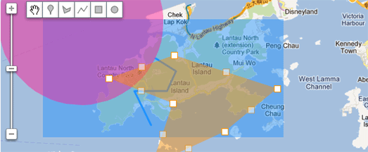
The Google Maps Drawing Library


Google Maps API developers can now offer users a range of drawing tools thanks to a new Drawing Library.

If developers include this library in their Google Maps it will allow users to add markers, polygons, polylines, squares and circles to a map. Use the library with a back-end database and you could allow users to add and save shapes to a map. Alternatively you could use the tools to allow users to draw an area to perform a search query.

I'm sure Google Maps developers will think of many other uses for the new Drawing Library tools.

Via: Google Geo Developers Blog

Tuesday, November 15, 2011

When Paris Becomes a Suburb of New York


As the world's population expands and urban sprawl takes over more and more rural land there will come a time when New York City encompasses the whole world.

ExtendNY - New York City Expanded allows you to type in any location in the world and find out where you would live if New York's grid pattern of streets was expanded across the globe. For example, The Eiffel Tower in Paris will sit on the corner of 64,857 St and 12,770 Ave, once Paris inevitably becomes a suburb of New York.

Stuck on Earth? What a Nice Place to Be


Flickr maps are probably one of the most overdone types of Google Maps mashup. Therefore I very rarely post them on Google Maps Mania any more. Stuck on Earth, however, is a thing of great beauty and deserves an honourable mention.

Stuck on You is an iPad travel guide application. The app itself works on the simple premise that most users of travel guides mostly look at the photographs and think 'I want to go there". The app therefore allows the user to explore the world through beautiful photography.

Stuck On Earth uses photography shared on Flickr. You can follow individual photographers that you like via the app and you can even submit your own photographs. Whilst browsing the app you can create individual trips based on your favourite locations and all saved trips can be accessed even when offline.

Via: TNW

What's Happening with Google Maps


SocialVents is a Google Map for nearby events that will work for any location. The map gives access to a massive live database of events from a variety of different sources.

The events shown on the map can be refined by location and date. If you select an event on the map details about the event, such as where and when it takes place, are loaded into the map sidebar.

It is also possible to post an upcoming event to the SocialVents map by completing a short form.

Monday, November 14, 2011

Google Maps Going Nuclear


Would I Survive a Nuke? is a little Google Maps application that allows you to see the likely effect of a nuclear bomb falling on any location.

The application allows you to select a location, the size of the bomb and view the likely effects of the bomb striking at your chosen location.

Ground Zero II is a similar application that includes more bomb choices and also includes a wind direction selector that will show you the likely fallout area of a nuclear bomb striking at a particular location.

If you are interested in knowing where the nuclear warheads near you actually are then you should check out the Mother Jones Nuclear Facilities Map. This map of the USA shows where the military stores its nuclear warheads, nuclear labs and civilian nuclear power plants.

The Weasley Clock for Sale


I saw John McKerrell present his home-made 'Weasley Clock' back in 2009 at a London Geomob meeting. I'm happy to report that a much improved WhereDial is now available to buy.

In the Harry Potter books the Weasley family have a clock which, instead of telling the time, shows the location of each member of the family. The hands on the clock don't point to the hours and minutes of the day but point to locations such as, 'Home', 'Travelling', 'School', 'Holidays' and 'Mortal Peril'.

The WhereDial, unlike the Weasley Clock, doesn't use magic but hooks into the full range of location services supported by mapme.at, and works with Foursquare and Google Latitude to show your current location.

WhereDials are available for sale for just $149 (or £99) + postage. More details are available here.

The Detroit Murder Map


The Detroit Free Press' Living with Murder Map plots the 3,184 lives lost to homicide in Detroit between 2003 and June 2011.

Each marker on the map represents a homicide victim. If you click on a marker you can view where, when and how the homicide happened. The map is searchable by year and beneath the map a list of the homicide victims is sortable by column heading. If you select a homicide victim from the list view the corresponding map marker is highlighted on the map.

As well as the map view the Detroit Free Press have created a series of graphs that explore the race, gender and chronology of Detroit's homicides.

Ship Tracking with Google Maps


Yesterday I revisited real-time tracking site Localiza Todo and I realised that they have added a lot of new cool features to their real-time map of ships and other vehicles.

Localiza Todo uses the Google Maps API to show in real-time the location of ships, planes, mobile phones and satellites. A really nice feature of the map is that you can select an individual vessel or a port and view an animation of its movements over the last 24 hours.

The map also features a Google Earth browser plugin view so it is also possible to track individual vehicles in 3D.