
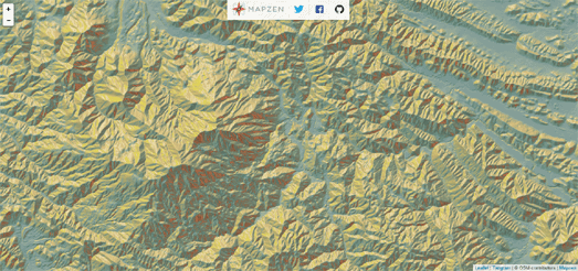
Peter Richardson has published a superb article on the Mapzen Blog which take you on a journey from the greatest historical relief maps to the wonders of interactive WebGL relief maps. Mapping Mountains includes some great examples of historical relief maps and also explores how you can use a few tricks in WebGL to emulate the relief map designs of some of history's finest cartographers.
The article explains how using WebGL it is possible to use 3d 'normal mapping' and light sources to create really impressive relief map layers for interactive maps. The article is necessarily technical in nature but happily, for us non-super human cartographers, it also includes loads of really impressive interactive relief maps.
Be sure to check out Peter's 'gratuitously animated contour map' and the metallic relief map examples.
No comments:
Post a Comment