Hurricane Ian Tracking Maps
Hurricane Ian is expected to reach Florida later today. At the time of writing the hurricane is a category four storm and is expected to cause major damage when it makes landfall, probably in the Tampa Bay region later today.
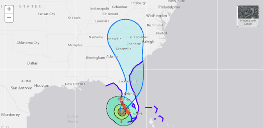
NOAA's National Hurricane Center has produced a number of maps showing the forecast track of Hurricane Ian, wind speed probabilities, storm surge warnings and rainfall potential. The Warnings map includes a layer which provides information on the most likely arrival times of tropical storm winds along the hurricane's forecast path.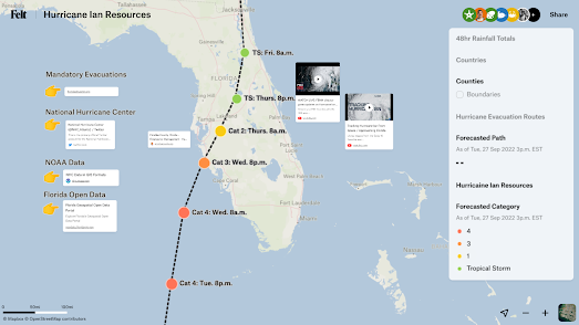
Felt's Hurrincane Ian Resources interactive map includes a forecast path, showing the times and dates the hurricane is expected to arrive. It also includes a layer which displays Florida evacuation routes and provides links to Florida's latest evacuation orders. Other links are provided for the NOAA website and the latest Tweets from the National Hurricane Center.
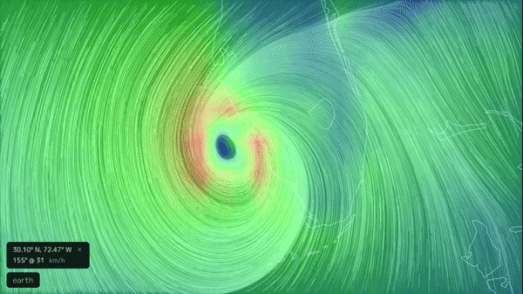
NBC has created a live streaming YouTube channel Tracking Hurricane Ian which is switching between a map using the latest satellite images to track the storms progress and a map showing the storm's forecast path with estimated times of arrival along the mapped path. You can also follow the storm in near real-time using the Earth interactive map. This animated wind map updates every three hours to show the latest weather forecasts around the world.


Comments