Mapping the World's Flora & Fauna
The popular Pla@ntnet website can help you identify the species of any plant just by submitting a photograph of the plant. Pla@ntnet has now also released a new interactive mapping tool which can list all the different species of plants that can be found in any chosen area.
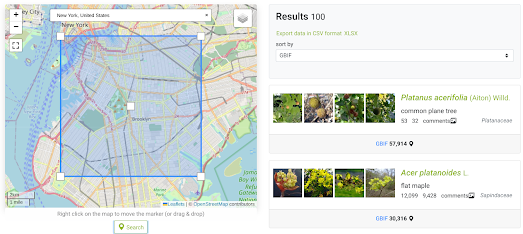
GeoPl@netNet is a simple tool which allows you to draw an area on an interactive map to discover which species of plants can be seen in that area. You can draw any sized rectangle on the map and GeoPl@netNet will then list all the plant species which can be found there.
The map uses AI to determine the potential plant species in an area based on climatic variables, soil-types, and data from the Global Biodiversity Information Facility (GBIF). When GeoPl@netNet lists the species which can be found in an area it returns the number of known occurrences of each species recorded by GBIF.
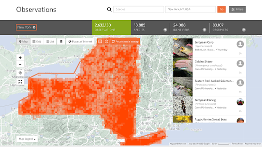
If you are interested in finding out more about the different types of flora and fauna which exist in your neighborhood you can also use the iNaturalist Explore tool. Enter a location into iNaturalist Explore and you can view a list of all the species of animal and plants which have been observed in the area by users of the iNaturalist app.
This app is used by citizen science naturalists around the world to identify and record observations of plants and animals. Using the iNaturalist Explore tool you can discover what observations have been recorded near where you live. You can also search individual species of plant or animal to view a global distribution map of that species' natural habitat.


Comments