Discover Your Earthquake Risk
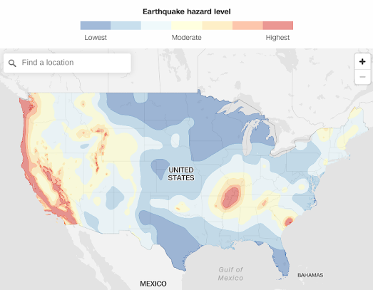
CNN has created an interactive map which reveals your risks from earthquake activity. Enter your address into the What's your earthquake risk interactive map and you can discover your earthquake hazard level based on data from the US Geological Survey.
CNN's map colors the United States based on seven different levels of earthquake risk. You can also click on a location on the map to reveal the hazard level at that location. The hazards are calculated based on the USGS's 2018 Long-term National Seismic Hazard Map. The USGS says that the hazard levels are "based on seismicity and fault-slip rates, and take into account the frequency of earthquakes of various magnitudes".
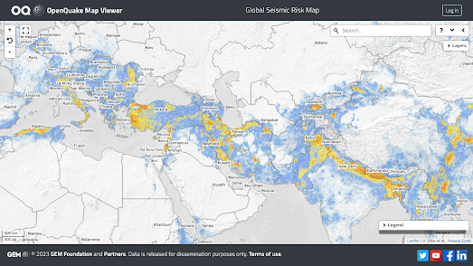
If you live outside the United States (or in the U.S.) you can use the Global Earthquake Model Foundation's earthquake hazard maps to assess your likely risk from seismic activity. The Global Earthquake Model Foundation is a non-profit organization working to assess and help manage the risk from earthquakes and seismic activity around the globe. Part of its mission is to assess and share open data on earthquake risks and hazards.
The Global Earthquake Model Foundation has released two interactive maps, the Global Seismic Risk Map and the Global Seismic Hazard Map, which can be used to explore the risk from earthquakes at locations around the world. The estimated hazards are based on the foundation's own OpenQuake engine, an open-source seismic hazard and risk model.

Comments