Monday, November 30, 2009

Streaming Tweets on Google Maps

PlanetEye Live Twitter Map

PlanetEye have put together a Google Map that summarises all geotagged tweets from around the world, filtered by recency (last hour, last 24hrs & last 7 days). The map utilises Twitter;s recent streaming API.

The Planet Eye Live Twitter Map summarises real time data into clusters of information based on your zoom level. These clusters break apart into smaller clusters as you zoom closer into the map.

The map comes with a dynamic url link so that you can share the current map view with your friends. The map also comes with an embed option allowing you to share the map in your own website or blog.

________________

Augmented Reality on Google Maps

Junaio

Junaio is a mobile and online platform that lets users create, explore and share information using augmented reality and location-based content. Users can
place 3D objects, twitter messages or websites into the real world and then share their creations with friends through social networks.

In the video above you can see an augmented 3D T-Rex placed on the Golden Gate Bridge. These 3D objects can then be discovered by others who come across the same location. Or you can search for restaurants, cafes, museums, bars or shops etc. in Google Maps and see the results in a 360° augmented live-view of the camera.

Junaio has partnered with film company Focus Features to licence memorable 3D characters from its hit animated movies '9' and 'Coraline' on the platform.

Junaio is currently available on the i-Phone. Download from the App Store: http://itunes.apple.com/us/app/junaio/id337415615

________________

The Geograph API - Part 2

This is the second part of Google Maps mashups using the Geograph API. Geograph has over 1.5 million photographs covering a large area of Great Britain and of Ireland and is a great resource for developers in the UK to provide images in their map mashups

CanalPlanAC

CanalPlanAC is an interactive guide to the inland waterways of Europe, it plans journeys, calculates the length (distance, number of locks, time taken etc) of your trip and shows information on places along the way, e.g. pubs, shops and museums.

The site uses the Google Maps API to show a map for each of the locations in its database and the Geograph API to show a corresponding photograph.

Arran.info
Arran.info is a Google Maps based guide to the Isle of Arran in Scotland. The map contains 931 photos, 77 virtual tours and a large number of points of interest on the island. The site includes a handy rating system so you can view the top rated and the most viewed entries. It is also possible to view locations by category.

BritEvents


This UK event listings site uses the Google Maps API to show the location of listed events and uses the Geograph API to show relevant photographs. It is possible to search for events by date, location and by type of event.

The map view shows live traffic data, the location of traffic cams and nearby garages.

Potton Online
Potton Online has a nice Google Map for this small town in Bedfordshire, England. The map includes a lot of categories of map marker, including pubs, food and public transport. The map uses the Geograph API to show photographs of local points of interest.


The Geograph API
The Geograph API - Part 1

________________

Sunday, November 29, 2009

Google Map of Early European Photographs

Huis Doorn Photo Collection


The Huis Doorn own a database of photographs from the collection of the German Emperor Wilhelm II (1859 - 1941). In 2007 they began digitising the 12,000 photos housed in this collection. So far, 5,500 photos have been processed.

As well as digitising the collection the Huis Doorn are also geo-tagging the collection and displaying the photographs on a Google Map. Clicking on the photograph on the map will take you to a dedicated page for the photograph with detailed information about the selected image.

The website is available in English and Dutch.

________________

German Renewable Energy Experts Map

Energie-Experten

Energie-Experten is a Google Maps mashup of renewable energy experts in Germany. The site offers a simple to use search function that will display on a Google Map the nearest renewable energy experts to a searched address.

It is possible to search the map by location and by type of renewable energy. Clicking on the returned map markers opens a tabbed information window with contact details and the areas of expertise of the renewable energy company.

________________

Saturday, November 28, 2009

Live 2010 Olympics Torch Relay

Vancouver 2010 Olympic Torch Relay

CTV are live streaming the Vancouver 2010 Olympic torch relay. Alongside the stream of the relay is a real-time Google Map which shows the current location of the torch bearer.


The torch will arrive in Vancouver for the start of the Olympics on February 12th. Using the official Vancouver 2010 Olympic Torch Route Google Maps mash-up it is possible to find out where and when you can go to watch the torch along its route.

________________

Google Map of NHL Players' Birthplaces

QuantHockey.com

This Google Maps mashup shows the birthplace of NHL players. Unsurprisingly the majority of NHL players seem to have been born in colder climates.

I'm not hugely surprised by the fact that no NHL players originate in Australia. What does surprise me (but I'm sure there's an historical reason) is the disproportionate number of players originating from the Czech Republic and Slovakia.

________________

French Tourism Google Maps

Vacances Vues du Ciel

Vacances Vues du Ciel is a French hotel search site that lets you explore and compare prices of more than 100,000 hotels around the world. The site lets you search for hotels directly from a Google Map.

The map displays hotels, tourist destinations and photographs. Clicking on a destination opens an information window containing information and photographs of the location. Clicking on a hotel map marker also opens an information window with information and photographs and the option to book a room.

Evaway

From the same company that produced Vacances Vues du Ciel comes Evaway, a website that lets you create and share travel itineraries in a simple, fun and visual way.

You can use the site to search for travel itineraries anywhere in the world. For example, if you are heading to Paris for the weekend you can search for tours that have already been created for the French capital. The tours that have already been created for Paris include Paris by Night, Monuments and Art Galleries. Of course, if you don't find the tour you are after, you can easily create your own.

Each itinerary includes a Google Map, highlighting all the stops on the tour and photographs of each of the planned locations. It is also possible to search each itinerary for nearby hotels and places of interest and to give it a rating.

________________

Friday, November 27, 2009

Virtual Panorama Tours on Google Maps

360Cities.net Virtual Panorama Tours


360cities.net uses Google Maps to display locations in virtual interactive panorama tours. A virtual tour is an embeddable Immersive Tour Widget that you can create using the 360 Cities site. Then you can embed it easily into a web page just like you would a YouTube video.

You can explore any location on the map by clicking a map marker, which opens a spherical interactive panorama. Hotspots in the panorama allow you to move seamlessly to other locations. The virtual tour uses the Google Maps Flash API to display a small floor plan with nearby map markers and a radar view to give you an idea in which direction you are currently looking.

________________

A Google Maps Adventure Game

PVII

PVII is an adventure game built on top of the Google Maps API. The game is in a very early (alpha) stage of development but already shows huge promise.

In the game you are able to move around on Google Maps and interact with other players, with virtual players and with buildings and objects. As you move around in the game photographs of your current location on the map are also displayed in the game.

The game interactions are largely in Spanish but the game controls, 'walk', 'take' 'enter' and 'look at' are in English, so even if your Spanish is non-existent you should still be able to move around the map.

Here are some quick tips to help you explore the game world:

1. Logging in - just enter a name (less than 8 characters) and you will be taken to the game. If you want your progress saved however you will have to register.

2. Walking - you can only walk short distances so click on the map fairly near your game avatar to walk to that position. You can not walk through buildings so stick to the roads.

3. Entering buildings - you can only enter some buildings. The game instructions tell you when you are near a building that you can enter. The instructions point you in the direction of the building and tell you how far away it is. When you are in the right position click enter and then click on the building in the map.

4. Virtual Players - it is important to interact with the virtual players as they can give you objects that you will need later.

________________

Thursday, November 26, 2009

Decorate Your House in Street View

Shelter - Bling Your House

UK housing charity Shelter have created this amazing Street View site that lets you decorate your house with some Christmas bling. Once you enter your postcode and find your house you can choose from a number of Christmas decorations to give your house that Christmas glow.

Once you have finished you can then share your creation via Facebook, Twitter or e-mail. The site has been created to remind you that no-one should be homeless at Christmas - so once you have created your decorated house please remember to give generously to Shelter.

Via: Mapperz & Street View Gallery

________________

Italian Google Maps Mashups Round-Up

Myopencity

Myopencity is a new italian Yelp/Qype competitor, that allows the user to easily browse Google Maps to find reviews, places, people and events. To discover what is happening in your town just drag and drop the map or search by town, category or tag.

The reviews and events are divided into a large number of categories, including restaurants/bars, cultural, sport and shopping. Each category has an individual map marker. Clicking on a marker opens an information window with information about the location and the option to give it a rating.


Bed & Breakfast in Termini Rome
This Google Maps mashup lets you find a B&B in Termini in Rome. The bed and breakfast establishments are shown on the map and also listed alphabetically in the map sidebar.

The site uses Street View so it is possible to view the exterior of the B&B and to take a virtual stroll around the immediate neighbourhood. Clicking on one of the markers opens an information window with the establishment's address and an e-mail address so that you can book a room.

New Moon Map

Italian newspaper la Repubblica has created this Google Maps mashup covering some of the locations in the movie New Moon. Part of the film is set in the picturesque Italian town of Volterra.

The map markers show some of the film's locations and include photographs and extracts from Stephenie Meyer's original novel.


More Italian Google Maps

________________

Wednesday, November 25, 2009

Copenhagen Climate Talks on Google Maps

Trouw.nl

Dutch national newspaper Trouw.nl have produced a number of Google Maps mashups. Visitors to the site can navigate news and reader's items for sale from one News Google Map and now Trouw have also produced a series of Google Maps to illustrate their coverage of the climate conference in Copenhagen.

The KlimaatKaart allows the user to read news articles about the conference and view a number of layers concerning the environment. The map also allows you to switch between the different layers.

This layer shows the temperature in 2100, this one shows the CO2 emissions per capita and this one wind energy production per country. The map also comes with a handy widget so you can embed the map in your own website.

________________

New Google Maps Flying Game

PlaneMap
PlaneMap is a great new flying game built with the Google Maps API. The game allows you to take off from one of over 500 airports around the world.

Once you have taken off your goal is to fly to the destination airport. As you fly your location is sporadically updated under the map, as is your fuel level and the distance left to your destination.

Check out the game in action in the video below,


________________

53,000 Hotels on One Google Map

RoomAtlas.com

RoomAtlas.com plots over 53 thousand hotels on Google Maps, with live pricing and availability. The map also includes TripAdvisor reviews, Google Street View, Wikipedia placemarks and hotel photographs.

It is possible to search the map by location, date, price range, star ratings and hotel amenities. The results are then shown on the map using prices within the map markers. It is therefore easy to select hotels you may be interested in at a glance.

________________

Tuesday, November 24, 2009

Tweeting Ski Resorts on Google Map

Tweeting Ski Resorts


This year I'm actually hoping to get some skiing in. Whilst researching for a resort I started thinking that it would be a really good idea if ski resorts used Twitter to provide snow updates. Guess what, lot's of them do!

So far I've compiled a list of around 50. Of course it wasn't long before I started thinking these Twitter accounts need to be mapped. What I want to do is to click on a resort on a Google Map and have the Twitter feed load automatically. Hence the Tweeting Ski Resorts map.

Over the next couple of days I'm going to track down more Tweeting ski resorts. I'll be adding them to the map as I find them.

________________

Mobile Reception Maps

Got Reception?

GotReception? uses Google Maps to show cellular phone coverage in the United States. Using the map anyone can search a location to see which carrier has the best ratings in the area. People can also share their experiences with others by posting their own rating for their carrier.

The site uses a heat map to show mobile phone coverage and allows the user to view the coverage of the major mobile phone providers. It is possible to search the map by location, link to any map view and embed a map in your own website or blog.

Orange UK Coverage

In the UK mobile hone company Orange have produced a Google Map to show where users can get a good reception. The site uses a heat map to show the quality of coverage in different locations.

It is possible to search the map by postcode and it is possible to compare six different locations for the quality of coverage.

________________

View Declassified Images on Google Maps

Declassified Military Aerial Images Map

The Royal Commission on the Ancient and Historical Monument of Scotland are busy mapping declassified military aerial photographs on Google Maps.

The Aerial Reconnaissance Archives have millions of military reconnaissance images of locations throughout the world declassified by the UK Ministry of Defence. The archives range from Second World War Allied and German Luftwaffe reconnaissance photographs to Cold War imagery.

To date RCAHMS have mapped reconnaissance photographs in Belgium, Croatia, the Czech Republic, Denmark, France, Germany, Italy, the Netherlands and Poland. Using Google Maps to display the photographs means that users can compare the present day satellite view of locations with reconnaissance images from the past (mostly from World War II).

________________

Monday, November 23, 2009

Google Maps Navigation for Android 1.6

Google announced today that Google Maps Navigation (Beta) is now available on devices running Android 1.6 (Donut) and higher, such as the T-Mobile myTouch 3G and the G1.

Google Maps Navigation comes with everything you'd expect to find in a GPS navigation system, like 3D views, turn-by-turn guidance and automatic rerouting. If you have a phone running Android 1.6, you can download an updated version of Google Maps from the Android Market to use Navigation today.

One feature not available in the Android 1.6 version is the "navigate to" voice command. However a new 'Layers' feature is available. Layers lets you overlay information on the map., such as My Maps, transit lines and Wikipedia articles.

Via: Official Google Mobile Blog

________________

Curing Diabetes with Google Maps

Zip the Cure

Zip the Cure aim to raise $100 in every zip code area to fund research to find a cure for juvenile diabetes. If you wish to donate to Zip the Cure you can check to see if your zip code area is free on this handy Google Map.

The map includes a search box to find a zip code or you can just zoom in on an area. Of course if someone has already given in your zip code you can choose another zip code area. The zip code areas where someone has already donated are shaded green. Zip codes still available are shaded yellow.

Once you have donated your generous support will be shown on the map. Whenever someone searches for your zip code area they will be shown that you have already donated.

________________

Driving Directions with Weather

Weather Underground Road Trip Planner

Weather Underground have launched a new service integrating weather conditions with driving directions. Weather Underground’s Road Trip Planner provides point-by-point driving directions for journeys as well as weather forecasts every five kilometres along the route.

Both the directional information and the weather data is displayed on a Google Map. Weather forecasts update dynamically depending on the departure date and time specified for the trip itinerary and can go as far out as seven days. For longer journeys, Weather Underground’s new Road Trip Planner is able to accommodate up to four different legs of a traveller's road trip.

The Road Trip Planner points out detailed weather events that could affect driving and road conditions including: below freezing temperatures, snow storms, rain and hail, all of which indicate unfavourable and potentially dangerous driving conditions. The Road Trip Planner allows drivers to make appropriate preparations for the smoothest and safest drive possible.

________________

The Geograph API - Part 1

Geograph
The Geograph project is trying to collect geographically representative photographs and information for every square kilometre of Great Britain and Ireland. Currently the site has over 1.5 million photographs representing over 75% of the target area.

This huge collection of photographs is an amazing resource for British and Irish map developers and can be accessed using the Geograph API.

Here is just a sample of some of the websites that are currently exploiting the Geograph API:

Good Beach Guide
The Marine Conservation Society's Good Beach Guide is a Google Map mashup being used as part of a campaign for clean seas and beaches. The Good Beach Guide uses the Geograph API to provide photographs of beaches throughout the British Isles and Ireland.

Clicking on any of the map markers opens an information window containing a photo and a link to the guide for the selected beach.

The Campsite Guide
BigFreeGuide.com uses the Google Maps API to show the locations of UK campsites and uses the Geograph API to provide photographs of the sites and locales.

Nestoria
Real estate website Nestoria uses Google Maps to show the locations of properties for sale. Beneath the Google Map of each location are a number of tabs that let house hunters research the area they wish to move to. As well as options to view information about schools, crime etc is an option to view photographs of the area from Geograph.

Places 2b

Places2B is a searchable list of every UK village, town and city. Users of the site can comment on and rate locations, see them on a Google Map and view photographs of them from Geograph. The site also uses Wikipedia to provide descriptions of the selected towns.

MyNeighbourhoods
My Neighbourhoods is an online community that allows you to chat with and get to know different people, view their profiles, share ideas and thoughts with other users in your neighbourhood.

The site uses the Google Maps API, the Nestoria API and the Geograph API to provide a wealth of information about all areas of the UK.

________________

Sunday, November 22, 2009

Google Map of Programming Languages

Timeline Map of Programming Languages

This mashup uses the Google Maps API with the Simile Timeline to show a map of the history of programming languages. The map presents a timeline of programming languages geo-tagged to the location of their development.

Clicking on any of the map markers displays a 'hello world' code snippet in the selected language. All the data on the map is compiled from History of Programming Languages and Their Evolution and from Wikipedia.

________________

The Google Maps Zombie Simulator

Zombie Outbreak Simulator

The Zombie Outlook Simulator allows you to unleash a horde of zombies on Washington DC in Google Maps and watch as up to 15,000 civilians are chased down, attacked and infected by hundreds or thousands of shambling zombies over a 1km square area.

Players can tweak a number of zombie and infection variables such as zombie speed, infection rate, number of civilians and shooting accuracy to create their own version of a zombie outbreak.

Zombie Outbreak Simulator is Binary Space's "teaser app" for their upcoming zombie RTS, "Class 3 Outbreak", which also runs on Google Maps. Game designer, Jay Weston says,

"ZOS and Class 3 Outbreak are by far the most ambitious games to be released on Google Maps, we can't wait to see what the reaction is like. A large scale zombie infection has never been simulated like this before."

Programmer, Saxon Druce has coded each of the 15,000 map inhabitants to behave individually and interact with terrain on Google Maps, meaning that characters move under trees, around walls and into buildings.

________________

Saturday, November 21, 2009

Floor Plan Maps With the Google Maps API

Office Floor Plans

This mashup is an interesting proof of concept of how the Google Maps API can be used to create an interactive office plan, complete with employee profiles. At the moment the map is just a demonstration of the possibilities, but it is also a working model so you can play with and explore the map's functionality.

The map overlays floor plans of an office directly on the building's satellite view in Google Maps. There are four overlays, one for each floor of the office building. It is possible to switch between each floor using the buttons in the top right corner of the map (replacing the normal map type buttons).

The mashup can also map the positions of employees on the floor plan. The map includes a search box so you can search for employees or you can select an employee from a drop down menu. There is even a form which allows the user to add an employee (and employee details) to the map.

________________

Friday, November 20, 2009

Ski Season on Google Maps

The London Times Ski Deals Map

The London Times has produced what will probably be the first of many ski related map mashups for this ski season. The Times' ski correspondent Mark Frary has used Mapalist.com to create a Google Map that shows ski deals in Europe.

The map ranks deals into four categories: amazing (>50% off), fantastic (>40% off), good (>30% off) and reasonable (anything else). The location of the deals is shown on the map with black, red, blue and green map markers. If you are a chalet owner, tour operator or travel agent you can add ski deals to the map by completing The Times' ski deals form.

________________

Important Google Maps Developer News

Google have announced that in a few weeks time they will be adding new functionality to the Google Maps API v2 that allows Google to log the location and content of the markers and/or infowindows that are displayed in Google Maps mashups. Google then plans to use the gathered data created by Google Maps developers within the main Google Maps site as 'search results'.

This could obviously have huge benefits for map developers. Presumably Google will acknowledge or link to the creators of this third party content which, in theory, should drive traffic from the main Google Maps site to the sites that created the content.

However I'm sure that there are a number of developers and web sites that won't want Google to reuse their content in this way. Therefore Google are allowing sites to opt out of sharing their content. Here is what the Google Geo Developers Blog says,

To ensure that this new feature doesn't cause any issues, we have put a few controls in place:
  1. We only index data from maps that have been viewed by many unique users. For example, maps only viewed by you and a few friends won't be indexed.
  2. If your page is protected by robots.txt, we will not index your content.
  3. You can opt-out of the logging by specifying "indexing=false" when loading the API.
  4. If you are a Maps API Premier customer, we will not index data from your maps, unless you opt into indexing by passing in "indexing=true".

The impact of this move on users of the main Google Maps site should of course be hugely beneficial. Now, as well as seeing local user created content, from Google My Maps and Mapplets, users of Google Maps will potentially be able to view content from the thousands of Google Maps mashups created using the Google Maps API.

Programmable Web
has recorded over 1,800 sites that use the Google Maps API. My guess is, however, that the number of websites using the Google Maps API runs into the tens of thousands. Therefore Google have a potentially enormous data set that they can leverage to enhance Google Maps as a product.


Via: Google Geo Developers Blog

________________

Thursday, November 19, 2009

Share Your Location with Google Maps

ImWaitingHere


I’m Waiting Here is a Google Map based service that you can use to easily point where you are and what are you doing. You can then share this point with your Facebook friends. Using the map you can also see other users' positions and their profiles and communicate with them.

To show where you are you just click on the map at your location and explain what you are doing there. You can then choose to share your point via Facebook. The site also has a number of other features, such as, in site messaging, user profiles, adding friends and photo galleries.

________________

Google Maps Integrated Travel Planning

maps.google.com.sg

Google Maps have teamed up with Singapore's Land Transport Authority to provide integrated travel directions for the country, complete with public transport and real-time traffic information.

Google Maps Singapore can give public transport directions with up to three options for routes. Users are then able to choose their preferred route and get step-by-step directions.

Driving directions use real-time traffic information from LTA to show the quickest routes. Users can then drag the suggested routes to avoid congestion (shown in red). Traffic conditions are updated every few minutes on the map and information from LTA is supplemented with crowdsourced information from mobile phone users. Users with Google Maps for Mobile can feedback on current traffic conditions and the data is then updated on the map.

maps.google.com.sg - Google Maps Singapore
m.google.com.sg/maps - Google Maps for Mobile Singapore

________________

All Literature Begins with Geography

Poetry Atlas


This City now doth, like a garment, wear
The beauty of the morning; silent, bare,
Ships, towers, domes, theatres, and temples lie
Open unto the fields, and to the sky;

(From Composed Upon Westminster Bridge - William Wordsworth)

The poet Robert Frost said that "All literature begins with geography". The Poetry Atlas believe that this is true and also believe that nearly everywhere on Earth, at some point, has had a poem written about it.

The Poetry Atlas has therefore created a Google Maps mashup to try and geotag as many poems as they can and also find poems for as much of the world as possible. If you know about a poem that isn't on the map you can e-mail it to Poetry Atlas and they will add it to the map.

________________

The SoundCloud Google Map

Tracks on a Map

This Google Map shows the locations of bands that have uploaded tracks to SoundCloud and even lets you listen to the tracks directly from the map.

The tracks can be selected by genre of music. Selecting to view markers by genre gives an interesting view of which types of music are popular in different parts of the world at the moment.

Clicking on a map marker opens an information window which lists the tracks loaded from that location. Clicking on 'play' lets you listen to the selected track. I'm currently listening to the Superfantastics out of Brighton, although something tells me this isn't actually where they are from.

________________

Wednesday, November 18, 2009

Where Politicians go to Party

LobbyData.com Party Map

The Capitol Hill Club in Washington is doing rather well out of politicians. Over the last two years it has hosted 689 receptions, lunches and dinners for Washington politicians.

The LobbyData.com Party Map shows the favourite party venues for Republican and Democrat politicians. Venues are shown on the map by appropriately cocktail glass shaped map markers. The colour of the markers represent the percentage of Republican or Democrat events held at each venue.

It is possible to search the map by location, by political party, by politician name or by date. The map also comes with a handy 'link to this view' option.

________________

Sherlock Holme's London Google Map

Londonist Sherlock Holmes Map

We all know that Sherlock Holmes lived at 221b Baker Street now, thanks to The Londonist, we can follow all of the great detective's known movements on Google Maps.

The Londonist have used Map Channels to plot every London location mentioned in Conan Doyle's famous novels. Having plotted Holmes' movements The Londonist have even undertaken a little detective work of their own.

Unsurprisingly, they find that there is a lot of action around the Baker Street area, interestingly however Holmes never once set foot in nearby Soho. There is also a lot amount of action around Crystal Palace and the "reason is elementary when you know that Conan Doyle lived for a time in South Norwood".

If you want to see some of the locations outside of London you can always check out the handy Google Maps provided on Google Books. For example, this page has a map of a all the locations in The Complete Sherlock Holmes Volume One.


Via: http://twitter.com/vicchi

________________

One Stop Google Map for Munich

WerWieWas

WerWieWas is a new website that uses Google Maps to present local news, events and recommended locations in Munich, Germany. Users of the map can add their own news, announcements or recommend locations.

It is possible to navigate the different categories of map marker via the tabs at the top of the map. Selecting a tab loads the markers for that category and also loads information for each location under the map.

Adding a location to the map is very simple. The user simply chooses a category from the menu under the map , places a marker at the correct location and completes a short form.

________________

Explore the Earth with PublicEarth

PublicEarth

PublicEarth is a 'wiki for places'. The site uses Google Maps as the means to display crowdsourced location recommendations. Registered users can rate places, get personalised suggestions, create collections, or add comments about added locations.

The unique selling point for PublicEarth could be the huge number of categories of locations. PublicEarth has over 450 categories, these include the usual categories such as restaurants and entertainment but also more esoteric topics such as 'Nut Harvesting and 'Glass-blowing Studios'.

The site allows the user to plan a trip or a day out and then send the saved locations to a GPS device, a mobile phone or e-mail them to friends. PublicEarth also lets you display your saved places on your own website or blog by creating and embedding a widget.

The site even comes with an API that allows developers to access PublicEarth's huge database of recommendations.

________________

Introducing the NextStop API

NextStop API

Nextstop is an online travel guide and social recommendation website that makes extensive use of Google Maps. I was very impressed with nextstop when I first reviewed the site back in May.

Here's what I said in the original review,

"There are already a number of well established social recommendation websites out there but the ease of use of nextstop should ensure it becomes a major player in the market. Adding recommendations to nextstop is truly an enjoyable experience, which can't be said of many social recommendation sites."

Nextstop are now opening up all of those user contributed recommendations with the release of an API. There is a lot that developers can do with the API, and nextstop have provided some great API examples. Map developers will probably be most interested in the map example and the guide map example.

I've just spent a couple of hours creating maps with the API and I must say it is one of the easiest API's that I've ever used. I can definitely see myself adding nextstop recommendations to a lot of the maps that I've personally created.

________________

Tuesday, November 17, 2009

Belgium Votes to Demolish Royal Palace

Le Batiment Le Plus Laid de Belgique

Here is a really cool Google Map from Belgium demolition company Jan Stallaert. The map let users submit and vote on the ugliest buildings in Belgium. Jan Stallaert promised to demolish the winning building with glee.

However Pascal Laureyn from Belgeoblog tells me that the competition didn't exactly go as planned. Instead of voting for Belgium's ugliest buildings many users just voted for the building that they most wanted to see destroyed. Popular buildings to be demolished were the Royal Palace, the headquarters of Belgium's political parties and the stadiums of a number of football teams.

This is a great first story from Google Maps Mania new Belgium contributor Belgeoblog.

________________

Annotating Street View Panoramas

Mapsicle

Mapsicle is a new Street View annotation library. The library allows you to easily overlay content, such as markers and information windows onto Street View.

Using the Mapsicle library you can:
  • Create and show markers at various locations on Street View
  • Show markers that are outside of the field of view
  • Create information windows at locations
The library is available in the Maps Util library with a developer's guide, reference section, and examples that show how to implement custom infowindows, markers, and map integration.

As a demonstration of the new library the developers have created a street tagging website.

StreetTag

As the name suggests StreetTag lets you tag Street Views. You can search for any location in the world (that has a Street View) and tag the Street View with an appropriate comment.

It is possible to search for previous tagged locations by destinations and by category. It is also possible to vote for tags submitted by other users.

Via: Google Geo Developers Blog

_____________

Find a School With Google Maps

okSchool Explorer

The okSchool Explorer is a Google Maps mashup to help parents find and decide on a school for their children. The map is an entry into the MashUpAustralia contest.

To use the map just click on one of the school map markers. This will load a beautiful looking chart describing how family dense the towns are. Green describes a town filled with families, while red describes a town with less.

A series of connections is displayed in the chart to other schools via emergency services. Family related statistics are then compared to the average across the region. You can filter schools using the colour chart key. Charts usually display statistics when rolled over. Where possible, they are also broken down by gender.

_____________

Google Geo Are Hiring

Mano Marks (http://twitter.com/manomarks) from Google has contacted me to say that Google have some positions available in the Geo Developer relations team.

Here's the information that he sent me:

We're excited to announce that we have some positions on our Geo Developer relations team. Geo Developer Relations helps developers outside of Google build on our Geo platforms, Google Maps and Earth. Our team is passionate about the web and web technologies. We have two positions available:

Developer Advocate: These are our technology evangelists. You'll be working directly with partners companies, executives and engineers, to help them put their Geo content on the web. And you'll advocate on their behalf with the Maps and Earth teams at Google. You will use your strong and well-rounded coding skills in a wide range of web/AJAX technologies along with excellent writing and presenting skills. And you have a passion for all things Geo.

Developer Programs Engineer: It's your job to help spread Geo into the Web. You will help group the Google Geo Developers community by helping 3rd party developers put their content into Google Earth and Maps. You will work with Google Geo engineering teams to improve Maps and Earth and make them even better for developers to work with. You're a driven team player with strong web application development skills who loves troubleshooting challenging coding issues and is passionate about developer communities. And you have a passion for all things Geo.

Link: http://sites.google.com/site/googdevreljobs/

Street View Type Map for Buenos Aires

Fotocalle

Fotocalle have released a Street View type service for Buenos Aires, Argentina. The site stitches together a number of interactive 360 degree panoramas of the city. The panoramas, just like Street View, include links to adjacent panoramas.

Fotocalle uses Google Maps as a navigation tool. Again like Street View the roads on the map with panoramas are coloured blue and it is possible to drag the map marker to view the panorama at a location.

Fotocalle use Nikon Cameras with Segways and cars to capture their panoramas. Unlike Street View they also provide interior interactive photos of to connect the outside with the inside of buildings.

________________

Monday, November 16, 2009

Turkish Earthquakes Google Maps Widget

Sondeprem.net

Sondeprem.net have created an embeddable widget that shows the latest Turkish earthquake news on a Google Map. By cutting and pasting a short piece of code you can add the map to your own website or blog.

The map itself animates through the latest earthquake news in Turkey. Map markers show the location of the news and a short headline is displayed at the bottom of the map.

________________

Google Maps & Mashups Blog for Belgium

Belgeoblog
Belgeoblog is an excellent source for information and news about Google Maps and Google Earth related developments in Belgium. The blog also has a number of interesting Google Maps mashups.

Typisch Belgisch

Typisch Belgisch is a collection of interesting Belgium satellite views from Google Maps. The views are categorised into a number of categories, 'Special Attractions', 'Useless Work', 'Flying Objects', Military' and 'Photogenic Phenomena'.

Brussels in 1953

This map displays a collection of historical photographs of Brussels. Most of the photos are from 1953, but the map also contains a number of older photographs of the city.

Brussels Metro Map
A map that shows the Metro lines of Brussels.

________________

Sharing Your Location for a Specified Time

Glympse
My guess is that most people aren't prepared to allow location tracking websites to have blanket coverage of their movements. Many services try to solve this issue by allowing the user to set the granularity of the location data being tracked. Fire Eagle, for example, allows the user to set the level of access to road, neighbourhood or city level.

Glympse however are betting on the fact that it isn't the degree of accuracy of location that concerns most people but the issue of time. Glympse therefore allows the user to share their location for a limited amount of time.

Using Glympse the user can use their smart phone to show their location on a Google Map for a specified period. To use the service you simply select a contact, set a duration, and hit send.

Here's the introductory video,


________________

Satellite Tracking in Street View

ToriSat
ToriSat is an amazing satellite tracking website that allows anyone to track satellites on Google Maps, in the Google Earth Browser plug-in and even in Google Street View. The Google Map view shows the path of the satellite around the Earth and the Google Earth option allows you to view the path of the satellite as if you were looking down from space.

What really impresses me, however, is the Street View option that allows the user to view the satellite superimposed on top of Google's Street View imagery. This is really useful as it shows the elevation of the satellite as it passes overhead. Oh, and you can see all three views at the same time.

You can see the tracking in action in the video below,


The default satellite is the International Space Station but you can select other satellites to track, including the Hubble telescope. You can also change the location of the observation point by clicking the cross at the top of the Street View and dragging the map marker to your location.

ToriSat also comes with a Twitter feed that will Tweet you when the ISS is approaching your location (the site will suggest the Twitter feed to follow from your saved location). There is even an option to save the ISS approaching schedules to your Google Calender.

I'm simply in awe of the developers of ToriSat. Check out some of the other amazing stuff they are involved in (including the Street View SpaceBike) here.

________________

Sunday, November 15, 2009

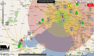
Australian Mashup Competition Round-Up

MashUpAustralia
The MashupAustralia competition is now closed. There has been an amazing 78 entries and the vast majority of the entries involve maps. Over at the All Things Spatial blog Arek has started to review all the map related mashups.

Arek has kindly allowed me to republish some of the highlights from his round-up. However, if you want to see the full round-up, which includes those mashups that use other map API's, you should head over to All Things Spatial.


Victoria: Fire Ready

Depicts locations of fire brigades and police stations in the vicinity of a chosen address. Distance circles of 10, 25 and 45km from the address are marked to allow users to discern how quickly aid can arrive in case of emergency. The application also plots incidents reported by Victorian Country Fire Authority as well as current weather and wind conditions from the Bureau of Meteorology.

FireMash
Firemash is an attempt to match official announcements from NSW Rural Fire Services with incidents reported by a community via Twitter. Users can plot location of their houses on the map and if any incidents are reported in the vicinity, the application will retweet the information to alert the user. Interesting concept although its usefulness will be difficult to demonstrate at the moment because there are no fires reported in the entire NSW!

AuScope Portal

This map built with Google Maps and using OGC web services (WMS and WFS) feels like a fully featured online GIS but I found it a bit cumbersome to use (I had real difficulties in displaying and removing layers and especially managing order of layers for display). Great collection of geology related information though!

LocateMe

This application was submitted by the Western Australia Landgate crew. It presents demographic profiles for areas of interest and lists government services available in the area. It uses Google Map as a background layer but is built with OpenLayers - it certainly does not behave like a real Google Map. Once again, the application is styled as a fully featured online GIS with traditional navigation tools - which makes it rather awkward to use (ie. no double click to zoom, no zoom slider tool, requires selection of buttons to either zoom in or out or pan). It could have been quite an interesting application if it wasn't for so many layers being restricted with a password. And I couldn't get demographic profiles to load at all.

Data Aggregator
This is a very slick and well built Google Map application that displays almost all datasets released for the MashupAustrlia competition, and more. It is easy to navigate and certainly much easier to use than any of the above mentioned mapping mashups. Which is quite surprising since the application is using hierarchical and expandable layer selector, very similar to the other applications mentioned today. A unique feature of Data Aggregator is a couple of custom controls for changing display options for markers and vector overlays.

To be continued…

Cross posted from All Things Spatial

________________

Saturday, November 14, 2009

Week of Geo Hacking

There are a number of geo-related events coming up this week.

If you are in the Mountain View area today you could pop along to Random Hacks of Kindness. Random Hacks of Kindness is an initiative bringing together disaster relief experts and software engineers to work on identifying key challenges to disaster relief, and developing solutions to these critical issues.

If you are in Denmark (Nov 18-19) then you shouldn't miss Kortdage (Map Days). This is a major conference with 47 speakers. As part of the conference there will be a 24 hours mashup competition to use free public data and free tools and web services to create on-line maps.

If you happen to be in London on Thursday (19th) then you can attend the latest Geomob meet. There will be presentations at the event from CloudMade, mapme.at, Mapstraction, Skyhook Wireless and Jaggeree.

In New York on Friday (20th) there is a Google Hackathon. This should be a great event for anyone interested in Google's geo-related APIs.

________________

Cycling and Jogging VR with Street View

Stationary Cycling through Google Street View
Using a head-mounted-display, an exercise bike and Google Street View Bako.ca has created a virtual reality VR environment for stationary cycling.


Bako.ca acknowledges that the project was partly inspired by the Wii and Street View project Tokyo Jogging.


Dev.tori.st
Dev.tori.st have also developed a stationary exercise 'Spacebike' that allows them to cycle over cities in Google Earth.


________________

Google Map of the World's Top Universities

World's Best Universities Map

This Google Maps mashup from Mibazaar shows the locations of the world's top 100 universities, as based on the Times Higher Education-QS World University Rankings and reported by US News.

The universities are ranked in six areas; Academic Peer Review, Employer Review, Student to Faculty, International Faculty, International Students, Citations per Faculty. On the map the universities' rankings are shown by numbered map markers. The universities are also listed in numerical order in the map sidebar.

________________

Friday, November 13, 2009

Oasis of the Seas - Update

Oasis of the Seas


In a few minutes time the Oasis of the Seas will be arriving at Port Everglades in Florida. You can see its current position on the ship's website.

You can also view its position at APRS or on MarineTraffic.com.


The Oasis of the Seas on Marine Traffic

The Oasis of the Seas is the largest cruise ship in the world.
________________