A Map of the World through Time
Two weeks ago I wrote a small round-up of interactive maps which attempt to plot historical borders and places by date. All the maps listed in this Mapping History post allow you to view maps which show the world at different times in its history.
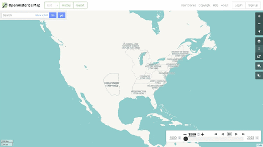
Unfortunately I forgot to mention OpenHistoricalMap in my Mapping History roundup. OpenHistoricalMap is another interactive mapping project which allows you to find and explore maps of places around the world as they were drawn at specific dates in history. Changing the date on OpenHistoricalMap and you can view a map of the world as it looked at that time. OpenHistoricalMap is therefore another great way to explore how locations have changed over the centuries (for example the animated map above shows the USA's changing state borders from 1800 to 1960).
Where OpenHistoricalMap differs from the other maps linked to in my Mapping History post is that it is an open source and crowdsourced project. This means that anyone can contribute to OpenHistoricalMap. If you are disappointed that OpenHistoricalMap appears to lack detailed data for a particular location at a specific point in history you can actually add the mapping data to the project yourself. Also because OpenHistoricalMap is built on open data you are free to download the data and reuse it in your own historical mapping projects.


Comments