A New Global Population Explorer
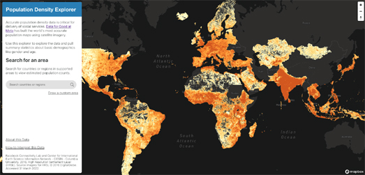
Population Explorer is a new interactive map for visualizing and exploring global population density. Using the tool you can explore where people live around the world and access basic demographic data (such as gender and age) for defined areas.
To create this new interactive tool Meta used artificial intelligence to estimate population density from buildings identified in satellite imagery. The result is a population density map which estimates population at a 30 meter resolution. The map currently has data for over 160 countries around the globe.
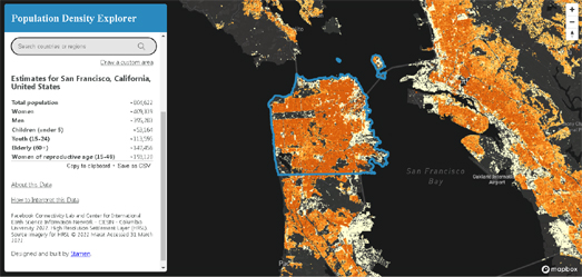
Using the map's drawing tools it is possible to define, search and download demographic data for defined areas. Draw around an area on the map and you can view the total estimated population living in that area and view a breakdown of the population based on gender and age.

There are also a number of other interactive map which allow you to visualize and explore population density around the world. For example, Duncan Smith's interactive map World Population Density uses data from the Global Human Settlement Layer (GHSL) to visualize the number of people living in each square kilometer of Earth.
Another interactive map which visualizes worldwide population data is the SEDAC Population Estimator (GPWv4). This interactive map uses NASA's Earth Observing System Data and Information System (EOSDIS) data to show where the world's population lives. The SEDAC Population Estimator map also includes a tool to draw an area on the map to see an estimate of the population that live there.

Comments