Street View of Middle Earth
Let me start this post with a disclaimer:
There are no real Street View images of Tolkein's fictional land of Middle Earth
I believe that Google did try to hire a Hobbit to drive the Street View car but unfortunately his feet couldn't reach the pedals.
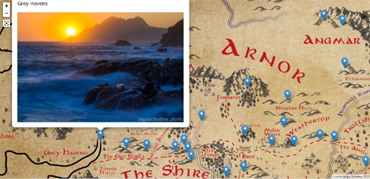
But do not despair! For while I may not have interactive 360 degree panoramic imagery of Middle Earth I do have photographs. For the last 20 years photographer Ingo Scholtes has been traveling across the length & breadth of Middle Earth capturing a series of beautiful landscape images.
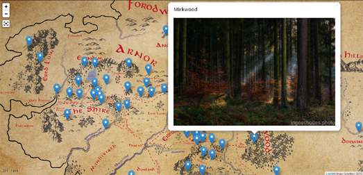
You can explore Ingo's amazing photography for yourself on Photographing Middle Earth. This amazing Lord of the Rings photo gallery uses an interactive map of Middle Earth to showcase the landscape photographs captured by Ingo Scholtes on his artistic journey. The map includes photographs of all your favorite Middle Earth locations, including Hobbiton, the Lonely Mountain, Mirkwoord and even Mordor.
(any resemblance between the Lonely Mountain & the Matterhorn is purely coincidental)
If you are a fan of Tolkien's novels then you can have more fun exploring the interactive maps created by the LOTR Project. These include interactive maps of both Beleriand and Middle Earth. The LOTR Project interactive maps include place-name labels and lots of optional layers which allow you to overlay time-lines, route and events from Tolkein's novels directly on top of the interactive maps.
Comments