Free Maps from USGS & NatGeo
National Geographic has released a great new service which allows you to print free USGS Quad maps. It's also very simple to use. It allows you to just zoom in on your area of interest, select the Quad Map that you want and press print.
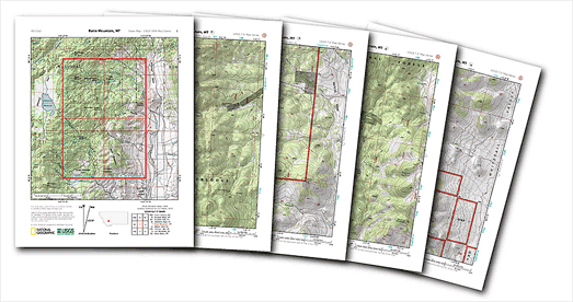
USGS's 7.5-minute quadrangle maps are topographical maps covering an area of 49 to 70 square miles. Using NatGeo's PDF Quads interactive map you can quickly find the USGS quad that you want and then download it as a PDF which has been optimized for printing.
Each quad downloads as a 5 page PDF. The first page provides an overview of the quad. Pages 2 to 5 are the standard USGS Quads cut into quarters to fit on standard printers.
If you want or need more control over the map area that you wish to print then you could try CalTopo. CalTopo allows you to print maps using the 1:24000 USGS scale. CalTopo also includes a whole range of other options, such as allowing you to plot hiking routes, measure the length of your hikes and compute elevation profiles.


Comments