Downloading Microsoft's Building Footprints
Microsoft's Building Footprints dataset now contains data on 777m buildings around the world. The data can be downloaded in GeoJSON format and can be used under a Open Data Commons Open Database License (ODbL).
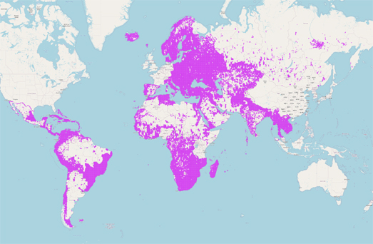
The building footprint data is created by Microsoft by AI detection of buildings from satellite imagery. The map at the top of this post shows where building footprint data is currently available. However Microsoft also has other building datasets available for
- US
- Australia
- Canada
- Uganda and Tanzania
- South America
- Kenya and Nigeria
- Indonesia, Malaysia, and the Philippines
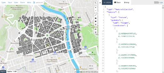
Each country's complete building footprint data can be downloaded as a separate GeoJSON file. These individual country files, however, are still very large.Thanks to a Tweet thread by Alsidair Rae I've discovered that you can create custom downloads of smaller sized areas using the UCR-Star interactive map. For example in the screenshot above I have downloaded the building footprints for a small neighborhood in Rome. Instead of downloading the 1.1GB file of the whole of Italy's building footprints from Microsoft I was able to use the UCR-Star map to zoom in on just the area of Rome that I needed and download the visible area on the UCR-Star map. The result is a GeoJSON file size which is a much more manageable 319 KB.
The UCR-Star map also allows you to download Microsoft's building footprint data in other formats (CSV, KMZ, Shapefile and JSON+WKT).
Comments