Madagascator & Mexicator
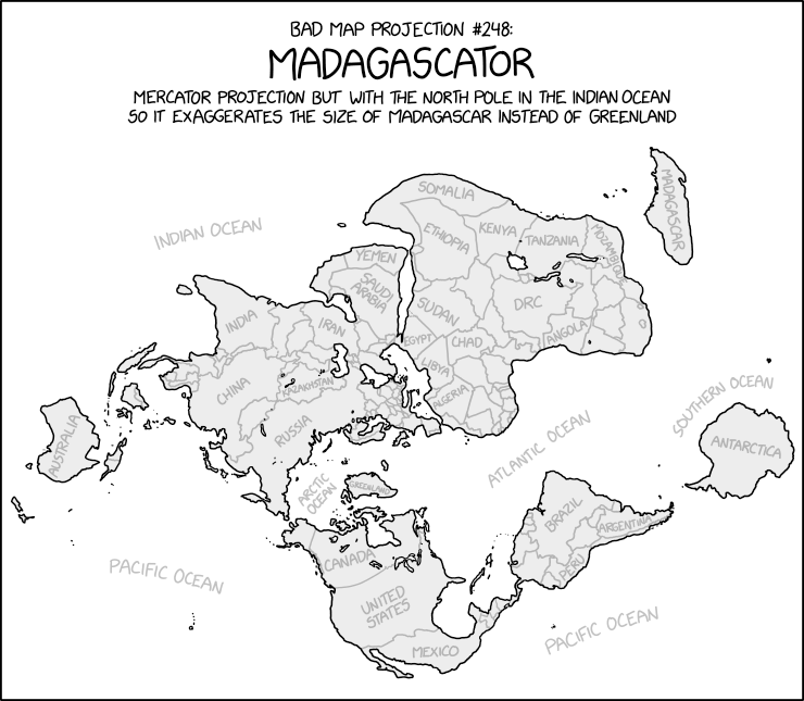
xkcd has published another fun, map based cartoon. Bad Map Projection No. 248: Madagascator is a world map which uses the Mercator projection "but with the North Pole in the Indian Ocean so that it exaggerates the size of Madagascar instead of Greenland.'
The map is a great way to visualize how the Mercator projection distorts size the more you move away from the equator. Because Mercator is so ubiquitous we are used to Greenland appearing as if it as large as the whole continent of Africa. Using the Madagascator projection Greenland appears much smaller than Africa (which it is). Unfortunately Madagascar now appears to be the size of Canada (Madagascar is 587,041 sq km, Canada is 9.985 million sq km).
While Bad Map Projection is a great illustration of how the Mercator projection distorts our perception of the Earth much more fun can be had by actually clicking on the cartoon map. xkcd 2613 is also a hotlink to Mercator Extreme. Click on the Madagascator map and you will be taken to Drew Roos' interactive Mercator Extreme map.
Mercator Extreme is a fantastic interactive map which allows you to set any location on Earth as the North Pole and visualize the resulting Mercator Projection distortion created as an interactive map. Type in your address into the map and you can visualize what a Mercator Projection map of the world would like if your home was the North Pole.
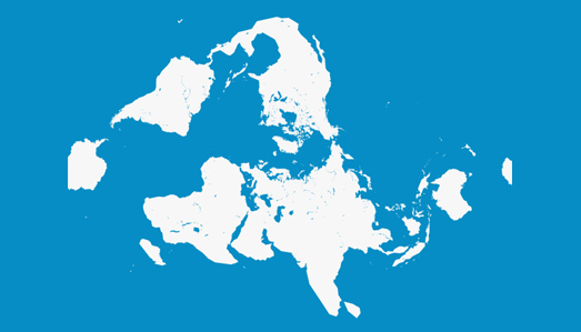
You can also play around more accurately with the Mercator projection on the Mercator Projection Explorer. The map above shows a world with Mexico as (approximately) the North Pole.
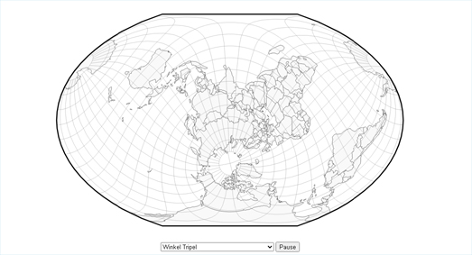
You can explore how other map projections distort the world using Jason Davies' Map Projection Transitions. Choose from any of the many different map projections provided in Map Projection Transitions and you can then drag the world map to explore how the chosen map distorts different countries. It is the perfect application for illustrating how all maps have to make compromises somewhere when trying to represent a three dimensional world in only two dimensions.


Comments