Clean Sailing on Google Maps
Bluemapia
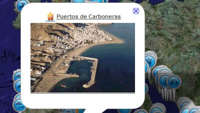
Bluemapia is a boating social network built around Google Maps.
Users can create placemarks, points of interest and plot their boat trips on a Google Map. They can also geotag photographs and videos of their voyages directly onto the map and use the map to view points of interest added by others.
Users can also embed mpas they have created of their trips, placemarks and points of interest into their own websites and blogs. The site also comes with its own Geo TV channel, showing videos of users' voyages and a blog with all the latest news from the boating world.
Isle of Wight Live Ship Tracking

This website is dedicated to the live tracking of ships around the Isle of Wight directly on Google Maps. This area of coast in the UK includes the busy ports of Southampton and Portsmouth, as well as Cowes, home of the world's oldest regular sailing regatta.
The site uses the Automatic Identification System (AIS) to track the vessels on the map. All vessels over 299GT are required to carry an AIS transponder on board, which transmits data on position, speed, course, the vessel’s name, dimensions and voyage details. All this information is available to the map user by just clicking on one of the ship markers.
Different types of vessels are shown on the map by different coloured markers and the course the vessel has taken is shown by a green polyline. All the vessels shown on the map are also listed underneath the map and it is possible to click on any of the names to identify its position on the map.
UK Live Ship Tracking
A group of ShipPlotter enthusiasts has created this map tracking vessels around the UK. It is possible to click on the map to see the individual ships, their statistics and photos. Non-Google Maps :(
Other Boating Maps
Bluemapia is a boating social network built around Google Maps.
Users can create placemarks, points of interest and plot their boat trips on a Google Map. They can also geotag photographs and videos of their voyages directly onto the map and use the map to view points of interest added by others.
Users can also embed mpas they have created of their trips, placemarks and points of interest into their own websites and blogs. The site also comes with its own Geo TV channel, showing videos of users' voyages and a blog with all the latest news from the boating world.
Isle of Wight Live Ship Tracking
This website is dedicated to the live tracking of ships around the Isle of Wight directly on Google Maps. This area of coast in the UK includes the busy ports of Southampton and Portsmouth, as well as Cowes, home of the world's oldest regular sailing regatta.
The site uses the Automatic Identification System (AIS) to track the vessels on the map. All vessels over 299GT are required to carry an AIS transponder on board, which transmits data on position, speed, course, the vessel’s name, dimensions and voyage details. All this information is available to the map user by just clicking on one of the ship markers.
Different types of vessels are shown on the map by different coloured markers and the course the vessel has taken is shown by a green polyline. All the vessels shown on the map are also listed underneath the map and it is possible to click on any of the names to identify its position on the map.
UK Live Ship Tracking
A group of ShipPlotter enthusiasts has created this map tracking vessels around the UK. It is possible to click on the map to see the individual ships, their statistics and photos. Non-Google Maps :(
Other Boating Maps
- Geowake Marina - a nautical mapping service that let's you display nav-aids and much more on your website.
- DockMarket - Boat slips for sale.
- Google Gadgets for Tides - Tide timetables for most of the US coastline.
- MarineTraffic.com - Real-time ship tracking throughout the world.
- Hi-Def San Francisco -real-time ship tracking in the San Francisco Bay
- Hurtigruten - Scandinavian ship tracking


Comments