
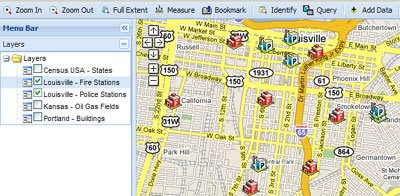
This Google Map is an entry in the ESRI Mashup Challenge. It is based on the Ext Framework, the Google Maps API and the ArcGIS JavaScript Extension for Google Maps API. The map is released under a Creative Commons Attribution-Only License so you can download the files and create your own ArcGIS map.
Download URL, Documentation URL
Via: Mapperz
GrafSchafter Atlas
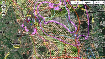
Graftchafter Atlas is a GIS portal for the towns of Bentheim, Bad Bentheim and Nordhorn in Germany.
The maps include a wealth of information about the towns. This information includes tourist information, bicycle paths, Lower Saxony Environment Management: water quality, construction, building plans and small business information, Lower Saxony Environment Management: soil, contaminated land and noise.
GIS Map Grids on Google Maps
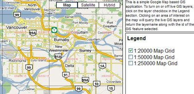
This is a simple Google Map based GIS application with three selectable live GIS layers. Clicking on an area of interest on the map will query the live GIS layers and return the layer name along with the id of the GIS feature selected.
______________
4 comments:
Did the creation of this map require ArcGIS Server?
I am trying to find a way to load GIS data into Google Maps without using ArcGIS Server.
You can use GmapGIS (www.gmapgis.com)to upload xy data set to Google map to classify and analyze with ease.
sounds interesting, but I am still confused with gis
I am taking an online class on it right now using Depiction. However the Google Maps is free, pretty simple and there is a tutorial and playing around to learn how to use the functions is fun in itself.
Post a Comment