Animating Big Data on Google Maps
DataDraw is a JavaScript library for the Google Maps API which can be used to visualize and animate large amounts of data on a Google Map using a canvas layer.
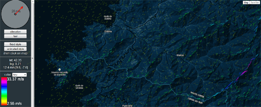
You can view the library in action on this impressive Wind Visualisation map. The map simulates wind patterns on a styled Google Map. If you select the 'animated style' option you can view a beautiful animated simulated visualization of wind patterns. You can adjust the direction and strength of the wind by dragging the red arrow in the circular wind control.


Comments